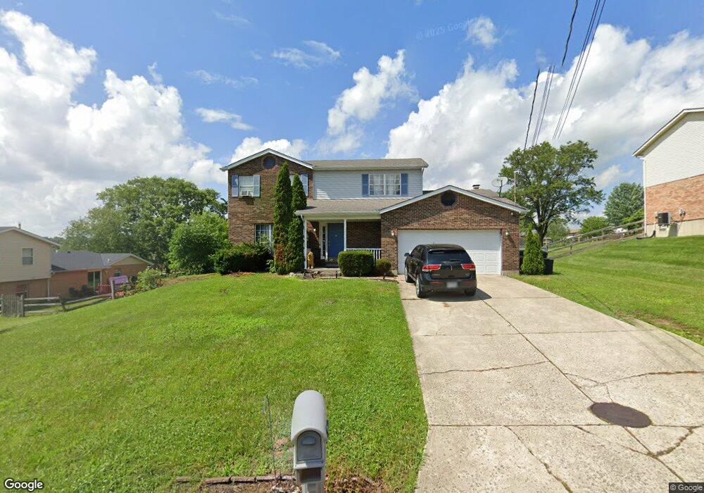
4040 Schroeder Dr Fairfield, OH 45011
Estimated Value: $323,000 - $366,000
4
Beds
3
Baths
2,088
Sq Ft
$167/Sq Ft
Est. Value
About This Home
This home is located at 4040 Schroeder Dr, Fairfield, OH 45011 and is currently estimated at $348,376, approximately $166 per square foot. 4040 Schroeder Dr is a home located in Butler County with nearby schools including Compass Elementary School, Creekside Middle School, and Fairfield Senior High School.
Ownership History
Date
Name
Owned For
Owner Type
Purchase Details
Closed on
Feb 25, 2005
Sold by
Katan Sandor and Katan Sharon G
Bought by
Hill Charesse L
Current Estimated Value
Home Financials for this Owner
Home Financials are based on the most recent Mortgage that was taken out on this home.
Original Mortgage
$128,000
Interest Rate
7%
Mortgage Type
Fannie Mae Freddie Mac
Purchase Details
Closed on
May 1, 1991
Purchase Details
Closed on
Mar 1, 1988
Create a Home Valuation Report for This Property
The Home Valuation Report is an in-depth analysis detailing your home's value as well as a comparison with similar homes in the area
Home Values in the Area
Average Home Value in this Area
Purchase History
| Date | Buyer | Sale Price | Title Company |
|---|---|---|---|
| Hill Charesse L | $160,000 | -- | |
| -- | $107,900 | -- | |
| -- | $93,000 | -- |
Source: Public Records
Mortgage History
| Date | Status | Borrower | Loan Amount |
|---|---|---|---|
| Previous Owner | Hill Charesse L | $128,000 | |
| Closed | Hill Charesse L | $32,000 |
Source: Public Records
Tax History
| Year | Tax Paid | Tax Assessment Tax Assessment Total Assessment is a certain percentage of the fair market value that is determined by local assessors to be the total taxable value of land and additions on the property. | Land | Improvement |
|---|---|---|---|---|
| 2025 | $3,796 | $102,410 | $13,340 | $89,070 |
| 2024 | $3,796 | $102,410 | $13,340 | $89,070 |
| 2023 | $3,764 | $107,510 | $13,340 | $94,170 |
| 2022 | $3,444 | $68,550 | $13,340 | $55,210 |
| 2021 | $3,077 | $65,430 | $13,340 | $52,090 |
| 2020 | $3,187 | $65,430 | $13,340 | $52,090 |
| 2019 | $5,455 | $58,040 | $13,230 | $44,810 |
| 2018 | $3,218 | $58,040 | $13,230 | $44,810 |
| 2017 | $3,234 | $58,040 | $13,230 | $44,810 |
| 2016 | $3,192 | $54,060 | $13,230 | $40,830 |
| 2015 | $3,179 | $54,060 | $13,230 | $40,830 |
| 2014 | $2,561 | $54,060 | $13,230 | $40,830 |
| 2013 | $2,561 | $48,430 | $13,230 | $35,200 |
Source: Public Records
Map
Nearby Homes
- 4058 Schroeder Dr
- 3835 Schroeder Dr
- 895 Millers Run Ct
- 4210 Tylers Estates Dr
- 4257 Primary Colors
- 4217 W Arbor Terrace
- 4401 E Observatory
- 4387 Tylers Estates Dr
- 4224 College Dictionary
- 7531 Tylers Hill Ct
- 7611 Tylers Hill Ct
- 8400 S Port Dr
- 3798 Riverdowns Ct
- 7885 Jessies Way
- 7893 Jessies Way
- 7918 Jessies Way Unit 304
- 7918 Jessies Way
- 4212 R E Smith Dr
- 4332 R E Smith Dr
- 8018 Jeannes Creek Ln
- 4050 Schroeder Dr
- 7642 Schroeder Ct
- 7642 Schroeder Ct
- 7626 Schroeder Ct
- 7616 Schroeder Ct
- 4037 Schroeder Dr
- 4045 Schroeder Dr
- 4027 Schroeder Dr
- 4053 Schroeder Dr
- 7641 Newkirk Dr
- 4012 Schroeder Dr
- 7619 Newkirk Dr
- 7629 Newkirk Dr
- 7606 Schroeder Ct
- 7627 Schroeder Ct
- 4017 Schroeder Dr
- 4061 Schroeder Dr
- 7617 Schroeder Ct
- 4007 Schroeder Dr
- 4069 Schroeder Dr
Your Personal Tour Guide
Ask me questions while you tour the home.