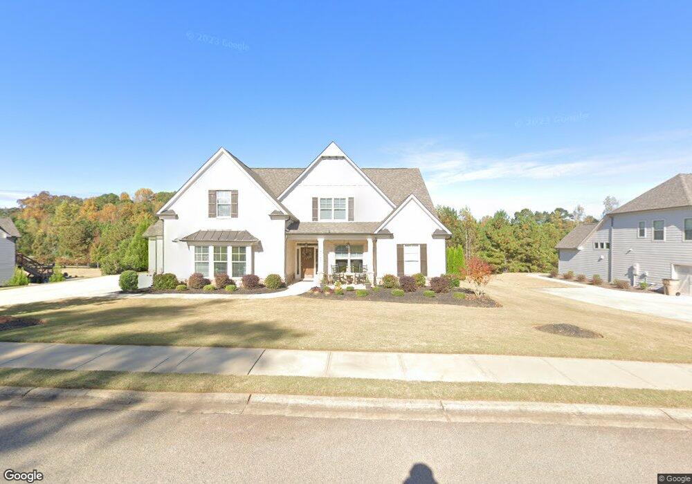
4047 Silverstone Dr Braselton, GA 30517
Estimated Value: $695,000 - $790,000
4
Beds
4
Baths
3,163
Sq Ft
$231/Sq Ft
Est. Value
About This Home
This home is located at 4047 Silverstone Dr, Braselton, GA 30517 and is currently estimated at $731,496, approximately $231 per square foot. 4047 Silverstone Dr is a home with nearby schools including Chestnut Mountain Elementary School, Cherokee Bluff Middle School, and Cherokee Bluff High School.
Ownership History
Date
Name
Owned For
Owner Type
Purchase Details
Closed on
May 31, 2019
Sold by
Veritas Homes Inc
Bought by
Green Stephen James and Green Marijean
Current Estimated Value
Purchase Details
Closed on
Jul 2, 2018
Sold by
Cbd Invstments Llc
Bought by
Veritas Homes Inc
Purchase Details
Closed on
Dec 16, 2010
Sold by
Bank Of North Georgia
Bought by
Cbd Invstments Llc
Purchase Details
Closed on
Feb 2, 2010
Sold by
Ruby Forrest Inc
Bought by
Bank Of North Georgia
Create a Home Valuation Report for This Property
The Home Valuation Report is an in-depth analysis detailing your home's value as well as a comparison with similar homes in the area
Home Values in the Area
Average Home Value in this Area
Purchase History
| Date | Buyer | Sale Price | Title Company |
|---|---|---|---|
| Green Stephen James | $455,553 | -- | |
| Veritas Homes Inc | $530,000 | -- | |
| Cbd Invstments Llc | $5,900 | -- | |
| Bank Of North Georgia | $1,505,300 | -- |
Source: Public Records
Tax History Compared to Growth
Tax History
| Year | Tax Paid | Tax Assessment Tax Assessment Total Assessment is a certain percentage of the fair market value that is determined by local assessors to be the total taxable value of land and additions on the property. | Land | Improvement |
|---|---|---|---|---|
| 2024 | $7,513 | $296,960 | $53,920 | $243,040 |
| 2023 | $6,719 | $264,680 | $43,920 | $220,760 |
| 2022 | $5,476 | $205,680 | $39,160 | $166,520 |
| 2021 | $4,638 | $169,920 | $18,600 | $151,320 |
| 2020 | $4,563 | $162,240 | $18,600 | $143,640 |
| 2019 | $525 | $12,560 | $4,640 | $7,920 |
| 2018 | $238 | $4,640 | $4,640 | $0 |
| 2017 | $235 | $4,640 | $4,640 | $0 |
| 2016 | $196 | $4,640 | $4,640 | $0 |
| 2015 | $193 | $4,640 | $4,640 | $0 |
| 2014 | $193 | $4,640 | $4,640 | $0 |
Source: Public Records
Map
Nearby Homes
- 4564 White Horse Dr
- 4156 Evian Way
- 1060 Regency Park Dr Unit 11
- 4331 Ellison Farm Rd
- 102 Cheval Ct
- 3945 Kilgore Falls Dr
- 5387 Ponderosa Farm Rd
- 5007 Chastain Way
- 5321 Shadow Walk Way
- 5354 Shadow Walk Way
- 2824 Cork St
- 3325 Tanners Mill Rd
- 4813 River Bottom Dr
- 4745 Shady Lake Cir
- 310 Hunting Hills Dr
- 5326 Windridge Pkwy Unit 19A
- 5326 Windridge Pkwy
- 5322 Windridge Pkwy Unit 18A
- 5339 Milford Dr
- 4051 Silverstone Dr
- 4039 Silverstone Dr
- 4055 Silverstone Dr
- 4025 Silverstone Dr
- 4035 Silverstone Dr
- 4048 Silverstone Dr
- 4063 Silverstone Dr
- 4036 Silverstone Dr
- 4052 Silverstone Dr
- 4040 Silverstone Dr
- 4118 Brands Ct
- 4110 Brands Ct
- 4122 Brands Ct
- 4056 Silverstone Dr
- 0 Silverstone Dr Unit 8704144
- 0 Silverstone Dr Unit 8617301
- 0 Silverstone Dr Unit 8601438
- 0 Silverstone Dr Unit 8358321
- 0 Silverstone Dr Unit 8274936
- 0 Silverstone Dr Unit 7574592