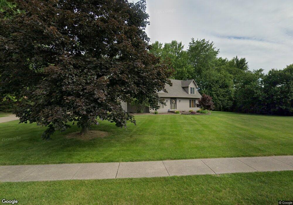
4048 E 61st Blvd Davenport, IA 52807
Estimated Value: $175,000 - $479,000
4
Beds
5
Baths
3,083
Sq Ft
$127/Sq Ft
Est. Value
About This Home
This home is located at 4048 E 61st Blvd, Davenport, IA 52807 and is currently estimated at $390,818, approximately $126 per square foot. 4048 E 61st Blvd is a home located in Scott County with nearby schools including Grant Wood Elementary School, Bettendorf Middle School, and Bettendorf High School.
Ownership History
Date
Name
Owned For
Owner Type
Purchase Details
Closed on
Apr 26, 2012
Sold by
Williams Thomas G and Williams Carla S
Bought by
Williams Thomas G and Williams Carla S
Current Estimated Value
Purchase Details
Closed on
Apr 17, 2012
Sold by
Williams Patricia Ann and Farrar Thomas A
Bought by
Williams Thomas G
Create a Home Valuation Report for This Property
The Home Valuation Report is an in-depth analysis detailing your home's value as well as a comparison with similar homes in the area
Home Values in the Area
Average Home Value in this Area
Purchase History
| Date | Buyer | Sale Price | Title Company |
|---|---|---|---|
| Williams Thomas G | -- | None Available | |
| Williams Thomas G | -- | None Available |
Source: Public Records
Tax History Compared to Growth
Tax History
| Year | Tax Paid | Tax Assessment Tax Assessment Total Assessment is a certain percentage of the fair market value that is determined by local assessors to be the total taxable value of land and additions on the property. | Land | Improvement |
|---|---|---|---|---|
| 2024 | $6,646 | $400,560 | $91,390 | $309,170 |
| 2023 | $6,448 | $400,560 | $91,390 | $309,170 |
| 2022 | $6,094 | $332,460 | $75,510 | $256,950 |
| 2021 | $6,094 | $318,030 | $75,510 | $242,520 |
| 2020 | $6,131 | $306,480 | $75,510 | $230,970 |
| 2019 | $6,431 | $306,480 | $75,510 | $230,970 |
| 2018 | $6,708 | $306,480 | $75,510 | $230,970 |
| 2017 | $6,893 | $320,910 | $75,510 | $245,400 |
| 2016 | $6,626 | $320,910 | $0 | $0 |
| 2015 | $6,572 | $318,580 | $0 | $0 |
| 2014 | $6,596 | $318,580 | $0 | $0 |
| 2013 | $6,452 | $0 | $0 | $0 |
| 2012 | -- | $354,050 | $78,850 | $275,200 |
Source: Public Records
Map
Nearby Homes
- 9 E 61st Ct
- 4150 E 60th St Unit 1004
- 6401 Utica Ridge Rd Unit 4
- 4006 Kathleen Way
- 1908 Katie Ct
- 1708 E 59th Ct
- 1816 E 59th Ct
- 1810 E 59th Ct
- 1804 E 59th Ct
- 1714 E 59th Ct
- 1705 E 59th Ct
- 1711 E 59th Ct
- 1717 E 59th Ct
- 1807 E 59th Ct
- 1813 E 59th Ct
- 1814 Katie Ct
- 1918 E 59th Ct
- 1912 E 59th Ct
- 1906 E 59th Ct
- 1716 Katie Ct
- 4034 E 61st Blvd
- 6215 Utica Ridge Rd Unit 102
- 6215 Utica Ridge Rd Unit 204
- 6215 Utica Ridge Rd
- 6215 Utica Ridge Rd Unit 103
- 6215 Utica Ridge Rd Unit 205
- 6215 Utica Ridge Rd Unit 107
- 6215 Utica Ridge Rd Unit 105
- 6215 Utica Ridge Rd Unit 2-107
- 6215 Utica Ridge Rd Unit 104
- 6215 Utica Ridge Rd Unit 101
- 6215 Utica Ridge Rd Unit 203
- 6215 Utica Ridge Rd Unit 2-201
- 6215 Utica Ridge Rd Unit 2203
- 6215 Utica Ridge Rd Unit 2101
- 6215 Utica Ridge Rd Unit 106
- 6215 Utica Ridge Rd Unit 202
- 6215 Utica Ridge Rd
- 00 Utica Ridge
- 4045 E 61st Blvd