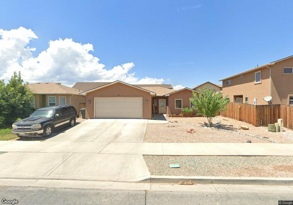
405 29 1/2 Rd Grand Junction, CO 81504
Southeast Grand Junction NeighborhoodEstimated Value: $356,000 - $361,000
3
Beds
2
Baths
1,448
Sq Ft
$248/Sq Ft
Est. Value
About This Home
This home is located at 405 29 1/2 Rd, Grand Junction, CO 81504 and is currently estimated at $358,413, approximately $247 per square foot. 405 29 1/2 Rd is a home located in Mesa County with nearby schools including Pear Park Elementary School, Bookcliff Middle School, and East Middle School.
Ownership History
Date
Name
Owned For
Owner Type
Purchase Details
Closed on
Jun 16, 2025
Sold by
Dennis Monica
Bought by
Monica Dennis Living Trust
Current Estimated Value
Home Financials for this Owner
Home Financials are based on the most recent Mortgage that was taken out on this home.
Original Mortgage
$162,000
Outstanding Balance
$161,580
Interest Rate
6.76%
Mortgage Type
New Conventional
Estimated Equity
$196,833
Purchase Details
Closed on
Apr 17, 2020
Sold by
Holdren William
Bought by
Fowler Matthew Lee and Helgesen Becky
Home Financials for this Owner
Home Financials are based on the most recent Mortgage that was taken out on this home.
Original Mortgage
$208,160
Interest Rate
3.25%
Mortgage Type
FHA
Purchase Details
Closed on
Jan 26, 2018
Sold by
Giles Janice
Bought by
Holdren William
Home Financials for this Owner
Home Financials are based on the most recent Mortgage that was taken out on this home.
Original Mortgage
$178,703
Interest Rate
3.93%
Mortgage Type
FHA
Purchase Details
Closed on
Mar 31, 2017
Sold by
Poulson Holdings Llp
Bought by
Giles Janice
Purchase Details
Closed on
Jul 29, 2008
Sold by
Poulson Giles W
Bought by
Poulson Holdings Llp
Home Financials for this Owner
Home Financials are based on the most recent Mortgage that was taken out on this home.
Original Mortgage
$188,800
Interest Rate
6.47%
Mortgage Type
Purchase Money Mortgage
Purchase Details
Closed on
Feb 26, 2007
Sold by
Flint Ridge Iii Land Development Llc
Bought by
Poulson Giles W
Home Financials for this Owner
Home Financials are based on the most recent Mortgage that was taken out on this home.
Original Mortgage
$180,900
Interest Rate
8.62%
Mortgage Type
Construction
Purchase Details
Closed on
Jan 31, 2007
Sold by
Tml Enterprises Inc
Bought by
Flint Ridge Iii Land Development Llc
Home Financials for this Owner
Home Financials are based on the most recent Mortgage that was taken out on this home.
Original Mortgage
$180,900
Interest Rate
8.62%
Mortgage Type
Construction
Create a Home Valuation Report for This Property
The Home Valuation Report is an in-depth analysis detailing your home's value as well as a comparison with similar homes in the area
Home Values in the Area
Average Home Value in this Area
Purchase History
| Date | Buyer | Sale Price | Title Company |
|---|---|---|---|
| Monica Dennis Living Trust | $100,000 | Fidelity National Title | |
| Dennis Monica | $357,000 | Fidelity National Title | |
| Fowler Matthew Lee | $212,000 | Abstract & Title Co | |
| Holdren William | $182,000 | Abstract & Title Co | |
| Giles Janice | $181,500 | Abstract & Title Co | |
| Poulson Holdings Llp | -- | None Available | |
| Poulson Giles W | $56,500 | Fahtco | |
| Flint Ridge Iii Land Development Llc | -- | Fahtco |
Source: Public Records
Mortgage History
| Date | Status | Borrower | Loan Amount |
|---|---|---|---|
| Open | Dennis Monica | $162,000 | |
| Previous Owner | Fowler Matthew Lee | $208,160 | |
| Previous Owner | Holdren William | $178,703 | |
| Previous Owner | Poulson Holdings Llp | $188,800 | |
| Previous Owner | Poulson Giles W | $180,900 |
Source: Public Records
Tax History Compared to Growth
Tax History
| Year | Tax Paid | Tax Assessment Tax Assessment Total Assessment is a certain percentage of the fair market value that is determined by local assessors to be the total taxable value of land and additions on the property. | Land | Improvement |
|---|---|---|---|---|
| 2024 | $1,353 | $19,130 | $3,480 | $15,650 |
| 2023 | $1,353 | $19,130 | $3,480 | $15,650 |
| 2022 | $1,202 | $16,680 | $4,170 | $12,510 |
| 2021 | $1,206 | $17,160 | $4,290 | $12,870 |
| 2020 | $1,029 | $14,970 | $3,220 | $11,750 |
| 2019 | $973 | $14,970 | $3,220 | $11,750 |
| 2018 | $894 | $12,550 | $2,520 | $10,030 |
| 2017 | $891 | $12,550 | $2,520 | $10,030 |
| 2016 | $1,014 | $13,670 | $2,790 | $10,880 |
| 2015 | $875 | $13,670 | $2,790 | $10,880 |
| 2014 | $1,109 | $12,120 | $1,670 | $10,450 |
Source: Public Records
Map
Nearby Homes
- 408 29 1 2 Rd
- 2961 Red Cloud Ln Unit A
- 433 Donogal Dr
- 421 Brealyn Ct
- 2931 Paula Ln Unit 4
- 2931 Paula Ln Unit 3
- 2972 Luke St
- 2910 D Rd Unit 3.2 AC
- 2910 D Rd Unit 1 Acre
- 2910 D Rd
- 2910 D Rd Unit 1 AC
- 408 Marianne Dr
- 410 Marianne Dr
- 432 Marianne Dr
- 374 29 5 8 Rd
- 359 29 5 8 Rd
- 2971 1/2 D 1 2 Rd
- 2979 D 1 2 Rd
- 442 Florence Rd
- 2986 Clarinet Ln
- 403 1/2 29 1 2 Rd
- 2945 Red Cloud Ln
- 403 1/2 29 1/2 Rd
- 403 29 1 2 Rd
- 404.5 Chert Dr
- 404 1/2 Chert Dr
- 2943 Red Cloud Ln
- 404 Chert Dr
- 403 29 1/2 Rd
- 2946 Chinto Dr
- 408 1/2 29 1/2 Rd
- 410 29 1/2 Rd
- 408 29 1/2 Rd
- 2944 Red Cloud Ln
- 412 29 1/2 Rd
- 406 29 1 2
- 406 29 1/2 Rd
- 412 29 1 2 Rd
- 412 29 1 2 Rd
- 406 29 1 2 Rd