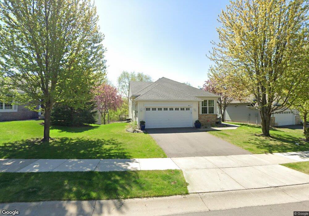
405 Campfire Curve Chaska, MN 55318
Estimated Value: $414,894 - $480,000
2
Beds
3
Baths
1,598
Sq Ft
$278/Sq Ft
Est. Value
About This Home
This home is located at 405 Campfire Curve, Chaska, MN 55318 and is currently estimated at $443,974, approximately $277 per square foot. 405 Campfire Curve is a home located in Carver County with nearby schools including Jonathan Elementary School, Chaska Middle School East, and Chaska High School.
Ownership History
Date
Name
Owned For
Owner Type
Purchase Details
Closed on
Mar 1, 2019
Sold by
Young Steven J and Young Amy
Bought by
Young Paul P and Young Katharine
Current Estimated Value
Purchase Details
Closed on
Oct 6, 2006
Sold by
Robert A Hillstrom Revocable Intervivos
Bought by
La June D Young Revocable Trust
Home Financials for this Owner
Home Financials are based on the most recent Mortgage that was taken out on this home.
Original Mortgage
$332,000
Interest Rate
6%
Mortgage Type
Land Contract Argmt. Of Sale
Purchase Details
Closed on
May 17, 2006
Sold by
Robert P Roepke Revocable Living Trust
Bought by
Robert A Hillstrom Revocable Inter Vivos
Purchase Details
Closed on
Sep 30, 2002
Sold by
Pulte Homes Of Minnesota Corp
Bought by
Roepke Robert P and Roepke Kathleen M
Create a Home Valuation Report for This Property
The Home Valuation Report is an in-depth analysis detailing your home's value as well as a comparison with similar homes in the area
Home Values in the Area
Average Home Value in this Area
Purchase History
| Date | Buyer | Sale Price | Title Company |
|---|---|---|---|
| Young Paul P | $500 | Entitle Inc | |
| La June D Young Revocable Trust | $352,000 | -- | |
| Robert A Hillstrom Revocable Inter Vivos | $351,500 | -- | |
| Roepke Robert P | $262,375 | -- |
Source: Public Records
Mortgage History
| Date | Status | Borrower | Loan Amount |
|---|---|---|---|
| Previous Owner | La June D Young Revocable Trust | $332,000 |
Source: Public Records
Tax History
| Year | Tax Paid | Tax Assessment Tax Assessment Total Assessment is a certain percentage of the fair market value that is determined by local assessors to be the total taxable value of land and additions on the property. | Land | Improvement |
|---|---|---|---|---|
| 2025 | $4,542 | $394,600 | $78,800 | $315,800 |
| 2024 | $4,538 | $387,500 | $78,800 | $308,700 |
| 2023 | $4,640 | $388,300 | $78,800 | $309,500 |
| 2022 | $4,456 | $412,500 | $78,700 | $333,800 |
| 2021 | $4,030 | $338,000 | $65,600 | $272,400 |
| 2020 | $4,062 | $338,000 | $65,600 | $272,400 |
| 2019 | $3,928 | $314,100 | $62,500 | $251,600 |
| 2018 | $3,930 | $314,100 | $62,500 | $251,600 |
| 2017 | $3,754 | $311,100 | $56,800 | $254,300 |
| 2016 | $3,898 | $280,500 | $0 | $0 |
| 2015 | $1,612 | $258,600 | $0 | $0 |
| 2014 | $1,612 | $220,800 | $0 | $0 |
Source: Public Records
Map
Nearby Homes
- 2338 Manuela Dr
- 319 Wilderness Dr Unit 22
- 2890 Autumn Woods Dr
- 3110 N Chestnut St Unit 209
- 110271 Village Rd
- 110212 Village Rd
- 2 Hazeltine Estates
- 3 Birdie Ln
- 110104 Arboretum Way
- 1609 Geske Rd
- 110136 Stanford Cir
- 14 Rita Ln
- 441 Pleasant Ln
- 2888 Forest Ridge
- 495 Pleasant Ct
- 112704 Hundertmark Rd
- 6408 Red Cedar Dr
- 6513 Timber Arch Dr
- 110912 von Hertzen Cir
- 661 Satori Way
- 401 Campfire Curve
- 409 Campfire Curve
- 411 Campfire Curve
- 487 Campfire Curve
- 415 Campfire Curve
- 483 Campfire Curve
- 419 Campfire Curve
- 499 Wilderness Dr
- 479 Campfire Curve
- 493 Wilderness Dr
- 423 Campfire Curve
- 397 Campfire Curve
- 489 Wilderness Dr
- 475 Campfire Curve
- 483 Wilderness Dr
- 427 Campfire Curve
- 435 Campfire Curve
- 479 Wilderness Dr
- 389 Campfire Curve
- 431 Campfire Curve
Your Personal Tour Guide
Ask me questions while you tour the home.