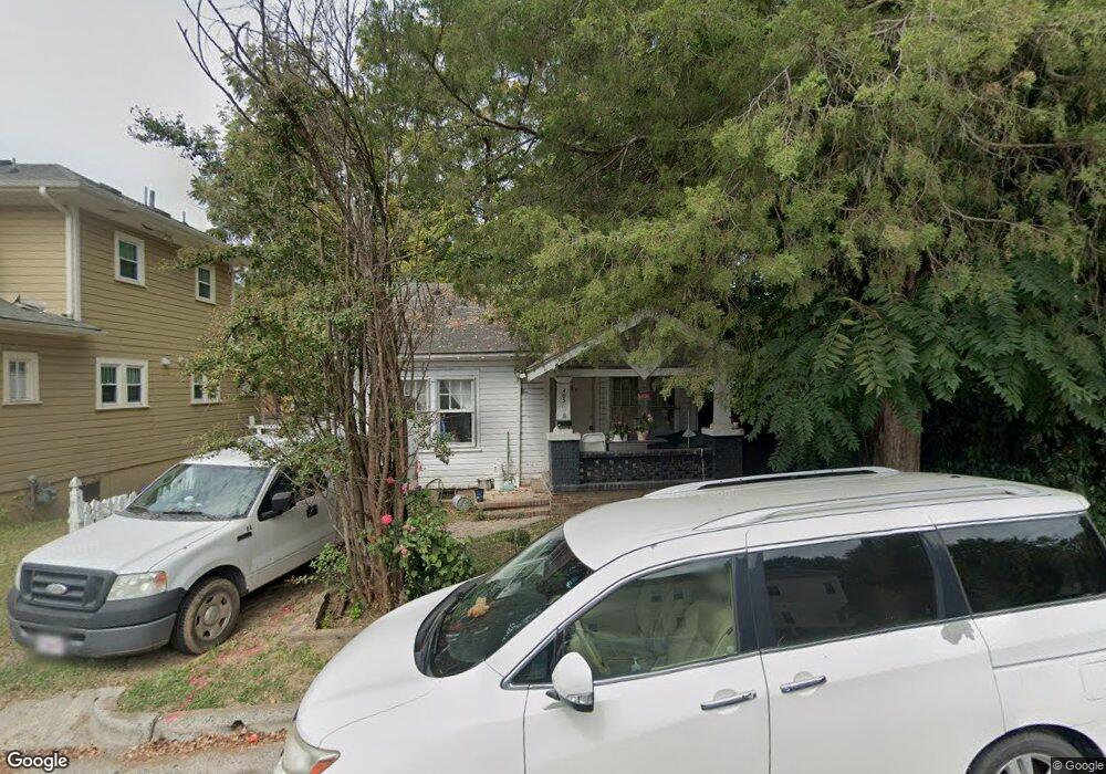
405 Carlton Ave Durham, NC 27701
Central Park NeighborhoodEstimated Value: $177,000 - $236,000
2
Beds
1
Bath
652
Sq Ft
$313/Sq Ft
Est. Value
About This Home
This home is located at 405 Carlton Ave, Durham, NC 27701 and is currently estimated at $204,296, approximately $313 per square foot. 405 Carlton Ave is a home located in Durham County with nearby schools including George Watts Elementary, W.G. Pearson Elementary School, and Brogden Middle.
Ownership History
Date
Name
Owned For
Owner Type
Purchase Details
Closed on
Nov 16, 2022
Sold by
Svn24 Properties Llc
Bought by
Burlage Realty Llc
Current Estimated Value
Home Financials for this Owner
Home Financials are based on the most recent Mortgage that was taken out on this home.
Original Mortgage
$165,000
Outstanding Balance
$78,546
Interest Rate
6.94%
Mortgage Type
New Conventional
Estimated Equity
$125,750
Create a Home Valuation Report for This Property
The Home Valuation Report is an in-depth analysis detailing your home's value as well as a comparison with similar homes in the area
Home Values in the Area
Average Home Value in this Area
Purchase History
| Date | Buyer | Sale Price | Title Company |
|---|---|---|---|
| Burlage Realty Llc | $170,000 | -- | |
| Svn24 Properties Llc | $128,000 | -- |
Source: Public Records
Mortgage History
| Date | Status | Borrower | Loan Amount |
|---|---|---|---|
| Open | Burlage Realty Llc | $165,000 |
Source: Public Records
Tax History Compared to Growth
Tax History
| Year | Tax Paid | Tax Assessment Tax Assessment Total Assessment is a certain percentage of the fair market value that is determined by local assessors to be the total taxable value of land and additions on the property. | Land | Improvement |
|---|---|---|---|---|
| 2025 | $2,601 | $262,399 | $185,500 | $76,899 |
| 2024 | $1,642 | $117,726 | $74,200 | $43,526 |
| 2023 | $1,542 | $117,726 | $74,200 | $43,526 |
| 2022 | $1,507 | $117,726 | $74,200 | $43,526 |
| 2021 | $1,500 | $117,726 | $74,200 | $43,526 |
| 2020 | $1,464 | $117,726 | $74,200 | $43,526 |
| 2019 | $1,464 | $117,726 | $74,200 | $43,526 |
| 2018 | $1,269 | $93,578 | $47,700 | $45,878 |
| 2017 | $1,260 | $93,578 | $47,700 | $45,878 |
| 2016 | $1,218 | $93,578 | $47,700 | $45,878 |
| 2015 | $455 | $32,856 | $10,162 | $22,694 |
| 2014 | $455 | $32,856 | $10,162 | $22,694 |
Source: Public Records
Map
Nearby Homes
- 506 N Roxboro St
- The PENTHOUSE Plan at The Willow
- The ALBA Plan at The Willow
- The IRIS Plan at The Willow
- 600 N Roxboro St Unit 34
- 600 N Roxboro St Unit 24
- 600 N Roxboro St Unit 43
- 600 N Roxboro St Unit 44
- 501 Mallard Ave
- 610 N Roxboro St Unit 22
- 610 N Roxboro St Unit 21
- 405 N Elizabeth St
- 310 Peachtree Place
- 314 Gray Ave
- 524 N Mangum St Unit 2
- 515 N Mangum St Unit 51
- 521 N Mangum St Unit 11
- 521 N Mangum St Unit 33
- 521 N Mangum St Unit 25
- 521 N Mangum St Unit 21
- 407 Carlton Ave
- 402 N Queen St
- 406 N Queen St
- 408 N Queen St
- 404 Ottawa Ave
- 410 N Queen St
- 408 Ottawa Ave
- 401 Oakwood Ave
- 405 Oakwood Ave
- 403 Oakwood Ave
- 403 Ottawa Ave
- 403 N Queen St
- 407 Oakwood Ave
- 405 N Queen St
- 401 N Queen St
- 311 Oakwood Ave
- 501 N Queen St
- 407 N Queen St
- 504 N Queen St
- 405 Ottawa Ave