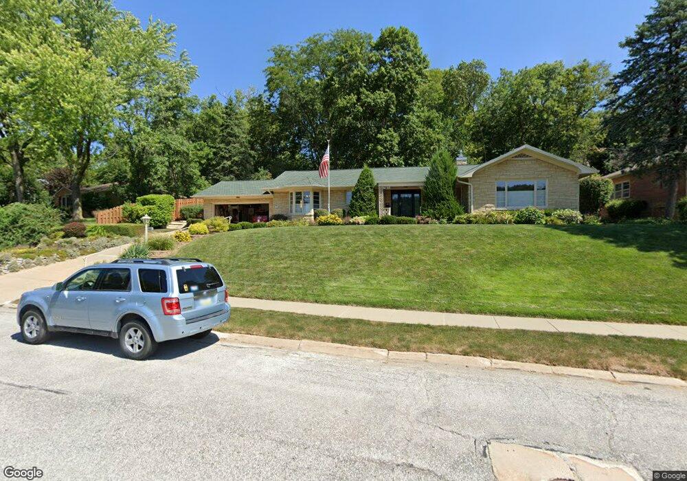
405 Kenmore Ave Council Bluffs, IA 51503
Downtown Council Bluffs NeighborhoodEstimated Value: $412,573 - $466,000
2
Beds
3
Baths
3,123
Sq Ft
$141/Sq Ft
Est. Value
About This Home
This home is located at 405 Kenmore Ave, Council Bluffs, IA 51503 and is currently estimated at $441,893, approximately $141 per square foot. 405 Kenmore Ave is a home located in Pottawattamie County with nearby schools including Hoover Elementary School, Gerald W. Kirn Middle School, and Abraham Lincoln High School.
Ownership History
Date
Name
Owned For
Owner Type
Purchase Details
Closed on
Apr 10, 2019
Sold by
Russell George W and Russell Elaine M
Bought by
Russell Revocable Trust
Current Estimated Value
Purchase Details
Closed on
Apr 17, 2009
Sold by
Kirchner Robert L and Kirchner Jane A
Bought by
Russell George and Russell Elaine
Home Financials for this Owner
Home Financials are based on the most recent Mortgage that was taken out on this home.
Original Mortgage
$50,000
Interest Rate
5.05%
Mortgage Type
Purchase Money Mortgage
Create a Home Valuation Report for This Property
The Home Valuation Report is an in-depth analysis detailing your home's value as well as a comparison with similar homes in the area
Home Values in the Area
Average Home Value in this Area
Purchase History
| Date | Buyer | Sale Price | Title Company |
|---|---|---|---|
| Russell Revocable Trust | -- | None Available | |
| Russell George | $244,500 | None Available |
Source: Public Records
Mortgage History
| Date | Status | Borrower | Loan Amount |
|---|---|---|---|
| Closed | Russell George | $50,000 |
Source: Public Records
Tax History Compared to Growth
Tax History
| Year | Tax Paid | Tax Assessment Tax Assessment Total Assessment is a certain percentage of the fair market value that is determined by local assessors to be the total taxable value of land and additions on the property. | Land | Improvement |
|---|---|---|---|---|
| 2025 | $6,806 | $396,900 | $65,200 | $331,700 |
| 2024 | $6,806 | $370,300 | $56,700 | $313,600 |
| 2023 | $6,862 | $370,300 | $56,700 | $313,600 |
| 2022 | $6,536 | $290,900 | $60,600 | $230,300 |
| 2021 | $10,020 | $290,900 | $60,600 | $230,300 |
| 2020 | $5,502 | $290,900 | $60,600 | $230,300 |
| 2019 | $5,706 | $233,700 | $51,759 | $181,941 |
| 2018 | $5,592 | $233,700 | $51,759 | $181,941 |
| 2017 | $5,658 | $233,700 | $51,759 | $181,941 |
| 2015 | $5,528 | $233,700 | $51,759 | $181,941 |
| 2014 | $5,536 | $233,700 | $51,759 | $181,941 |
Source: Public Records
Map
Nearby Homes
- 601 Forest Dr
- 52 Gould Ave
- 216 Morningside Ave
- 222 Locust Lodge Ave
- 400 Frank St
- 118 Euclid Ave
- 28 Cooper Ave
- 1426 Mcpherson Ave
- 269 Elmwood Dr
- 440 Simms Ave
- 111 Union St
- 1542 N Broadway
- 335 Logan St
- 415 Midland Dr
- 603 Hillcrest Ave
- 329 Prospect St
- 212 Highland Dr
- 613 Grace St
- 122 Platner St
- 420 Fuller Ave
- 403 Kenmore Ave
- 105 Kenmore Ave
- 389 Kenmore Ave
- 247 Kenmore Ave
- 385 Kenmore Ave
- 111 Kenmore Ave
- 77 Kenmore Ave
- 263 Kenmore Ave
- 60 Kenmore Ave
- 235 Kenmore Ave
- 215 Kenmore Ave
- 379 Kenmore Ave
- 206 Keeline Ave
- 120 Kenmore Ave
- 301 Kenmore Ave
- 58 Kenmore Ave
- 207 Kenmore Ave
- 254 Kenmore Ave
- 121 Kenmore Ave
- 367 Kenmore Ave