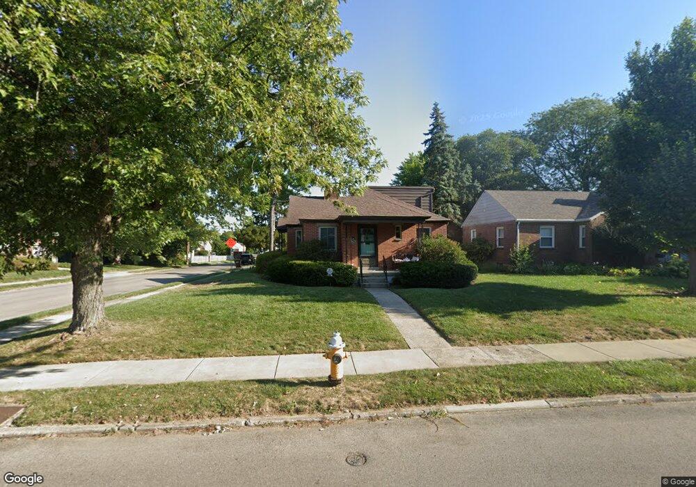
405 Lewiston Rd Dayton, OH 45429
Estimated Value: $272,854 - $313,000
4
Beds
2
Baths
1,807
Sq Ft
$158/Sq Ft
Est. Value
About This Home
This home is located at 405 Lewiston Rd, Dayton, OH 45429 and is currently estimated at $285,214, approximately $157 per square foot. 405 Lewiston Rd is a home located in Montgomery County with nearby schools including Orchard Park Elementary School, Van Buren Middle School, and Kettering Fairmont High School.
Ownership History
Date
Name
Owned For
Owner Type
Purchase Details
Closed on
Nov 16, 2021
Sold by
Russo Daniel Robert and Russo Mary E
Bought by
Gator Ventures Llc
Current Estimated Value
Purchase Details
Closed on
Jan 31, 2018
Sold by
Mehaffie Kymberly A and Mehaffie David
Bought by
Russo Daniel Robert and Russo Mary E
Home Financials for this Owner
Home Financials are based on the most recent Mortgage that was taken out on this home.
Original Mortgage
$126,000
Interest Rate
3.12%
Mortgage Type
Adjustable Rate Mortgage/ARM
Purchase Details
Closed on
Aug 21, 2017
Sold by
Turnbull Lois Jane
Bought by
Mehaffie Kymberly A
Create a Home Valuation Report for This Property
The Home Valuation Report is an in-depth analysis detailing your home's value as well as a comparison with similar homes in the area
Home Values in the Area
Average Home Value in this Area
Purchase History
| Date | Buyer | Sale Price | Title Company |
|---|---|---|---|
| Gator Ventures Llc | -- | None Listed On Document | |
| Russo Daniel Robert | $151,500 | Vantage Land Title | |
| Mehaffie Kymberly A | $158,900 | Triad Title Agency Inc |
Source: Public Records
Mortgage History
| Date | Status | Borrower | Loan Amount |
|---|---|---|---|
| Previous Owner | Russo Daniel Robert | $126,000 |
Source: Public Records
Tax History Compared to Growth
Tax History
| Year | Tax Paid | Tax Assessment Tax Assessment Total Assessment is a certain percentage of the fair market value that is determined by local assessors to be the total taxable value of land and additions on the property. | Land | Improvement |
|---|---|---|---|---|
| 2024 | $4,706 | $73,600 | $14,880 | $58,720 |
| 2023 | $4,706 | $73,600 | $14,880 | $58,720 |
| 2022 | $4,058 | $50,710 | $10,260 | $40,450 |
| 2021 | $3,759 | $50,710 | $10,260 | $40,450 |
| 2020 | $3,737 | $50,710 | $10,260 | $40,450 |
| 2019 | $4,230 | $50,860 | $12,110 | $38,750 |
| 2018 | $4,252 | $50,860 | $12,110 | $38,750 |
| 2017 | $3,258 | $50,860 | $12,110 | $38,750 |
| 2016 | $3,032 | $45,110 | $12,110 | $33,000 |
| 2015 | $2,868 | $45,110 | $12,110 | $33,000 |
| 2014 | $2,868 | $45,110 | $12,110 | $33,000 |
| 2012 | -- | $45,830 | $12,290 | $33,540 |
Source: Public Records
Map
Nearby Homes
- 320 E Dorothy Ln
- 441 Cushing Ave
- 309 Lewiston Rd
- 320 Brydon Rd
- 233 E Dorothy Ln
- 117 Cushing Ave
- 209 Brydon Rd
- 235 Claranna Ave
- 587 Cottingwood Ct
- 101 Blue Gate Cir Unit 1
- 2817 Royalston Ave
- 349 Orchard Dr
- 2701 Aerial Ave
- 709 E Dorothy Ln
- 651 Broad Blvd
- 663 Broad Blvd
- 3212 Lenox Dr
- 445 Peach Orchard Ave
- 311 Parkdale St Unit 309
- 436 Monteray Ave
- 407 Lewiston Rd
- 341 Lewiston Rd
- 411 Lewiston Rd
- 3000 Delaine Ave
- 404 E Dorothy Ln
- 337 Lewiston Rd
- 415 Lewiston Rd
- 3001 Delaine Ave
- 408 E Dorothy Ln
- 400 Lewiston Rd
- 402 Lewiston Rd
- 340 E Dorothy Ln
- 333 Lewiston Rd
- 412 E Dorothy Ln
- 340 Lewiston Rd
- 406 Lewiston Rd
- 336 Lewiston Rd
- 410 Lewiston Rd
- 336 E Dorothy Ln
- 416 E Dorothy Ln