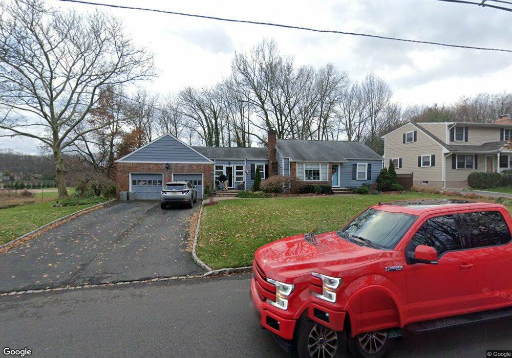
405 N Scotch Plains Ave Westfield, NJ 07090
Estimated Value: $749,000 - $929,000
--
Bed
--
Bath
1,190
Sq Ft
$695/Sq Ft
Est. Value
About This Home
This home is located at 405 N Scotch Plains Ave, Westfield, NJ 07090 and is currently estimated at $826,991, approximately $694 per square foot. 405 N Scotch Plains Ave is a home located in Union County with nearby schools including McKinley Elementary School, Westfield Senior High School, and Holy Trinity School.
Ownership History
Date
Name
Owned For
Owner Type
Purchase Details
Closed on
Apr 15, 2005
Sold by
Didario Benny V
Bought by
Scirocco Prisco and Scirocco Lorenzina
Current Estimated Value
Home Financials for this Owner
Home Financials are based on the most recent Mortgage that was taken out on this home.
Original Mortgage
$85,000
Interest Rate
5.38%
Mortgage Type
New Conventional
Create a Home Valuation Report for This Property
The Home Valuation Report is an in-depth analysis detailing your home's value as well as a comparison with similar homes in the area
Home Values in the Area
Average Home Value in this Area
Purchase History
| Date | Buyer | Sale Price | Title Company |
|---|---|---|---|
| Scirocco Prisco | -- | -- |
Source: Public Records
Mortgage History
| Date | Status | Borrower | Loan Amount |
|---|---|---|---|
| Closed | Scirocco Prisco | $85,000 |
Source: Public Records
Tax History Compared to Growth
Tax History
| Year | Tax Paid | Tax Assessment Tax Assessment Total Assessment is a certain percentage of the fair market value that is determined by local assessors to be the total taxable value of land and additions on the property. | Land | Improvement |
|---|---|---|---|---|
| 2025 | $11,042 | $490,300 | $335,400 | $154,900 |
| 2024 | $10,816 | $490,300 | $335,400 | $154,900 |
| 2023 | $10,816 | $490,300 | $335,400 | $154,900 |
| 2022 | $10,590 | $490,300 | $335,400 | $154,900 |
| 2021 | $10,605 | $490,300 | $335,400 | $154,900 |
| 2020 | $10,581 | $490,300 | $335,400 | $154,900 |
| 2019 | $10,541 | $490,300 | $335,400 | $154,900 |
| 2018 | $10,078 | $108,400 | $61,200 | $47,200 |
| 2017 | $10,023 | $108,400 | $61,200 | $47,200 |
| 2016 | $9,787 | $108,400 | $61,200 | $47,200 |
| 2015 | $11,362 | $128,400 | $61,200 | $67,200 |
| 2014 | $10,987 | $128,400 | $61,200 | $67,200 |
Source: Public Records
Map
Nearby Homes
- 119 Lamberts Mill Rd
- 2154 W Broad St
- 350 W Dudley Ave
- 2116 Newark Ave
- 524 Edgar Rd
- 724 South Ave W Unit 724A
- 525 Edgar Rd
- 2314 Longfellow Ave
- 314 Highgate Ave
- 1466 Lamberts Mill Rd
- 614 Dorian Rd
- 2219 North Ave Unit 6
- 538 Westfield Ave
- 303 Prospect St
- 2 Brookside Ct
- 260 Prospect St Unit C15
- 1933 W Broad St
- 1933 Mary Ellen Ln
- 2286 Stocker Ln
- 143 Stanmore Place
- 409 N Scotch Plains Ave
- 419 N Scotch Plains Ave
- 323 N Scotch Plains Ave
- 644 Hort St
- 651 Hort St
- 421 N Scotch Plains Ave
- 642 Hort St
- 313 N Scotch Plains Ave
- 645 Roosevelt St
- 645 Hort St
- 636 Hort St
- 641 Roosevelt St
- 641 Hort St
- 309 N Scotch Plains Ave
- 310 N Scotch Plains Ave
- 637 Roosevelt St
- 634 Hort St
- 639 Hort St
- 503 N Scotch Plains Ave
- 308 N Scotch Plains Ave