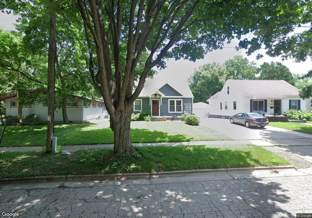
405 Ring St Madison, WI 53714
Eastmorland NeighborhoodEstimated Value: $382,227 - $428,000
3
Beds
2
Baths
1,395
Sq Ft
$289/Sq Ft
Est. Value
About This Home
This home is located at 405 Ring St, Madison, WI 53714 and is currently estimated at $403,307, approximately $289 per square foot. 405 Ring St is a home located in Dane County with nearby schools including Schenk Elementary School, Whitehorse Middle School, and La Follette High School.
Ownership History
Date
Name
Owned For
Owner Type
Purchase Details
Closed on
Jul 1, 2011
Sold by
Fourrier Keith D
Bought by
Fourrier Keith D and Fourrier Jennifer L
Current Estimated Value
Home Financials for this Owner
Home Financials are based on the most recent Mortgage that was taken out on this home.
Original Mortgage
$118,000
Interest Rate
4.63%
Mortgage Type
New Conventional
Create a Home Valuation Report for This Property
The Home Valuation Report is an in-depth analysis detailing your home's value as well as a comparison with similar homes in the area
Home Values in the Area
Average Home Value in this Area
Purchase History
We collect this data history from publicly available records. To have your information removed, we recommend requesting removal directly through your county’s website.
| Date | Buyer | Sale Price | Title Company |
|---|---|---|---|
| Fourrier Keith D | -- | Dane County Title Company |
Source: Public Records
Mortgage History
We collect this data history from publicly available records. To have your information removed, we recommend requesting removal directly through your county’s website.
| Date | Status | Borrower | Loan Amount |
|---|---|---|---|
| Closed | Fourrier Keith D | $118,000 |
Source: Public Records
Tax History
| Year | Tax Paid | Tax Assessment Tax Assessment Total Assessment is a certain percentage of the fair market value that is determined by local assessors to be the total taxable value of land and additions on the property. | Land | Improvement |
|---|---|---|---|---|
| 2025 | $6,997 | $394,600 | $68,700 | $325,900 |
| 2024 | $12,339 | $368,400 | $68,700 | $299,700 |
| 2023 | $5,998 | $350,900 | $65,400 | $285,500 |
| 2022 | $11,516 | $308,900 | $57,600 | $251,300 |
| 2021 | $5,293 | $264,300 | $57,600 | $206,700 |
| 2020 | $5,214 | $244,200 | $52,800 | $191,400 |
| 2019 | $4,999 | $234,800 | $50,800 | $184,000 |
| 2018 | $4,585 | $215,400 | $50,800 | $164,600 |
| 2017 | $4,479 | $201,300 | $46,200 | $155,100 |
| 2016 | $4,157 | $183,000 | $42,000 | $141,000 |
| 2015 | $4,056 | $161,400 | $42,000 | $119,400 |
| 2014 | $3,701 | $161,400 | $42,000 | $119,400 |
| 2013 | $3,786 | $158,200 | $42,000 | $116,200 |
Source: Public Records
Map
Nearby Homes
- 3806 Tulane Ave
- 3701 Margaret St
- 125 Cumberland Ln
- 3509 Richard St
- 3718 Atwood Ave
- 713 Dempsey Rd
- 3809 Busse St
- 58 Bradford Ln
- 53 Walter St
- 101 Ferchland Place Unit 306
- 3606 Atwood Ave
- 4002 Bruns Ave
- 4205 Claire St
- 4208 Elinor St
- 518 Bowman Ave
- 3144 Lakeland Ave
- 814 Acewood Blvd
- 3010 Fairview St
- 205 Dixon St
- 206 Dixon St
- 3701 Tulane Ave
- 409 Ring St
- 413 Ring St
- 406 Gunderson St
- 3702 Dennett Dr
- 414 Gunderson St
- 406 Ring St
- 3641 Tulane Ave
- 410 Ring St
- 3710 Dennett Dr
- 414 Ring St
- 3702 Tulane Ave
- 3706 Tulane Ave
- 3650 Tulane Ave
- 3642 Dennett Dr
- 3710 Tulane Ave
- 3646 Tulane Ave
- 3637 Tulane Ave
- 3801 Tulane Ave
- 3714 Tulane Ave
Your Personal Tour Guide
Ask me questions while you tour the home.