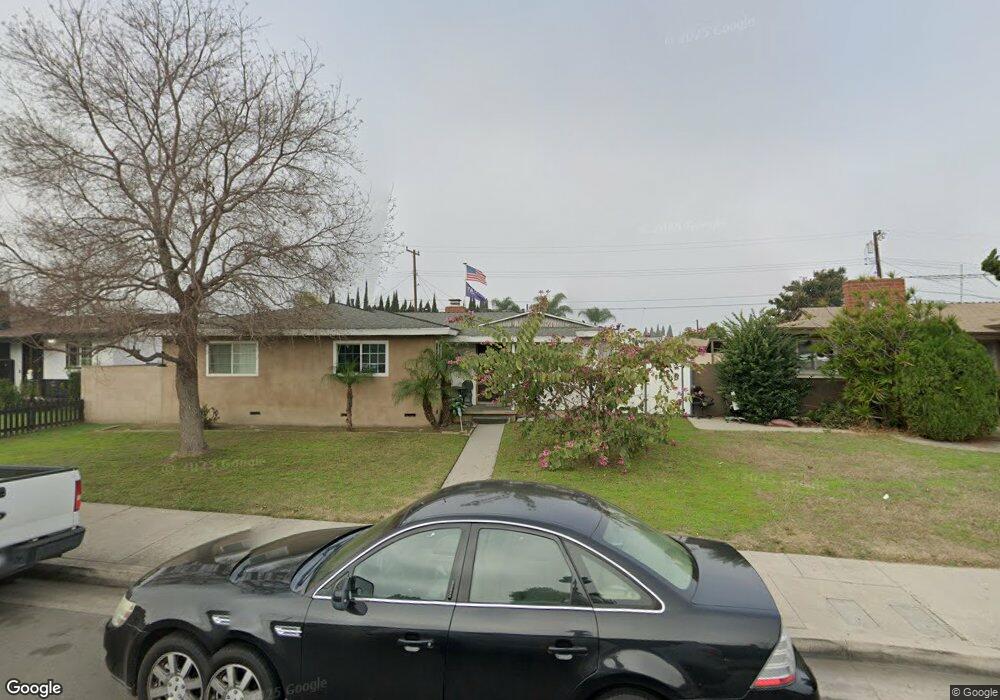
405 S Dale Ave Anaheim, CA 92804
West Anaheim NeighborhoodEstimated Value: $854,000 - $937,000
3
Beds
2
Baths
1,479
Sq Ft
$607/Sq Ft
Est. Value
About This Home
This home is located at 405 S Dale Ave, Anaheim, CA 92804 and is currently estimated at $898,311, approximately $607 per square foot. 405 S Dale Ave is a home located in Orange County with nearby schools including Dr. Albert Schweitzer Elementary School, Dale Jr High School, and Magnolia High.
Ownership History
Date
Name
Owned For
Owner Type
Purchase Details
Closed on
Jan 31, 2002
Sold by
Huard Tamre L
Bought by
Huard Michael F
Current Estimated Value
Home Financials for this Owner
Home Financials are based on the most recent Mortgage that was taken out on this home.
Original Mortgage
$200,000
Interest Rate
7.04%
Purchase Details
Closed on
Oct 10, 1997
Sold by
Huard Marcel E and Huard Helen M
Bought by
Huard Michael F and Huard Tamre L
Home Financials for this Owner
Home Financials are based on the most recent Mortgage that was taken out on this home.
Original Mortgage
$147,495
Interest Rate
7.23%
Mortgage Type
FHA
Create a Home Valuation Report for This Property
The Home Valuation Report is an in-depth analysis detailing your home's value as well as a comparison with similar homes in the area
Home Values in the Area
Average Home Value in this Area
Purchase History
| Date | Buyer | Sale Price | Title Company |
|---|---|---|---|
| Huard Michael F | -- | Orange Coast Title Los Angel | |
| Huard Michael F | $150,000 | Lawyers Title Company |
Source: Public Records
Mortgage History
| Date | Status | Borrower | Loan Amount |
|---|---|---|---|
| Closed | Huard Michael F | $200,000 | |
| Closed | Huard Michael F | $147,495 |
Source: Public Records
Tax History Compared to Growth
Tax History
| Year | Tax Paid | Tax Assessment Tax Assessment Total Assessment is a certain percentage of the fair market value that is determined by local assessors to be the total taxable value of land and additions on the property. | Land | Improvement |
|---|---|---|---|---|
| 2025 | $1,399 | $102,331 | $43,286 | $59,045 |
| 2024 | $1,399 | $100,325 | $42,437 | $57,888 |
| 2023 | $1,359 | $98,358 | $41,605 | $56,753 |
| 2022 | $1,339 | $96,430 | $40,789 | $55,641 |
| 2021 | $1,321 | $94,540 | $39,990 | $54,550 |
| 2020 | $1,311 | $93,571 | $39,580 | $53,991 |
| 2019 | $1,285 | $91,737 | $38,804 | $52,933 |
| 2018 | $1,268 | $89,939 | $38,043 | $51,896 |
| 2017 | $1,228 | $88,176 | $37,297 | $50,879 |
| 2016 | $1,218 | $86,448 | $36,566 | $49,882 |
| 2015 | $1,205 | $85,150 | $36,017 | $49,133 |
| 2014 | $1,151 | $83,483 | $35,312 | $48,171 |
Source: Public Records
Map
Nearby Homes
- 507 S Shields Dr
- 619 S Shields Dr
- 2770 W Lincoln Ave Unit 29A
- 2770 W Lincoln Ave Unit 40
- 2770 W Lincoln Ave Unit 58
- 2945 W Bridgeport Ave
- 2942 W Floyd Ave
- 2943 W Lincoln Ave
- 103 S Laxore St
- 106 S Laxore St Unit 407
- 107 S Laxore St
- Plan Two at Mason
- Plan Four at Mason
- Plan Three at Mason
- 2871 W Tyler Ave
- 109 S Laxore St
- 211 S Beach Blvd Unit 92
- 2955 W Lincoln Ave Unit 7
- 2550 W Rowland Ave
- 235 S Beach Blvd Unit 132
- 401 S Dale Ave
- 409 S Dale Ave
- 325 S Dale Ave
- 413 S Dale Ave
- 404 S Benwood Dr
- 408 S Benwood Dr
- 400 S Benwood Dr
- 412 S Benwood Dr
- 321 S Dale Ave
- 417 S Dale Ave
- 314 S Benwood Dr
- 403 S Vicki Ln
- 409 S Vicki Ln
- 333 S Vicki Ln
- 416 S Benwood Dr
- 329 S Vicki Ln
- 310 S Benwood Dr
- 317 S Dale Ave
- 421 S Dale Ave
- 413 S Vicki Ln