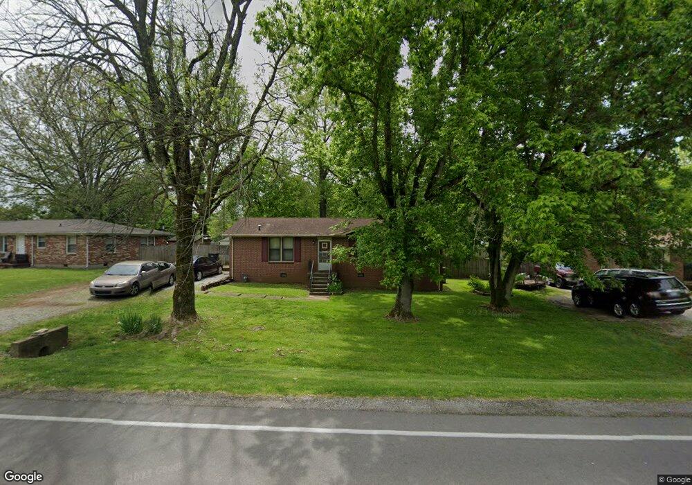
405 S James M Campbell Blvd Columbia, TN 38401
Estimated Value: $4,943,488
--
Bed
2
Baths
27,842
Sq Ft
$178/Sq Ft
Est. Value
About This Home
This home is located at 405 S James M Campbell Blvd, Columbia, TN 38401 and is currently estimated at $4,943,488, approximately $177 per square foot. 405 S James M Campbell Blvd is a home located in Maury County with nearby schools including J. Brown Elementary School, Whitthorne Middle School, and Columbia Central High School.
Ownership History
Date
Name
Owned For
Owner Type
Purchase Details
Closed on
Nov 7, 2023
Sold by
Roman Waltz Llc
Bought by
Agree Limited Partnership
Current Estimated Value
Purchase Details
Closed on
Aug 25, 2016
Sold by
Roman Waltz Llc
Bought by
Mcewen Thornton Llc
Purchase Details
Closed on
Aug 4, 2015
Sold by
Campbell And Lovell Rentals
Bought by
Mcewen Thornton Llc
Home Financials for this Owner
Home Financials are based on the most recent Mortgage that was taken out on this home.
Original Mortgage
$3,220,000
Interest Rate
4.04%
Mortgage Type
Future Advance Clause Open End Mortgage
Purchase Details
Closed on
May 19, 1992
Bought by
Campbell Edward J and Bobby Lovell
Purchase Details
Closed on
Sep 16, 1988
Bought by
Campbell James M
Purchase Details
Closed on
Dec 23, 1982
Create a Home Valuation Report for This Property
The Home Valuation Report is an in-depth analysis detailing your home's value as well as a comparison with similar homes in the area
Home Values in the Area
Average Home Value in this Area
Purchase History
| Date | Buyer | Sale Price | Title Company |
|---|---|---|---|
| Agree Limited Partnership | $4,700,000 | None Listed On Document | |
| Mcewen Thornton Llc | $4,500,000 | Fidelity National Title | |
| Mcewen Thornton Llc | $850,000 | Bridgehouse Title | |
| Campbell Edward J | -- | -- | |
| Campbell James M | $260,000 | -- | |
| -- | -- | -- |
Source: Public Records
Mortgage History
| Date | Status | Borrower | Loan Amount |
|---|---|---|---|
| Previous Owner | Mcewen Thornton Llc | $3,220,000 |
Source: Public Records
Tax History Compared to Growth
Tax History
| Year | Tax Paid | Tax Assessment Tax Assessment Total Assessment is a certain percentage of the fair market value that is determined by local assessors to be the total taxable value of land and additions on the property. | Land | Improvement |
|---|---|---|---|---|
| 2024 | $22,769 | $1,192,120 | $338,520 | $853,600 |
| 2023 | $22,769 | $1,192,120 | $338,520 | $853,600 |
| 2022 | $32,605 | $1,192,120 | $338,520 | $853,600 |
| 2021 | $32,605 | $1,066,800 | $260,400 | $806,400 |
| 2020 | $36,230 | $1,066,800 | $260,400 | $806,400 |
| 2019 | $24,744 | $1,066,800 | $260,400 | $806,400 |
| 2018 | $23,858 | $1,066,800 | $260,400 | $806,400 |
| 2017 | $38,935 | $915,040 | $245,520 | $669,520 |
| 2016 | $38,935 | $915,040 | $245,520 | $669,520 |
| 2015 | $6,416 | $158,040 | $144,640 | $13,400 |
| 2014 | $3,799 | $93,560 | $80,160 | $13,400 |
Source: Public Records
Map
Nearby Homes
- 0 Mcintosh Dr
- 2023 Denise Dr
- 308 Due Ln
- 1815 Ableson Way
- 1930 Woodmont Dr
- 2204 Denham Ave
- 3021 Glenstone Dr
- 2124 Circle Dr
- 2135 Thomas Ave
- 112 Mckinley Dr
- 1913 Morris Ave
- 1923 Overton Dr
- 1918 Overton Dr
- 1912 Paul Dr
- 516 Pickens Ln
- 1818 Morningside Ave
- 2011 Denham Ave
- 1830 Dimple Ct
- 501 Green Acres Dr
- 120 Dogwood Dr
- 2503 Keith Dr
- 202 Ashwood Dr
- 200 Ashwood Dr
- 204 Ashwood Dr
- 204 Ashwood Dr
- 206 Ashwood Dr
- 101 Ashwood Dr
- 2502 Keith Dr
- 401 S James Campbell Blvd
- 208 Ashwood Dr
- 201 Ashwood Dr
- 103 Ashwood Dr
- 203 Ashwood Dr
- 2601 Campbellsville Pike
- 205 Ashwood Dr
- 501 S James M Campbell Blvd
- 102 Ashwood Dr
- 105 Ashwood Dr
- 210 Ashwood Dr
- 2513 Keith Dr