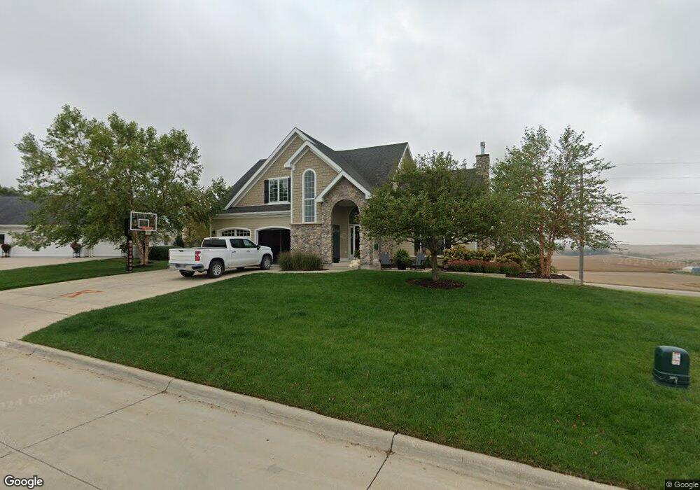
405 Southridge Dr Carroll, IA 51401
Estimated Value: $459,000 - $595,000
3
Beds
5
Baths
2,342
Sq Ft
$224/Sq Ft
Est. Value
About This Home
This home is located at 405 Southridge Dr, Carroll, IA 51401 and is currently estimated at $525,611, approximately $224 per square foot. 405 Southridge Dr is a home with nearby schools including Fairview Elementary School, Adams Elementary School, and Carroll Middle School.
Ownership History
Date
Name
Owned For
Owner Type
Purchase Details
Closed on
Jul 19, 2007
Sold by
704 Development Corp
Bought by
Glynn Dirk A and Glynn Beth A
Current Estimated Value
Home Financials for this Owner
Home Financials are based on the most recent Mortgage that was taken out on this home.
Original Mortgage
$260,000
Interest Rate
6.71%
Mortgage Type
Purchase Money Mortgage
Create a Home Valuation Report for This Property
The Home Valuation Report is an in-depth analysis detailing your home's value as well as a comparison with similar homes in the area
Home Values in the Area
Average Home Value in this Area
Purchase History
| Date | Buyer | Sale Price | Title Company |
|---|---|---|---|
| Glynn Dirk A | $37,000 | Security Title & Investment |
Source: Public Records
Mortgage History
| Date | Status | Borrower | Loan Amount |
|---|---|---|---|
| Closed | Glynn Dirk A | $260,000 |
Source: Public Records
Tax History Compared to Growth
Tax History
| Year | Tax Paid | Tax Assessment Tax Assessment Total Assessment is a certain percentage of the fair market value that is determined by local assessors to be the total taxable value of land and additions on the property. | Land | Improvement |
|---|---|---|---|---|
| 2025 | $6,184 | $520,690 | $50,510 | $470,180 |
| 2024 | $6,064 | $471,630 | $50,510 | $421,120 |
| 2023 | $6,265 | $471,630 | $50,510 | $421,120 |
| 2022 | $5,950 | $410,410 | $46,420 | $363,990 |
| 2021 | $5,950 | $410,410 | $46,420 | $363,990 |
| 2020 | $6,073 | $410,410 | $46,420 | $363,990 |
| 2019 | $6,058 | $410,410 | $46,420 | $363,990 |
| 2018 | $5,706 | $410,410 | $46,420 | $363,990 |
| 2017 | $5,702 | $398,296 | $49,669 | $348,627 |
| 2016 | $5,328 | $372,240 | $0 | $0 |
| 2015 | $5,328 | $351,560 | $0 | $0 |
| 2014 | $4,974 | $351,560 | $0 | $0 |
Source: Public Records
Map
Nearby Homes
- 629 Meadow Ln
- 407 Westridge Dr
- 308 Prairie View Dr
- 409 E Valley Dr
- 451 Deer Creek Ln
- Deer Creek Ln Lot 36
- 121 S West St
- 120 E 1st St Unit 2
- 519 E 1st St
- 619 W 2nd St
- 19383 U S 30
- 0 Deer Creek Ln Unit 6302348
- 727 N Adams St
- 807 N Court St
- 804 N Clark St
- 926 N Court St
- 907 Salinger Ave
- 1015 N Adams St
- 0 E 10th St Unit 5423085
- 0 E 10th St Unit 6324630
- 739 Prairie View Dr
- 725 Prairie View Dr
- 0 W Pleasant Ridge Rd
- 322 W Pleasant Ridge Rd
- 715 Prairie View Dr
- 325 W Pleasant Ridge Rd
- 706 Prairie View Dr
- 643 Field Crest Dr
- 705 Prairie View Dr
- 501 Summit Dr
- 642 Prairie View Dr
- 639 Field Crest Dr
- 511 Summit Dr
- 306 W Pleasant Ridge Rd
- 714 Hidden Valley Rd
- 639 Prairie View Dr
- 636 Prairie View Dr
- 633 Field Crest Dr
- 521 Summit Dr
- 504 Summit Dr