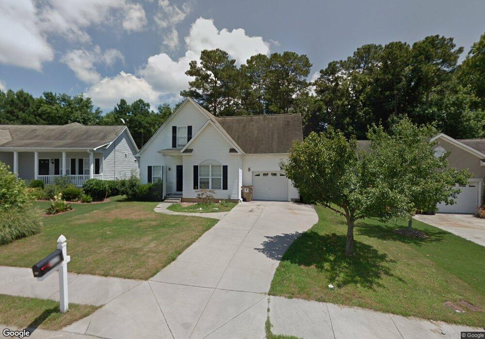
405 St Dunstans Peachtree City, GA 30269
Estimated Value: $398,671 - $463,000
4
Beds
3
Baths
1,852
Sq Ft
$233/Sq Ft
Est. Value
About This Home
This home is located at 405 St Dunstans, Peachtree City, GA 30269 and is currently estimated at $432,418, approximately $233 per square foot. 405 St Dunstans is a home located in Fayette County with nearby schools including Peachtree City Elementary School, Booth Middle School, and McIntosh High School.
Ownership History
Date
Name
Owned For
Owner Type
Purchase Details
Closed on
Jul 29, 2010
Sold by
Jlk Investment Properties Llc
Bought by
King Jeff
Current Estimated Value
Purchase Details
Closed on
Oct 18, 2006
Sold by
King Properties & Invs Inc
Bought by
Rowe Jack T
Home Financials for this Owner
Home Financials are based on the most recent Mortgage that was taken out on this home.
Original Mortgage
$168,000
Interest Rate
6%
Mortgage Type
New Conventional
Create a Home Valuation Report for This Property
The Home Valuation Report is an in-depth analysis detailing your home's value as well as a comparison with similar homes in the area
Home Values in the Area
Average Home Value in this Area
Purchase History
| Date | Buyer | Sale Price | Title Company |
|---|---|---|---|
| King Jeff | -- | -- | |
| Rowe Jack T | -- | -- | |
| King Jeff | $210,000 | -- |
Source: Public Records
Mortgage History
| Date | Status | Borrower | Loan Amount |
|---|---|---|---|
| Previous Owner | King Jeff | $168,000 |
Source: Public Records
Tax History Compared to Growth
Tax History
| Year | Tax Paid | Tax Assessment Tax Assessment Total Assessment is a certain percentage of the fair market value that is determined by local assessors to be the total taxable value of land and additions on the property. | Land | Improvement |
|---|---|---|---|---|
| 2024 | $4,497 | $152,168 | $22,000 | $130,168 |
| 2023 | $4,126 | $136,000 | $21,800 | $114,200 |
| 2022 | $3,798 | $125,400 | $22,000 | $103,400 |
| 2021 | $3,351 | $109,080 | $22,000 | $87,080 |
| 2020 | $3,364 | $108,360 | $22,000 | $86,360 |
| 2019 | $3,272 | $104,360 | $22,000 | $82,360 |
| 2018 | $3,210 | $100,760 | $22,000 | $78,760 |
| 2017 | $3,234 | $100,840 | $22,000 | $78,840 |
| 2016 | $3,002 | $90,160 | $22,000 | $68,160 |
| 2015 | $2,918 | $86,200 | $19,600 | $66,600 |
| 2014 | $2,916 | $84,640 | $19,600 | $65,040 |
| 2013 | -- | $66,080 | $0 | $0 |
Source: Public Records
Map
Nearby Homes
- 147 Westberry St
- 405 Abbey Rd
- 719 Gittings Ave
- 138 Wynnmeade Pkwy
- 412 Constitution Cir
- 124 Kings Ridge Dr
- 111 S Fairfield Dr
- 169 Wynnmeade Pkwy
- 171 Wynnmeade Pkwy
- 713 S Fairfield Dr
- 505 N Fairfield Dr
- 64 Star Spangled Ln
- 826 Richmond Cir
- 405 Sherrels Ford
- 22 Star Spangled Ln
- 637 N Fairfield Dr
- 844 Richmond Cir Unit 7
- 327 Walnut Grove Rd
- 308 Bandon Way
- 0 Highway 54 Unit 10555371
- 405 Saint Dunstans Ct Unit 1
- 407 Saint Dunstans Ct
- 403 St Dustans Ct
- 403 St Dustans Ct Unit 1
- 403 St Dunstans Ct
- 403 Saint Dunstans Ct
- 0 Saint Dunstans Ct Unit 7510253
- 0 Saint Dunstans Ct Unit 7070222
- 0 Saint Dunstans Ct Unit 8932656
- 0 Saint Dunstans Ct Unit 8967028
- 0 Saint Dunstans Ct Unit 7419001
- 0 Saint Dunstans Ct Unit 7539394
- 409 Saint Dunstans Ct
- 206 Turnbridge Cir Unit 1
- 400 St Dunstans Ct Unit Lot 65 Cedar
- 400 St Dunstans Ct
- 400 Saint Dunstans Ct
- 208 Turnbridge Cir Unit 55
- 208 Turnbridge Cir
- 402 Saint Dunstans Ct