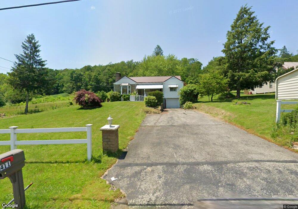
405 State Route 217 Latrobe, PA 15650
Estimated Value: $148,000
--
Bed
--
Bath
1,552
Sq Ft
$95/Sq Ft
Est. Value
About This Home
This home is located at 405 State Route 217, Latrobe, PA 15650 and is currently estimated at $148,000, approximately $95 per square foot. 405 State Route 217 is a home located in Westmoreland County with nearby schools including Grandview Elementary School, Derry Area Middle School, and Derry Area Senior High School.
Ownership History
Date
Name
Owned For
Owner Type
Purchase Details
Closed on
Jul 12, 2024
Sold by
Ray Robert J and Ray Emily A
Bought by
Delenne Christopher Michael and Ellenberger Sarah Jane
Current Estimated Value
Purchase Details
Closed on
Mar 15, 2021
Sold by
Rhodes Brian K and Rhodes Susan M
Bought by
Ray Robert J and Ray Emily A
Purchase Details
Closed on
Mar 6, 2020
Sold by
Rhodes Gary A and Rhodes Beth
Bought by
Rhodes Erik C and Rhodes Jenny D
Home Financials for this Owner
Home Financials are based on the most recent Mortgage that was taken out on this home.
Original Mortgage
$82,500
Interest Rate
3.5%
Mortgage Type
New Conventional
Purchase Details
Closed on
Jul 16, 2019
Sold by
Rhodes Brian K and Rhodes Susan M
Bought by
Torba Edward M
Purchase Details
Closed on
Feb 22, 2018
Sold by
Rhodes Nancy
Bought by
Rhodes Brian K and Rhodes Gary A
Create a Home Valuation Report for This Property
The Home Valuation Report is an in-depth analysis detailing your home's value as well as a comparison with similar homes in the area
Home Values in the Area
Average Home Value in this Area
Purchase History
| Date | Buyer | Sale Price | Title Company |
|---|---|---|---|
| Delenne Christopher Michael | $115,000 | None Listed On Document | |
| Ray Robert J | $55,000 | None Available | |
| Rhodes Erik C | $120,000 | None Available | |
| Torba Edward M | $60,000 | None Available | |
| Rhodes Brian K | -- | None Available |
Source: Public Records
Mortgage History
| Date | Status | Borrower | Loan Amount |
|---|---|---|---|
| Previous Owner | Rhodes Erik C | $82,500 |
Source: Public Records
Tax History Compared to Growth
Tax History
| Year | Tax Paid | Tax Assessment Tax Assessment Total Assessment is a certain percentage of the fair market value that is determined by local assessors to be the total taxable value of land and additions on the property. | Land | Improvement |
|---|---|---|---|---|
| 2025 | $580 | $4,670 | $4,670 | $0 |
| 2024 | $580 | $4,670 | $4,670 | $0 |
| 2023 | $548 | $4,670 | $4,670 | $0 |
| 2022 | $543 | $4,670 | $4,670 | $0 |
| 2021 | $543 | $4,670 | $4,670 | $0 |
| 2020 | $1,839 | $16,090 | $5,270 | $10,820 |
| 2019 | $2,137 | $19,120 | $6,270 | $12,850 |
| 2018 | $2,042 | $19,120 | $6,270 | $12,850 |
| 2017 | $1,988 | $19,120 | $6,270 | $12,850 |
| 2016 | $1,902 | $19,120 | $6,270 | $12,850 |
| 2015 | $1,902 | $19,120 | $6,270 | $12,850 |
| 2014 | $1,902 | $19,120 | $6,270 | $12,850 |
Source: Public Records
Map
Nearby Homes
- 510 Pennsylvania 217
- 515 Sunview Cir
- 498 Sunview Cir
- 1224 High St
- 219 10th St
- 211 10th St
- 408 Highview St
- 4974 State Route 982
- 147 N Valley St
- 33 Brinker St
- 332 Richmond St
- 913 W 1st Ave
- 0 Hillview Ave
- 0 Tanner Ln
- 213 Greenfield Rd
- 513 Jennie Ln
- 226 Brinker St
- 410 Smith St
- 707 Victoria Way
- 793 Victoria Way
- 411 State Route 217
- 409 State Route 217
- 415 State Route 217
- 406 State Route 217 Unit B
- 419 State Route 217
- 416 State Route 217
- 103 Chestnut Ridge Rd
- 405 Pennsylvania 217
- 423 State Route 217
- 110 Chestnut Ridge Rd
- 420 State Route 217
- 111 Chestnut Ridge Rd
- 427 State Route 217
- 378 Pennsylvania 217
- 378 State Route 217
- 428 State Route 217
- 379 State Route 217
- 121 Chestnut Ridge Rd
- 382 Pennsylvania 217
- 374 State Route 217