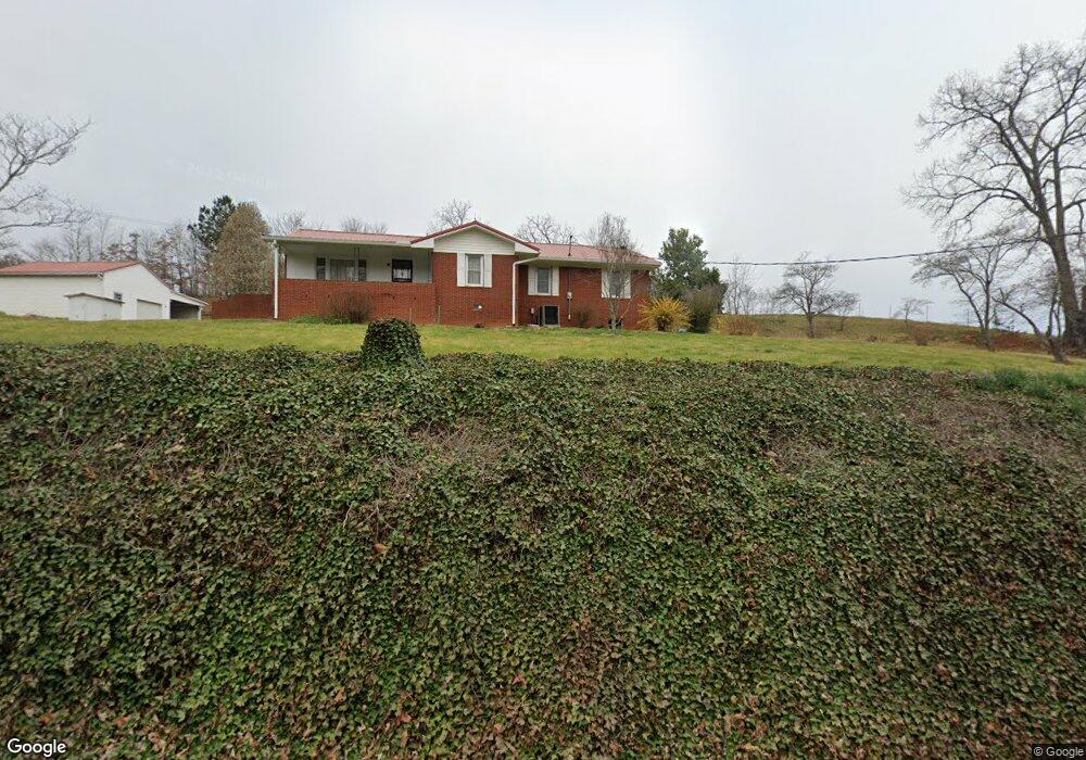
4054 Highway 411 Dandridge, TN 37725
Estimated Value: $315,000 - $490,000
--
Bed
--
Bath
1,789
Sq Ft
$231/Sq Ft
Est. Value
About This Home
This home is located at 4054 Highway 411, Dandridge, TN 37725 and is currently estimated at $413,234, approximately $230 per square foot. 4054 Highway 411 is a home.
Ownership History
Date
Name
Owned For
Owner Type
Purchase Details
Closed on
Sep 10, 2021
Sold by
Ellis Darrell W and Ellis Brenda C
Bought by
Bush Brothers & Company
Current Estimated Value
Purchase Details
Closed on
Aug 26, 2016
Sold by
Ellis Dorotha Ann Thornton and Ellis Raymond C
Bought by
Ellis Darrell W and Ellis Brenda C
Purchase Details
Closed on
May 15, 2014
Sold by
Griffin Stanley R
Bought by
Griffin Stanley R
Purchase Details
Closed on
Feb 28, 2014
Sold by
Willocks Benny
Bought by
Griffin Stanley R
Purchase Details
Closed on
Feb 10, 2004
Sold by
Thornton Ellis Dortha Ann
Bought by
Thronton Ellis Dortha Ann
Purchase Details
Closed on
Nov 29, 1967
Bought by
Ellis Dortha Ann T
Purchase Details
Closed on
Feb 1, 1960
Bought by
Thornton Mrs Chester
Create a Home Valuation Report for This Property
The Home Valuation Report is an in-depth analysis detailing your home's value as well as a comparison with similar homes in the area
Home Values in the Area
Average Home Value in this Area
Purchase History
| Date | Buyer | Sale Price | Title Company |
|---|---|---|---|
| Bush Brothers & Company | $370,000 | Tennessee Land Title | |
| Ellis Darrell W | $122,900 | None Available | |
| Griffin Stanley R | -- | -- | |
| Griffin Stanley R | $150,000 | -- | |
| Thronton Ellis Dortha Ann | -- | -- | |
| Ellis Dortha Ann T | -- | -- | |
| Thornton Mrs Chester | -- | -- |
Source: Public Records
Tax History Compared to Growth
Tax History
| Year | Tax Paid | Tax Assessment Tax Assessment Total Assessment is a certain percentage of the fair market value that is determined by local assessors to be the total taxable value of land and additions on the property. | Land | Improvement |
|---|---|---|---|---|
| 2025 | $1,034 | $72,275 | $12,250 | $60,025 |
| 2023 | $815 | $35,425 | $0 | $0 |
| 2022 | $776 | $35,425 | $5,500 | $29,925 |
| 2021 | $776 | $35,425 | $5,500 | $29,925 |
| 2020 | $776 | $35,425 | $5,500 | $29,925 |
| 2019 | $776 | $35,425 | $5,500 | $29,925 |
| 2018 | $722 | $30,725 | $5,375 | $25,350 |
| 2017 | $722 | $30,725 | $5,375 | $25,350 |
| 2016 | $722 | $30,725 | $5,375 | $25,350 |
| 2015 | $722 | $30,725 | $5,375 | $25,350 |
| 2014 | $722 | $30,725 | $5,375 | $25,350 |
Source: Public Records
Map
Nearby Homes
- 0 Stonehenge Way Unit 37 11571633
- 0 Stonehenge Way
- Lot 37 Stonehenge Way
- Lot 4 Stonehenge Way
- 4310 Stonehenge Way
- 4169 Newport Hwy
- 4151 Newport Hwy
- 2303 Rainwater Rd
- 105 Burning Oaks Dr
- 3851 Mistletoe Loop
- 125 Burning Oaks Dr
- 134 Burning Oaks Dr
- 150 Burning Oaks Dr
- 1011 Frank Thornton Rd
- 320 Muscadine Ct
- 223 Burning Oaks Dr
- 274 Burning Oaks Dr
- 224 Burning Oaks Dr
- 279 Arrowhead Mountain Way
- 0 Vera Ln
- 2307 Joe Thornton Rd
- 2314 Joe Thornton Rd
- 4107 Highway 411
- 000 Highway 411
- 2320 Joe Thornton Rd
- 2308 Joe Thornton Rd
- 2325 Joe Thornton Rd
- 4115 Highway 411
- 4125 Highway 411
- 4131 Highway 411
- 4025 Highway 411
- 2342 Joe Thornton Rd
- 4312 Newport Hwy
- 3437 Baxter Rd
- 143 County Line Rd
- 7 County Line Rd
- 9 County Line Rd
- 13 County Line Rd
- 161 County Line Rd
- Lot 9 County Line Rd