Estimated Value: $165,426 - $195,000
--
Bed
--
Bath
1,040
Sq Ft
$171/Sq Ft
Est. Value
About This Home
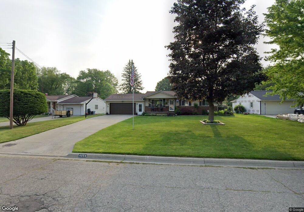
This home is located at 4054 Sam Snead Dr, Flint, MI 48506 and is currently estimated at $178,357, approximately $171 per square foot. 4054 Sam Snead Dr is a home located in Genesee County with nearby schools including Weston Elementary School, Kate Dowdall Elementary School, and Leota Fiedler Elementary School.
Ownership History
Date
Name
Owned For
Owner Type
Purchase Details
Closed on
Oct 18, 2024
Sold by
Coon-Williams Melissa
Bought by
Coon-Williams Melissa and Williams Timothy
Current Estimated Value
Purchase Details
Closed on
Aug 11, 2010
Sold by
Coon John M and Coon Melissa L
Bought by
Us Bank National Association
Purchase Details
Closed on
Jun 28, 1999
Sold by
Birtles Robert C and Birtles Cindy L
Bought by
Coon John M and Coon Melissa L
Home Financials for this Owner
Home Financials are based on the most recent Mortgage that was taken out on this home.
Original Mortgage
$110,100
Interest Rate
7.29%
Mortgage Type
Purchase Money Mortgage
Create a Home Valuation Report for This Property
The Home Valuation Report is an in-depth analysis detailing your home's value as well as a comparison with similar homes in the area
Home Values in the Area
Average Home Value in this Area
Purchase History
| Date | Buyer | Sale Price | Title Company |
|---|---|---|---|
| Coon-Williams Melissa | -- | None Listed On Document | |
| Us Bank National Association | $68,000 | None Available | |
| Coon John M | $115,900 | Metropolitan Title Company |
Source: Public Records
Mortgage History
| Date | Status | Borrower | Loan Amount |
|---|---|---|---|
| Previous Owner | Coon John M | $110,100 |
Source: Public Records
Tax History Compared to Growth
Tax History
| Year | Tax Paid | Tax Assessment Tax Assessment Total Assessment is a certain percentage of the fair market value that is determined by local assessors to be the total taxable value of land and additions on the property. | Land | Improvement |
|---|---|---|---|---|
| 2025 | $1,668 | $76,800 | $0 | $0 |
| 2024 | $440 | $75,100 | $0 | $0 |
| 2023 | $420 | $68,800 | $0 | $0 |
| 2022 | $1,384 | $60,000 | $0 | $0 |
| 2021 | $1,372 | $54,000 | $0 | $0 |
| 2020 | $384 | $50,300 | $0 | $0 |
| 2019 | $378 | $47,100 | $0 | $0 |
| 2018 | $1,295 | $41,000 | $0 | $0 |
| 2017 | $1,268 | $39,400 | $0 | $0 |
| 2016 | $1,238 | $37,300 | $0 | $0 |
| 2015 | $1,044 | $34,600 | $0 | $0 |
| 2014 | $348 | $31,100 | $0 | $0 |
| 2012 | -- | $33,300 | $33,300 | $0 |
Source: Public Records
Map
Nearby Homes
- 4318 Tommy Armour Dr
- 3413 Blue Lake Dr
- 3414 N Genesee Rd
- 5142 Berneda Dr
- 4141 Hidden View Dr
- 3294 Comer Dr
- 4055 Mitchell Dr
- 5111 Paro Dr
- 4237 Sugar Maple Run Unit 8
- 4231 Sugar Maple Run Unit 7
- 3301 S Kearsley Blvd
- 4225 Sugar Maple Run Unit 6
- 4213 Sugar Maple Run Unit 4
- 4419 Maple Leaf Trail
- 4413 Maple Leaf Trail
- 4444 Maple Leaf Trail
- 4207 Sugar Maple Run Unit 3
- 4438 Maple Leaf Trail
- 4455 N Genesee Rd
- 4432 Maple Leaf Trail
- 4044 Sam Snead Dr
- 4060 Sam Snead Dr
- 4036 Sam Snead Dr
- 4070 Sam Snead Dr
- 4026 Sam Snead Dr
- 4375 Esta Dr
- 4405 Esta Dr
- 4059 Ben Hogan Dr
- 4082 Sam Snead Dr
- 4067 Ben Hogan Dr
- 4065 Sam Snead Dr
- 4051 Sam Snead Dr
- 4057 Sam Snead Dr
- 4363 Esta Dr
- 4075 Ben Hogan Dr
- 4045 Ben Hogan Dr
- 4413 Esta Dr
- 4053 Ben Hogan Dr
- 4083 Ben Hogan Dr
- 4071 Sam Snead Dr