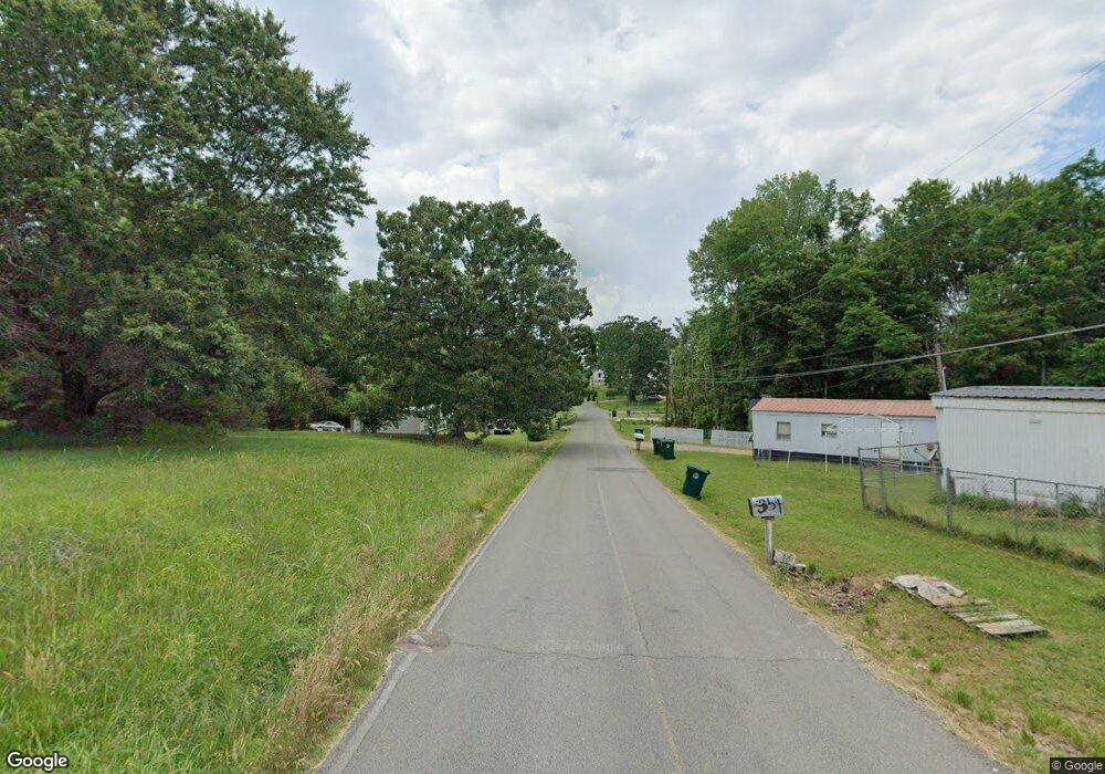
406 A & B High St E Mc Ewen, TN 37101
Estimated Value: $47,000 - $272,744
Studio
2
Baths
1,550
Sq Ft
$113/Sq Ft
Est. Value
About This Home
This home is located at 406 A & B High St E, Mc Ewen, TN 37101 and is currently estimated at $174,915, approximately $112 per square foot. 406 A & B High St E is a home with nearby schools including St. Patrick's School.
Ownership History
Date
Name
Owned For
Owner Type
Purchase Details
Closed on
May 6, 2025
Sold by
Rishton Maria H
Bought by
Elkhorn Partners Llc
Current Estimated Value
Purchase Details
Closed on
Aug 27, 2021
Sold by
Pinnacle Investment Group Llc
Bought by
Rishton Robert B and Rishton Maria H
Home Financials for this Owner
Home Financials are based on the most recent Mortgage that was taken out on this home.
Original Mortgage
$186,700
Interest Rate
2.17%
Purchase Details
Closed on
Apr 29, 2005
Bought by
Hildebrand Allan S and Hildebrand Kristie R Smith
Purchase Details
Closed on
Aug 1, 1986
Bought by
Jones Ruby Mae L and Jones E
Purchase Details
Closed on
Aug 19, 1961
Create a Home Valuation Report for This Property
The Home Valuation Report is an in-depth analysis detailing your home's value as well as a comparison with similar homes in the area
Purchase History
| Date | Buyer | Sale Price | Title Company |
|---|---|---|---|
| Elkhorn Partners Llc | $645,000 | None Listed On Document | |
| Elkhorn Partners Llc | $645,000 | None Listed On Document | |
| Rishton Robert B | $26,666 | None Available | |
| Hildebrand Allan S | $71,000 | -- | |
| Jones Ruby Mae L | -- | -- | |
| -- | -- | -- |
Source: Public Records
Mortgage History
| Date | Status | Borrower | Loan Amount |
|---|---|---|---|
| Previous Owner | Rishton Robert B | $186,700 |
Source: Public Records
Tax History Compared to Growth
Tax History
| Year | Tax Paid | Tax Assessment Tax Assessment Total Assessment is a certain percentage of the fair market value that is determined by local assessors to be the total taxable value of land and additions on the property. | Land | Improvement |
|---|---|---|---|---|
| 2025 | $2,142 | $91,640 | $0 | $0 |
| 2024 | $1,923 | $91,640 | $3,640 | $88,000 |
| 2023 | $1,923 | $91,640 | $3,640 | $88,000 |
| 2022 | $434 | $2,300 | $2,300 | $0 |
| 2021 | $59 | $2,300 | $2,300 | $0 |
| 2020 | $68 | $2,300 | $2,300 | $0 |
| 2019 | $66 | $2,600 | $2,600 | $0 |
| 2018 | $66 | $2,600 | $2,600 | $0 |
| 2017 | $67 | $2,600 | $2,600 | $0 |
| 2016 | $72 | $2,600 | $2,600 | $0 |
| 2015 | $72 | $2,600 | $2,600 | $0 |
| 2014 | $72 | $2,598 | $0 | $0 |
Source: Public Records
Map
Nearby Homes
- 596 High St E
- 0 Ridgewood Dr Unit RTC2791892
- 100 Indian Creek Rd
- 62 High St E
- 58 Florence St
- 220 Indian Creek Rd
- 135 Main St
- 297 Bold Springs Rd
- 4407 Tennessee 231
- 0 Curtis Chapel Rd
- 93 Valley Rd
- 8871 Highway 70 E
- 0 Ridge Rd
- 120 Pinethicket Rd
- 885 Long St W
- 895 Long St W
- 0 Hurt Loop
- 320 Capps Farm Ln
- 7731 Highway 70 E
- 2044 Old Blacktop Rd
