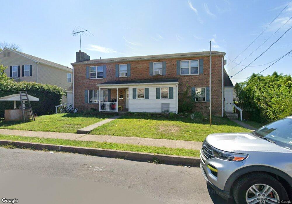
406 Acorn St Unit 410 Lansdale, PA 19446
Estimated Value: $492,000 - $625,963
4
Beds
3
Baths
2,915
Sq Ft
$197/Sq Ft
Est. Value
About This Home
This home is located at 406 Acorn St Unit 410, Lansdale, PA 19446 and is currently estimated at $574,241, approximately $196 per square foot. 406 Acorn St Unit 410 is a home located in Montgomery County with nearby schools including Knapp Elementary School, Penndale Middle School, and North Penn Senior High School.
Ownership History
Date
Name
Owned For
Owner Type
Purchase Details
Closed on
Jul 11, 2022
Sold by
Dominic Pallante
Bought by
Mollah Sharmin
Current Estimated Value
Home Financials for this Owner
Home Financials are based on the most recent Mortgage that was taken out on this home.
Original Mortgage
$542,983
Outstanding Balance
$516,586
Interest Rate
5.09%
Mortgage Type
FHA
Estimated Equity
$57,655
Purchase Details
Closed on
Feb 15, 1991
Bought by
Pallante Dominic
Create a Home Valuation Report for This Property
The Home Valuation Report is an in-depth analysis detailing your home's value as well as a comparison with similar homes in the area
Home Values in the Area
Average Home Value in this Area
Purchase History
| Date | Buyer | Sale Price | Title Company |
|---|---|---|---|
| Mollah Sharmin | $555,000 | Evans Abstract Llc | |
| Pallante Dominic | -- | -- |
Source: Public Records
Mortgage History
| Date | Status | Borrower | Loan Amount |
|---|---|---|---|
| Open | Mollah Sharmin | $542,983 |
Source: Public Records
Tax History Compared to Growth
Tax History
| Year | Tax Paid | Tax Assessment Tax Assessment Total Assessment is a certain percentage of the fair market value that is determined by local assessors to be the total taxable value of land and additions on the property. | Land | Improvement |
|---|---|---|---|---|
| 2025 | $7,486 | $177,990 | $45,400 | $132,590 |
| 2024 | $7,486 | $177,990 | $45,400 | $132,590 |
| 2023 | $7,003 | $177,990 | $45,400 | $132,590 |
| 2022 | $6,781 | $177,990 | $45,400 | $132,590 |
| 2021 | $6,505 | $177,990 | $45,400 | $132,590 |
| 2020 | $6,309 | $177,990 | $45,400 | $132,590 |
| 2019 | $6,204 | $177,990 | $45,400 | $132,590 |
| 2018 | $1,664 | $177,990 | $45,400 | $132,590 |
| 2017 | $5,791 | $177,990 | $45,400 | $132,590 |
| 2016 | $5,722 | $177,990 | $45,400 | $132,590 |
| 2015 | $5,310 | $177,990 | $45,400 | $132,590 |
| 2014 | $5,310 | $177,990 | $45,400 | $132,590 |
Source: Public Records
Map
Nearby Homes
- 302 W 8th St Unit 21
- 816 Kenilworth Ave
- 833 W 4th St
- 129 W Fifth St
- 1025 Birch St
- 1028 Poplar St Unit 75
- 204 N Valley Forge Rd Unit 7B
- 831 W Main St
- 625 Derstine Ave
- 405 Derstine Ave
- 108 Allison Ct Unit 8
- 21 S Valley Forge Rd Unit 213
- 13 W End Dr
- 39 E 5th St
- 529 N Chestnut St
- 1035 Forest Ave
- 124 E 5th St
- 130 E 5th St
- 200 E 5th St
- 135 Third
- 406 410 Acorn St
- 404 Acorn St
- 421 W 6th St
- 402 Acorn St
- 402 Acorn St Unit B
- 419 W 6th St
- 623 N Cannon Ave
- 621 N Cannon Ave
- 619 N Cannon Ave
- 419 Acorn St
- 627 N Cannon Ave
- 417 Acorn St
- 421 Acorn St
- 417 W 6th St
- 617 N Cannon Ave
- 629 N Cannon Ave
- 530 W 6th St
- 415 Acorn St
- 615 N Cannon Ave
- 613 N Cannon Ave