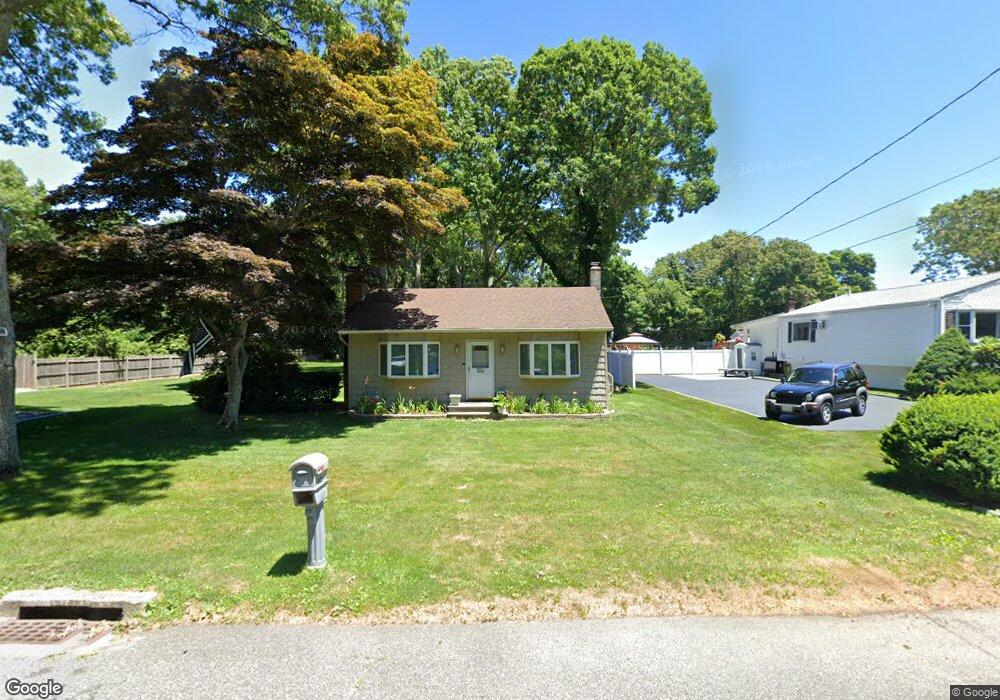
406 Auborn Ave Shirley, NY 11967
Estimated Value: $387,797 - $462,000
2
Beds
1
Bath
660
Sq Ft
$626/Sq Ft
Est. Value
About This Home
This home is located at 406 Auborn Ave, Shirley, NY 11967 and is currently estimated at $412,949, approximately $625 per square foot. 406 Auborn Ave is a home located in Suffolk County with nearby schools including Longwood Junior High School, Longwood Middle School, and Longwood Senior High School.
Ownership History
Date
Name
Owned For
Owner Type
Purchase Details
Closed on
Jun 23, 2005
Sold by
Parker Gerald
Bought by
Perotta John
Current Estimated Value
Purchase Details
Closed on
Oct 14, 2004
Sold by
Botwinick Joel
Bought by
Parker Gerald
Purchase Details
Closed on
Apr 6, 2001
Sold by
Spano Michael W
Bought by
Botwinick Joel
Home Financials for this Owner
Home Financials are based on the most recent Mortgage that was taken out on this home.
Original Mortgage
$121,950
Interest Rate
6.85%
Mortgage Type
FHA
Create a Home Valuation Report for This Property
The Home Valuation Report is an in-depth analysis detailing your home's value as well as a comparison with similar homes in the area
Home Values in the Area
Average Home Value in this Area
Purchase History
| Date | Buyer | Sale Price | Title Company |
|---|---|---|---|
| Perotta John | $265,000 | Edward Cunningham | |
| Parker Gerald | $221,450 | Susan Warren | |
| Botwinick Joel | $122,960 | -- |
Source: Public Records
Mortgage History
| Date | Status | Borrower | Loan Amount |
|---|---|---|---|
| Previous Owner | Botwinick Joel | $121,950 |
Source: Public Records
Tax History Compared to Growth
Tax History
| Year | Tax Paid | Tax Assessment Tax Assessment Total Assessment is a certain percentage of the fair market value that is determined by local assessors to be the total taxable value of land and additions on the property. | Land | Improvement |
|---|---|---|---|---|
| 2024 | $3,675 | $1,000 | $200 | $800 |
| 2023 | $3,675 | $1,000 | $200 | $800 |
| 2022 | $3,168 | $1,000 | $200 | $800 |
| 2021 | $3,168 | $1,000 | $200 | $800 |
| 2020 | $3,273 | $1,000 | $200 | $800 |
| 2019 | $3,273 | $0 | $0 | $0 |
| 2018 | $3,082 | $1,000 | $200 | $800 |
| 2017 | $3,082 | $1,000 | $200 | $800 |
| 2016 | $3,050 | $1,000 | $200 | $800 |
| 2015 | -- | $1,000 | $200 | $800 |
| 2014 | -- | $1,000 | $200 | $800 |
Source: Public Records
Map
Nearby Homes
- 68 Crestwood Dr
- 1330 William Floyd Pkwy
- 283 W End Ave
- 334 Carnation Dr
- 411 Glen Dr
- 336 Auborn Ave
- 380 Wellwood Dr
- 101 Crestwood Dr
- 65 Colin Dr
- 8 & 11 William Floyd Pkwy
- 313 Decatur Ave
- Lot Avondale Dr
- 84 Ridgewood Dr
- 88 Ridgewood Dr
- 459 Wellwood Dr
- 1276 William Floyd Pkwy
- 461 Avondale Dr
- 188 W End Ave
- 425 Puritan Dr
- 149 Crestwood Dr
- 402 Auborn Ave
- 410 Auborn Ave
- 400 Auborn Ave
- 409 Auborn Ave
- 414 Auborn Ave
- 396 Auborn Ave
- 403 Auborn Ave
- 415 Auborn Ave
- 407 Revilo Ave
- 403 Revilo Ave
- 415 Revilo Ave
- 62 Crestwood Dr
- 418 Auborn Ave
- 397 Revilo Ave
- 397 Auborn Ave
- 60 Crestwood Dr
- 397 Revilo Ave
- 395 Revilo Ave
- 404 W End Ave
- 388 Auborn Ave