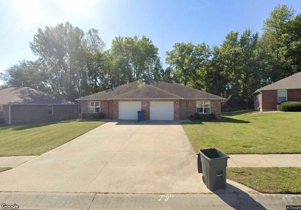
406 Blake Anthony Dr Warrensburg, MO 64093
Estimated Value: $281,000 - $310,000
--
Bed
--
Bath
2,159
Sq Ft
$138/Sq Ft
Est. Value
About This Home
This home is located at 406 Blake Anthony Dr, Warrensburg, MO 64093 and is currently estimated at $296,962, approximately $137 per square foot. 406 Blake Anthony Dr is a home located in Johnson County with nearby schools including Maple Grove Elementary School, Martin Warren Elementary School, and Warrensburg Middle School.
Ownership History
Date
Name
Owned For
Owner Type
Purchase Details
Closed on
Jun 24, 2022
Sold by
Schmidt Jerry A and Schmidt Lisa A
Bought by
D & K Investment Co Llc
Current Estimated Value
Home Financials for this Owner
Home Financials are based on the most recent Mortgage that was taken out on this home.
Original Mortgage
$2,126,531
Outstanding Balance
$2,023,928
Interest Rate
5.3%
Mortgage Type
New Conventional
Estimated Equity
-$1,726,966
Create a Home Valuation Report for This Property
The Home Valuation Report is an in-depth analysis detailing your home's value as well as a comparison with similar homes in the area
Home Values in the Area
Average Home Value in this Area
Purchase History
| Date | Buyer | Sale Price | Title Company |
|---|---|---|---|
| D & K Investment Co Llc | -- | Truman Title |
Source: Public Records
Mortgage History
| Date | Status | Borrower | Loan Amount |
|---|---|---|---|
| Open | D & K Investment Co Llc | $2,126,531 |
Source: Public Records
Tax History Compared to Growth
Tax History
| Year | Tax Paid | Tax Assessment Tax Assessment Total Assessment is a certain percentage of the fair market value that is determined by local assessors to be the total taxable value of land and additions on the property. | Land | Improvement |
|---|---|---|---|---|
| 2024 | $2,257 | $29,550 | $0 | $0 |
| 2023 | $2,257 | $29,550 | $0 | $0 |
| 2022 | $2,181 | $28,435 | $0 | $0 |
| 2021 | $2,173 | $28,435 | $0 | $0 |
| 2020 | $2,111 | $27,320 | $0 | $0 |
| 2019 | $2,110 | $27,320 | $0 | $0 |
| 2017 | $2,105 | $27,320 | $0 | $0 |
| 2016 | $1,940 | $27,320 | $0 | $0 |
| 2015 | $1,992 | $27,320 | $0 | $0 |
| 2014 | -- | $27,320 | $0 | $0 |
Source: Public Records
Map
Nearby Homes
- 317 E Hale Lake Rd
- 507 Larkin Ct
- 503 Quail Trail
- 428 Swallow N A
- 1106 S Mitchell St
- 813 S Maguire St
- 399 Hazelwood Dr
- 111 Fairview Ave
- 0 Business 13 Hwy
- 323 Hamilton St
- 706 Cedar Dr Unit B
- 101 Fairview Ave
- 991 S Mitchell St
- 311 Franklin Ave
- 901 S Holden St
- 606 Cleburn St
- tbd Hamilton St
- 19 SE 150th Rd
- 8 SW 160th Rd
- 153 SE 125 Rd
- 404 Blake Anthony Dr
- TBD Blake Anthony Dr
- 112 N Marr Dr
- 405 Blake Anthony Dr
- 402 Blake Anthony Dr
- 407 Blake Anthony Dr
- 403 Blake Anthony Dr
- 411 Blake Anthony Dr
- 409 Blake Anthony Dr
- 110 N Marr Dr
- 400 Blake Anthony Dr
- 413 Blake Anthony Dr
- 412 Blake Anthony Dr
- 408 Larkin Ct
- 111 N Marr Dr
- 406 Larkin Ct
- 410 Larkin Ct
- 108 N Marr Dr
- 404 Larkin Ct
- 412 Larkin Ct