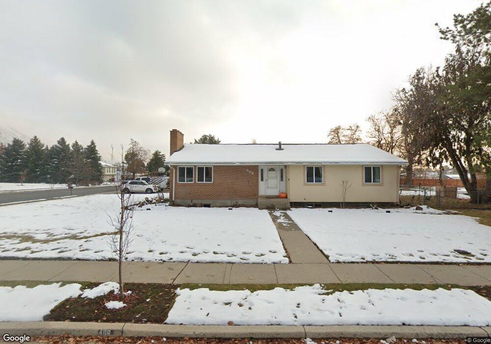
406 E 426 N Alpine, UT 84004
Estimated Value: $760,000 - $822,897
6
Beds
3
Baths
3,750
Sq Ft
$211/Sq Ft
Est. Value
About This Home
This home is located at 406 E 426 N, Alpine, UT 84004 and is currently estimated at $791,474, approximately $211 per square foot. 406 E 426 N is a home located in Utah County with nearby schools including Alpine School, Timberline Middle School, and Lone Peak High School.
Ownership History
Date
Name
Owned For
Owner Type
Purchase Details
Closed on
Jul 3, 2003
Sold by
Stapp Richard O and Stapp Cherie L
Bought by
Stapp Richard O and Stapp Cherie L
Current Estimated Value
Home Financials for this Owner
Home Financials are based on the most recent Mortgage that was taken out on this home.
Original Mortgage
$137,500
Interest Rate
5.22%
Mortgage Type
Purchase Money Mortgage
Purchase Details
Closed on
Apr 18, 2001
Sold by
Stapp Richard O and Stapp Cherie L
Bought by
Stapp Richard O and Stapp Cherie L
Home Financials for this Owner
Home Financials are based on the most recent Mortgage that was taken out on this home.
Original Mortgage
$145,500
Interest Rate
6.98%
Create a Home Valuation Report for This Property
The Home Valuation Report is an in-depth analysis detailing your home's value as well as a comparison with similar homes in the area
Home Values in the Area
Average Home Value in this Area
Purchase History
| Date | Buyer | Sale Price | Title Company |
|---|---|---|---|
| Stapp Richard O | -- | Cpr Title | |
| Stapp Richard O | -- | Cpr Title | |
| Stapp Richard O | -- | Title One | |
| Stapp Richard O | -- | Title One |
Source: Public Records
Mortgage History
| Date | Status | Borrower | Loan Amount |
|---|---|---|---|
| Closed | Stapp Richard O | $137,500 | |
| Closed | Stapp Richard O | $145,500 |
Source: Public Records
Tax History
| Year | Tax Paid | Tax Assessment Tax Assessment Total Assessment is a certain percentage of the fair market value that is determined by local assessors to be the total taxable value of land and additions on the property. | Land | Improvement |
|---|---|---|---|---|
| 2025 | $3,308 | $385,605 | -- | -- |
| 2024 | $3,308 | $385,495 | $0 | $0 |
| 2023 | $3,111 | $389,235 | $0 | $0 |
| 2022 | $3,108 | $377,630 | $0 | $0 |
| 2021 | $2,494 | $470,700 | $229,200 | $241,500 |
| 2020 | $2,324 | $429,300 | $199,300 | $230,000 |
| 2019 | $2,182 | $420,700 | $199,300 | $221,400 |
| 2018 | $2,069 | $394,300 | $183,400 | $210,900 |
| 2017 | $1,913 | $193,930 | $0 | $0 |
| 2016 | $1,838 | $173,800 | $0 | $0 |
| 2015 | $1,873 | $167,530 | $0 | $0 |
| 2014 | $1,628 | $144,045 | $0 | $0 |
Source: Public Records
Map
Nearby Homes
- 499 E 300 N
- 475 Grove Dr
- 48 N 100 E
- 512 Eastridge Cir
- 151 Glacier Lily Dr
- 30 S Main St
- 887 E Village Way
- 248 Deerfield Dr
- 202 E Alpine Dr
- 1103 E Lone Peak Dr
- 381 E Watkins Cir Unit 28
- 250 S Main St Unit 25
- 250 S Main St Unit 9
- 250 S Main St Unit 7
- 382 E Heritage Hills Dr
- 463 Heritage Hills Dr
- 1063 E Alpine Dr
- 19 E Elk Ct
- 287 Heritage Hills Dr
- 259 Twin River Loop
Your Personal Tour Guide
Ask me questions while you tour the home.