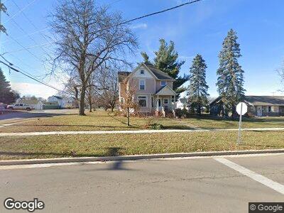
406 N Euclid Ave Princeton, IL 61356
Estimated Value: $88,041 - $156,000
--
Bed
--
Bath
--
Sq Ft
0.32
Acres
About This Home
This home is located at 406 N Euclid Ave, Princeton, IL 61356 and is currently estimated at $122,010. 406 N Euclid Ave is a home located in Bureau County with nearby schools including Lincoln Elementary School, Jefferson Elementary School, and Logan Junior High School.
Ownership History
Date
Name
Owned For
Owner Type
Purchase Details
Closed on
Sep 11, 2017
Sold by
Perkins Roger D and Perkins Rebecca L
Bought by
Rodda Hunter S
Current Estimated Value
Home Financials for this Owner
Home Financials are based on the most recent Mortgage that was taken out on this home.
Original Mortgage
$60,000
Outstanding Balance
$50,960
Interest Rate
3.92%
Mortgage Type
New Conventional
Estimated Equity
$82,877
Purchase Details
Closed on
Jul 8, 2016
Sold by
Perkins Roger D and Perkins Rebecca L
Bought by
Perkins Roger D and Perkins Rebecca L
Create a Home Valuation Report for This Property
The Home Valuation Report is an in-depth analysis detailing your home's value as well as a comparison with similar homes in the area
Home Values in the Area
Average Home Value in this Area
Purchase History
| Date | Buyer | Sale Price | Title Company |
|---|---|---|---|
| Rodda Hunter S | -- | -- | |
| Perkins Roger D | -- | Attorney |
Source: Public Records
Mortgage History
| Date | Status | Borrower | Loan Amount |
|---|---|---|---|
| Open | Rodda Hunter S | $60,000 |
Source: Public Records
Tax History Compared to Growth
Tax History
| Year | Tax Paid | Tax Assessment Tax Assessment Total Assessment is a certain percentage of the fair market value that is determined by local assessors to be the total taxable value of land and additions on the property. | Land | Improvement |
|---|---|---|---|---|
| 2024 | $2,120 | $33,447 | $8,476 | $24,971 |
| 2023 | $2,120 | $30,804 | $7,806 | $22,998 |
| 2022 | $1,971 | $28,881 | $7,319 | $21,562 |
| 2021 | $1,899 | $27,339 | $6,928 | $20,411 |
| 2020 | $1,821 | $26,338 | $6,674 | $19,664 |
| 2019 | $1,821 | $26,023 | $6,594 | $19,429 |
| 2018 | $1,778 | $25,578 | $6,481 | $19,097 |
| 2017 | $2,363 | $25,670 | $6,504 | $19,166 |
| 2016 | $3,803 | $41,245 | $6,334 | $34,911 |
| 2015 | -- | $40,524 | $6,224 | $34,300 |
| 2014 | -- | $40,524 | $6,224 | $34,300 |
| 2013 | -- | $40,744 | $6,258 | $34,486 |
Source: Public Records
Map
Nearby Homes
- 314 N Euclid Ave
- 232 N Euclid Ave
- 509 N Main St
- 324 N 1st St
- 205 Elm Place
- 305 S Chestnut St
- 504 Harvey Dr
- 425 W Clark St
- 423 S Randolph St
- 520 W Crown St
- 545 S 5th St
- 719 Park Ave E
- 810 W Railroad Ave
- 1111 N Jacqualine Ln
- 503 Billings St
- 920 Sunshine Dr
- 940 Sunshine Dr
- 8&9 W Century Dr
- 933 S 5th St
- 625 N Linn St
- 406 N Euclid Ave
- 430 N Euclid Ave
- 324 N Euclid Ave
- 318 N Euclid Ave
- 450 N Euclid Ave
- 417 N Chestnut St
- 407 N Chestnut St
- 419 N Euclid Ave
- 325 N Chestnut St
- 447 N Euclid Ave
- 437 N Euclid Ave
- 425 N Chestnut St
- 319 N Chestnut St
- 402 N Chestnut St
- 313 N Chestnut St
- 501 N Euclid Ave
- 415 E Washington St
- 506 N Euclid Ave
- 304 N Euclid Ave
- 324 N Chestnut St