
Seller's Agent in 2025
Andrew Romano
Bold Real Estate Inc.
(774) 473-4049
2 in this area
80 Total Sales

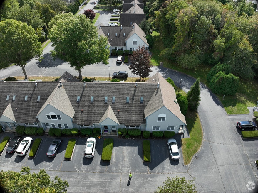
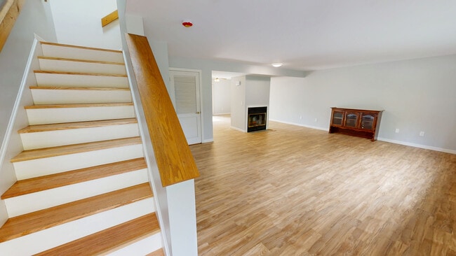

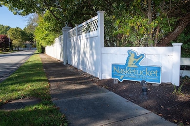
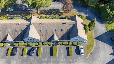
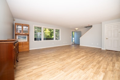
This bright and inviting townhouse is perfectly tucked away off the main road in a private community of just 26 homes. The first level offers an open floor plan with charming bay window. Updated flooring, a cozy fireplace and half bath create a warm, welcoming, and convenient living space, while the dining area and kitchen feature a slider that opens to your own private backyard retreat. Upstairs, you’ll find two comfortable bedrooms, including a spacious primary suite with an en-suite bath. The second floor is drenched in sunlight from multiple skylights. A key feature is the second floor laundry area located the near the bedrooms, plus an additional bathroom for flexibility. Recent updates include a newer heating system and a brand-new hot water heater. Two assigned parking spaces complete this desirable home. Do not miss your opportunity to live in the Nasketucket Townhouses!
| Date | Type | Sale Price | Title Company |
|---|---|---|---|
| Condominium Deed | $400,000 | -- | |
| Quit Claim Deed | -- | -- | |
| Quit Claim Deed | -- | -- | |
| Deed | -- | -- | |
| Deed | $120,000 | -- |
| Date | Status | Loan Amount | Loan Type |
|---|---|---|---|
| Open | $200,000 | New Conventional | |
| Previous Owner | $90,000 | No Value Available | |
| Previous Owner | $80,000 | No Value Available | |
| Previous Owner | $81,200 | No Value Available | |
| Previous Owner | $86,800 | No Value Available |
| Date | Event | Price | List to Sale | Price per Sq Ft |
|---|---|---|---|---|
| 11/25/2025 11/25/25 | Sold | $400,000 | -6.9% | $262 / Sq Ft |
| 10/27/2025 10/27/25 | Pending | -- | -- | -- |
| 10/13/2025 10/13/25 | Price Changed | $429,800 | -4.1% | $281 / Sq Ft |
| 09/29/2025 09/29/25 | For Sale | $448,000 | -- | $293 / Sq Ft |
| Year | Tax Paid | Tax Assessment Tax Assessment Total Assessment is a certain percentage of the fair market value that is determined by local assessors to be the total taxable value of land and additions on the property. | Land | Improvement |
|---|---|---|---|---|
| 2025 | $33 | $349,600 | $0 | $349,600 |
| 2024 | $2,893 | $313,400 | $0 | $313,400 |
| 2023 | $2,602 | $261,500 | $0 | $261,500 |
| 2022 | $2,673 | $261,500 | $0 | $261,500 |
| 2021 | $2,662 | $235,800 | $0 | $235,800 |
| 2020 | $2,670 | $241,400 | $0 | $241,400 |
| 2019 | $2,739 | $234,700 | $0 | $234,700 |
| 2018 | $2,758 | $234,700 | $0 | $234,700 |
| 2017 | $2,739 | $227,500 | $0 | $227,500 |
| 2016 | $2,716 | $223,000 | $0 | $223,000 |
| 2015 | $2,801 | $230,500 | $0 | $230,500 |
Seller's Agent in 2025
Andrew Romano
Bold Real Estate Inc.
(774) 473-4049
2 in this area
80 Total Sales
Buyer's Agent in 2025
Luisa Soares
Keller Williams South Watuppa
(401) 644-8137
1 in this area
15 Total Sales
Source: MLS Property Information Network (MLS PIN)
MLS Number: 73436906
APN: FAIR-000000-N000000AT000406O
Disclaimer: Certain information contained herein is derived from information provided by parties other than Homes.com. All information provided is deemed reliable, but is not guaranteed to be accurate and should be independently verified.
![]() The property listing data and information, or the Images, set forth herein were provided to MLS Property Information Network, Inc. from third party sources, including sellers, lessors and public records, and were compiled by MLS Property Information Network, Inc. The property listing data and information, and the Images, are for the personal, non-commercial use of consumers having a good faith interest in purchasing or leasing listed properties of the type displayed to them and may not be used for any purpose other than to identify prospective properties which such consumers may have a good faith interest in purchasing or leasing. MLS Property Information Network, Inc. and its subscribers disclaim any and all representations and warranties as to the accuracy of the property listing data and information, or as to the accuracy of any of the Images, set forth herein.
The property listing data and information, or the Images, set forth herein were provided to MLS Property Information Network, Inc. from third party sources, including sellers, lessors and public records, and were compiled by MLS Property Information Network, Inc. The property listing data and information, and the Images, are for the personal, non-commercial use of consumers having a good faith interest in purchasing or leasing listed properties of the type displayed to them and may not be used for any purpose other than to identify prospective properties which such consumers may have a good faith interest in purchasing or leasing. MLS Property Information Network, Inc. and its subscribers disclaim any and all representations and warranties as to the accuracy of the property listing data and information, or as to the accuracy of any of the Images, set forth herein.
Ask me questions while you tour the home.