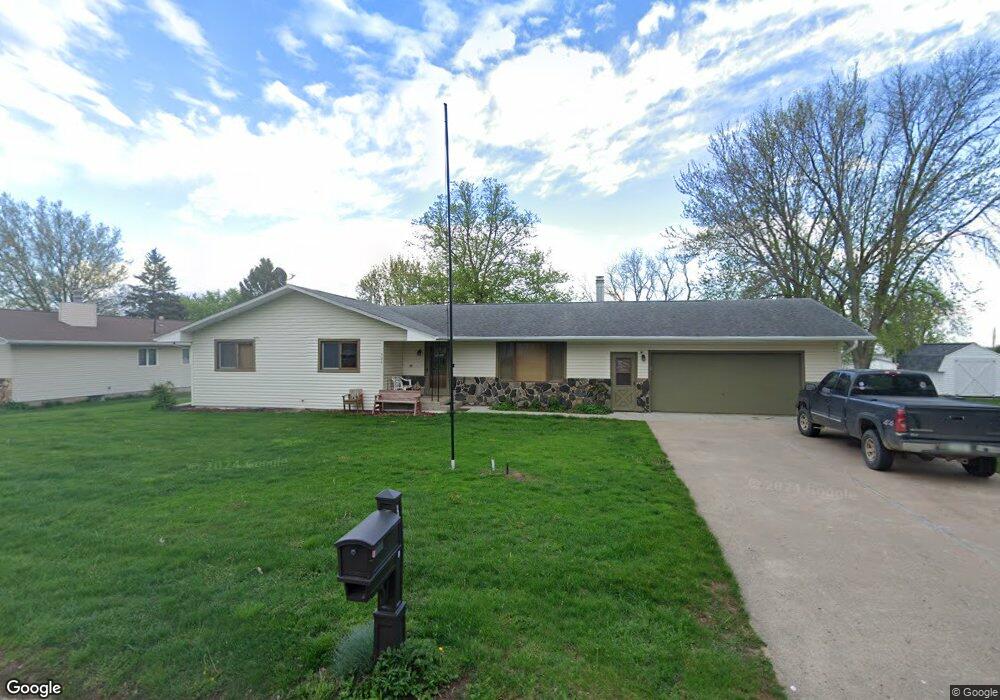
406 Page Dr Kingsley, IA 51028
Estimated Value: $279,713 - $337,000
4
Beds
5
Baths
1,508
Sq Ft
$196/Sq Ft
Est. Value
About This Home
This home is located at 406 Page Dr, Kingsley, IA 51028 and is currently estimated at $296,178, approximately $196 per square foot. 406 Page Dr is a home located in Plymouth County with nearby schools including Pierson Elementary School, Pierson Middle School, and Kingsley-Pierson High School.
Ownership History
Date
Name
Owned For
Owner Type
Purchase Details
Closed on
Jul 22, 2022
Sold by
Lynn Fouts Matthew
Bought by
Fouts Matthew Lynn and Hass Robin A
Current Estimated Value
Purchase Details
Closed on
Jul 1, 2021
Sold by
Regennitter Adilyn
Bought by
Fouts Matthew Lynn
Home Financials for this Owner
Home Financials are based on the most recent Mortgage that was taken out on this home.
Original Mortgage
$235,290
Interest Rate
2.96%
Mortgage Type
VA
Create a Home Valuation Report for This Property
The Home Valuation Report is an in-depth analysis detailing your home's value as well as a comparison with similar homes in the area
Home Values in the Area
Average Home Value in this Area
Purchase History
| Date | Buyer | Sale Price | Title Company |
|---|---|---|---|
| Fouts Matthew Lynn | -- | None Listed On Document | |
| Fouts Matthew Lynn | $230,000 | None Available |
Source: Public Records
Mortgage History
| Date | Status | Borrower | Loan Amount |
|---|---|---|---|
| Previous Owner | Fouts Matthew Lynn | $235,290 |
Source: Public Records
Tax History Compared to Growth
Tax History
| Year | Tax Paid | Tax Assessment Tax Assessment Total Assessment is a certain percentage of the fair market value that is determined by local assessors to be the total taxable value of land and additions on the property. | Land | Improvement |
|---|---|---|---|---|
| 2024 | $3,398 | $229,930 | $28,590 | $201,340 |
| 2023 | $3,088 | $263,420 | $21,830 | $241,590 |
| 2022 | $2,752 | $205,350 | $21,830 | $183,520 |
| 2021 | $2,790 | $177,030 | $21,830 | $155,200 |
| 2020 | $2,790 | $171,760 | $21,830 | $149,930 |
| 2019 | -- | $171,760 | $21,830 | $149,930 |
| 2018 | -- | $158,430 | $21,830 | $136,600 |
| 2017 | -- | $136,870 | $0 | $0 |
| 2016 | -- | $136,870 | $0 | $0 |
| 2015 | -- | $131,810 | $0 | $0 |
| 2014 | -- | $0 | $0 | $0 |
Source: Public Records
Map
Nearby Homes
- TBD Brides Circle Dr
- 315 Kurtz Dr
- 116 Rutland St
- 520 Rutland St
- 20 W 3rd St
- 301 Brookside Dr Unit A
- 0 Country Ln Unit Lot 10
- 29995 Iowa 140
- 43637 C60
- 43637 County Road C60
- 411 West St
- 115 Haines St
- 710 1st St
- 805 Paige Place
- TBD Clearview St
- 500 N 4th St
- 755 Glen Dr
- 612 Jackson St
- 504 Jackson St
- 47 1st St