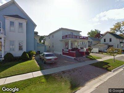
406 Rawlins St Port Huron, MI 48060
Downtown Port Huron NeighborhoodEstimated Value: $148,000 - $162,000
3
Beds
2
Baths
2,044
Sq Ft
$75/Sq Ft
Est. Value
About This Home
This home is located at 406 Rawlins St, Port Huron, MI 48060 and is currently estimated at $153,565, approximately $75 per square foot. 406 Rawlins St is a home located in St. Clair County with nearby schools including H.D. Crull Elementary School, Holland Woods Middle School, and Port Huron Northern High School.
Ownership History
Date
Name
Owned For
Owner Type
Purchase Details
Closed on
Nov 3, 2015
Sold by
Finn M J M and Finn J M
Bought by
Fdic 2010 R1 Trust and Citibank Na
Current Estimated Value
Purchase Details
Closed on
Apr 13, 2010
Sold by
Holcomb Bertha Cleora
Bought by
Holcomb Timmy Lee
Purchase Details
Closed on
Dec 4, 2009
Sold by
Bruske Larry and Bruske Nancy Lou
Bought by
Holcomb Timmy Lee and Holcomb Bertha Cleora
Purchase Details
Closed on
Aug 8, 2008
Sold by
Deseck Andre J and Deseck Betty I
Bought by
Bruske Larry and Bruske Nancy L
Create a Home Valuation Report for This Property
The Home Valuation Report is an in-depth analysis detailing your home's value as well as a comparison with similar homes in the area
Home Values in the Area
Average Home Value in this Area
Purchase History
| Date | Buyer | Sale Price | Title Company |
|---|---|---|---|
| Fdic 2010 R1 Trust | $21,250 | -- | |
| Holcomb Timmy Lee | -- | None Available | |
| Holcomb Timmy Lee | $130,000 | None Available | |
| Bruske Larry | $50,000 | None Available |
Source: Public Records
Mortgage History
| Date | Status | Borrower | Loan Amount |
|---|---|---|---|
| Open | Holcomb Timmy Lee | $111,925 | |
| Closed | Holcomb Timmy Lee | $49,600 |
Source: Public Records
Tax History Compared to Growth
Tax History
| Year | Tax Paid | Tax Assessment Tax Assessment Total Assessment is a certain percentage of the fair market value that is determined by local assessors to be the total taxable value of land and additions on the property. | Land | Improvement |
|---|---|---|---|---|
| 2024 | $2,050 | $67,400 | $0 | $0 |
| 2023 | $1,705 | $56,900 | $0 | $0 |
| 2022 | $1,721 | $49,100 | $0 | $0 |
| 2021 | $1,644 | $46,200 | $0 | $0 |
| 2020 | $1,605 | $41,400 | $41,400 | $0 |
| 2019 | $1,517 | $27,300 | $0 | $0 |
| 2018 | $1,483 | $27,300 | $0 | $0 |
| 2017 | $1,394 | $26,200 | $0 | $0 |
| 2016 | $1,175 | $26,200 | $0 | $0 |
| 2015 | $958 | $27,000 | $27,000 | $0 |
| 2014 | $958 | $27,500 | $27,500 | $0 |
| 2013 | -- | $26,300 | $0 | $0 |
Source: Public Records
Map
Nearby Homes
- 805 Pine Grove Ave
- 713 Superior St
- 707 Glenwood Ave
- 201 Beers St Unit 53
- 201 Beers St Unit 34
- 1107 Glenwood Ave Unit 1/2
- 1408 Stanton St
- 1416 Kearney St
- 1433 Poplar St
- 1111 Varney St
- 229 12th St
- 1203 Varney St
- 1756 Edison Shores Place
- 1508 Sedgwick St
- 1122 Pearl St
- 1330 Arch St
- 1036 Gillett St
- 1025 Howard St
- 1330 Water St
- 1227 Lapeer Ave
- 406 Rawlins St
- 402 Rawlins St
- 921 Michigan St
- 924 Huron Ave
- 928 Huron Ave
- 920 Huron Ave
- 917 Michigan St
- 405 Rawlins St
- 317 Rawlins St
- 910 Huron Ave Unit 912
- 913 Michigan St
- 308 Rawlins St
- 1008 Huron Ave
- 907 Michigan St
- 914 Michigan St
- 924 Merchant St
- V/L Merchant St Vacant
- VL Merchant St
- 411 Stanton St
- 912 Michigan St