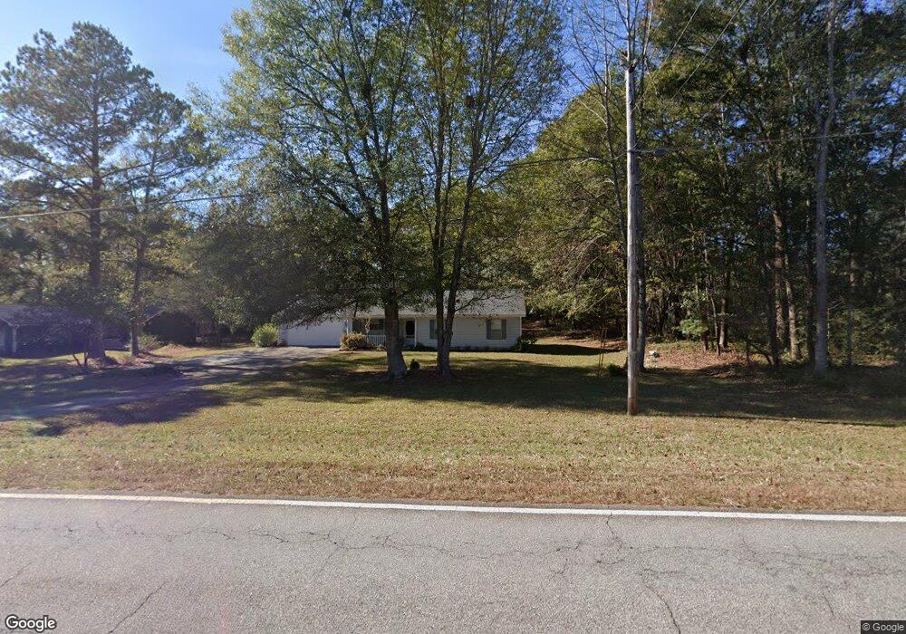
406 Smith Store Rd Covington, GA 30016
Estimated Value: $233,000 - $267,000
3
Beds
2
Baths
1,446
Sq Ft
$175/Sq Ft
Est. Value
About This Home
This home is located at 406 Smith Store Rd, Covington, GA 30016 and is currently estimated at $253,050, approximately $175 per square foot. 406 Smith Store Rd is a home located in Newton County with nearby schools including West Newton Elementary School, Veterans Memorial Middle School, and Alcovy High School.
Ownership History
Date
Name
Owned For
Owner Type
Purchase Details
Closed on
Jan 31, 2019
Sold by
Daniel Mark G
Bought by
Daniel Crystal Celeste
Current Estimated Value
Purchase Details
Closed on
Nov 30, 2017
Sold by
Morris Charlotte J
Bought by
Daniel Mark D
Purchase Details
Closed on
Apr 1, 2011
Sold by
2006Rz4 Ramp
Bought by
Morris Charlotte J and Morris Sidney R
Home Financials for this Owner
Home Financials are based on the most recent Mortgage that was taken out on this home.
Original Mortgage
$53,096
Interest Rate
4.85%
Mortgage Type
VA
Purchase Details
Closed on
Dec 7, 2010
Sold by
Thomas Clyde T and Thomas Debra J
Bought by
Ramp 2006Rz4
Purchase Details
Closed on
Jan 26, 1996
Sold by
Mote Lanier
Bought by
Thomas Clyde Debra
Create a Home Valuation Report for This Property
The Home Valuation Report is an in-depth analysis detailing your home's value as well as a comparison with similar homes in the area
Home Values in the Area
Average Home Value in this Area
Purchase History
| Date | Buyer | Sale Price | Title Company |
|---|---|---|---|
| Daniel Crystal Celeste | -- | -- | |
| Daniel Mark D | $98,700 | -- | |
| Morris Charlotte J | $51,400 | -- | |
| Ramp 2006Rz4 | $48,750 | -- | |
| Thomas Clyde Debra | $81,000 | -- |
Source: Public Records
Mortgage History
| Date | Status | Borrower | Loan Amount |
|---|---|---|---|
| Previous Owner | Morris Charlotte J | $53,096 | |
| Closed | Thomas Clyde Debra | $0 |
Source: Public Records
Tax History
| Year | Tax Paid | Tax Assessment Tax Assessment Total Assessment is a certain percentage of the fair market value that is determined by local assessors to be the total taxable value of land and additions on the property. | Land | Improvement |
|---|---|---|---|---|
| 2025 | $2,529 | $105,480 | $15,200 | $90,280 |
| 2024 | $2,603 | $106,600 | $15,200 | $91,400 |
| 2023 | $2,598 | $99,600 | $5,600 | $94,000 |
| 2022 | $1,746 | $68,200 | $5,600 | $62,600 |
| 2021 | $1,555 | $55,160 | $5,600 | $49,560 |
| 2020 | $1,155 | $38,280 | $5,600 | $32,680 |
| 2019 | $1,310 | $38,400 | $5,600 | $32,800 |
| 2018 | $1,274 | $37,120 | $5,600 | $31,520 |
| 2017 | $176 | $34,360 | $5,600 | $28,760 |
| 2016 | $22 | $24,880 | $3,600 | $21,280 |
| 2015 | $22 | $25,560 | $3,600 | $21,960 |
| 2014 | $18 | $22,600 | $0 | $0 |
Source: Public Records
Map
Nearby Homes
- 415 Rosser Rd
- 75 Tulip Dr
- 615 St Annes Place
- 417 Rosser Rd
- 165 Tulip Dr
- 40 Freebia Walk
- 800 Mills Dr
- 50 Freedom Ct
- 161 Geranium Ln
- 113 St Annes Place
- 149 St Annes Place
- 45 Geranium Ln
- 80 Barge Ln
- 465 St Annes Place
- 275 Roberts Rd
- 231 St Annes Place
- 231 Saint Anne's Place
- 70 Countryside Ln
- 25 Woodcrest Dr
- 50 Trinity Ln
- 418 Smith Store Rd
- 388 Smith Store Rd
- 25 Glynn Isle Dr
- 35 Patrick Ct
- 25 Patrick Ct
- 45 Glynn Isle Dr
- 45 Patrick Ct
- 430 Smith Store Rd
- 10 Glynn Isle Dr Unit /2
- 10 Glynn Isle Dr
- 450 Smith Store Rd
- 20 Glynn Isle Dr
- 30 Glynn Isle Dr
- 375 Smith Store Rd
- 40 Patrick Ct
- 40 Glynn Isle Dr
- 20 Patrick Ct
- 30 Patridge Dr Unit 75
- 30 Patrick Ct
- 10 Patrick Ct
Your Personal Tour Guide
Ask me questions while you tour the home.