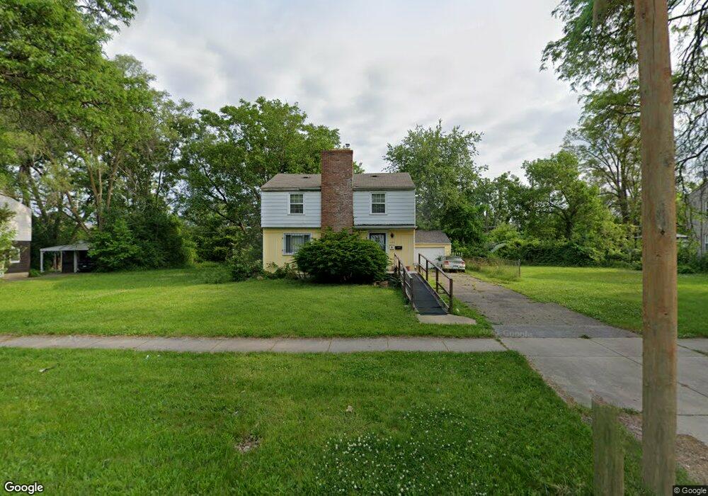
406 W Pierson Rd Flint, MI 48505
MLK Circle NeighborhoodEstimated Value: $60,000 - $108,000
4
Beds
3
Baths
1,824
Sq Ft
$43/Sq Ft
Est. Value
About This Home
This home is located at 406 W Pierson Rd, Flint, MI 48505 and is currently estimated at $79,215, approximately $43 per square foot. 406 W Pierson Rd is a home located in Genesee County with nearby schools including Brownell STEM Academy, The New Standard Academy, and Eagle's Nest Academy.
Ownership History
Date
Name
Owned For
Owner Type
Purchase Details
Closed on
Feb 1, 2024
Sold by
Wells Carolyn R
Bought by
Wells Carolyn R and Wells Larhonda R
Current Estimated Value
Purchase Details
Closed on
Oct 11, 2013
Sold by
Grundy Carolyn Rose and Wells Carolyn Rose
Bought by
Wells Carolyn Rose
Purchase Details
Closed on
Feb 21, 2013
Sold by
Grundy Benny D and Wells Carolyn Rose
Bought by
Grundy Carolyn Rose and Wells Carolyn Rose
Purchase Details
Closed on
Aug 22, 2002
Sold by
Grundy Benny D
Bought by
Grundy Benny D and Wells Carolyn Rose
Create a Home Valuation Report for This Property
The Home Valuation Report is an in-depth analysis detailing your home's value as well as a comparison with similar homes in the area
Home Values in the Area
Average Home Value in this Area
Purchase History
| Date | Buyer | Sale Price | Title Company |
|---|---|---|---|
| Wells Carolyn R | -- | None Listed On Document | |
| Wells Carolyn Rose | -- | None Available | |
| Grundy Carolyn Rose | -- | None Available | |
| Grundy Benny D | -- | Centennial Title |
Source: Public Records
Tax History
| Year | Tax Paid | Tax Assessment Tax Assessment Total Assessment is a certain percentage of the fair market value that is determined by local assessors to be the total taxable value of land and additions on the property. | Land | Improvement |
|---|---|---|---|---|
| 2025 | $1,205 | $24,500 | $0 | $0 |
| 2024 | $1,115 | $22,200 | $0 | $0 |
| 2023 | $1,088 | $17,200 | $0 | $0 |
| 2022 | $0 | $14,000 | $0 | $0 |
| 2021 | $1,104 | $13,500 | $0 | $0 |
| 2020 | $1,014 | $11,600 | $0 | $0 |
| 2019 | $990 | $12,700 | $0 | $0 |
| 2018 | $1,041 | $13,100 | $0 | $0 |
| 2017 | $958 | $0 | $0 | $0 |
| 2016 | $951 | $0 | $0 | $0 |
| 2015 | -- | $0 | $0 | $0 |
| 2014 | -- | $0 | $0 | $0 |
| 2012 | -- | $14,300 | $0 | $0 |
Source: Public Records
Map
Nearby Homes
- 525 W Pulaski Ave
- 329 W Baltimore Blvd
- 5416 Dupont St
- 510 W Bishop Ave
- 4808 Edwards Ave
- 124 W Flint Park Blvd
- 205 E Baltimore Blvd
- 702/718 W Flint Park Blvd
- 5610 Baldwin Blvd
- 4816 Glenn Ave
- 536 W Home Ave
- 5518 Winthrop Blvd
- 350 E Mott Ave
- 5502 Susan St
- 225 E Piper Ave
- 610 W Austin Ave
- 518 W Ruth Ave
- 618 E Parkway Ave
- 4310 Berger Dr
- 605 W Foss Ave
- 410 W Pierson Rd
- 402 W Pierson Rd
- 414 W Pierson Rd
- 322 W Pierson Rd
- 405 W Ridgeway Ave
- 401 W Ridgeway Ave
- 409 W Ridgeway Ave
- 418 W Pierson Rd
- 321 W Ridgeway Ave
- 413 W Ridgeway Ave
- 318 W Pierson Rd
- 317 W Ridgeway Ave
- 417 W Ridgeway Ave
- 314 W Pierson Rd
- 450 W Pierson Rd
- 401 W Pierson Rd
- 329 W Pierson Rd
- 405 W Pierson Rd
- 325 W Pierson Rd
- 409 W Pierson Rd
Your Personal Tour Guide
Ask me questions while you tour the home.