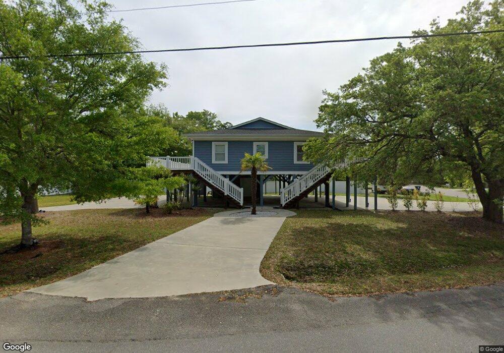
406 Wando St Murrells Inlet, SC 29576
Estimated Value: $720,000 - $807,000
4
Beds
2
Baths
1,360
Sq Ft
$563/Sq Ft
Est. Value
About This Home
This home is located at 406 Wando St, Murrells Inlet, SC 29576 and is currently estimated at $765,961, approximately $563 per square foot. 406 Wando St is a home located in Horry County with nearby schools including Seaside Elementary, St. James Intermediate, and St. James Middle School.
Ownership History
Date
Name
Owned For
Owner Type
Purchase Details
Closed on
Jun 24, 2009
Sold by
Exchange Bts No 1 Inc
Bought by
Williams David L
Current Estimated Value
Purchase Details
Closed on
Mar 27, 2006
Sold by
Taylor Bobby C and Odell Harry Randolph
Bought by
Exchange Bts #1 Inc
Home Financials for this Owner
Home Financials are based on the most recent Mortgage that was taken out on this home.
Original Mortgage
$25,000
Interest Rate
6.23%
Mortgage Type
Unknown
Purchase Details
Closed on
Aug 7, 1998
Sold by
Warren Junius P
Bought by
Curran Angela
Create a Home Valuation Report for This Property
The Home Valuation Report is an in-depth analysis detailing your home's value as well as a comparison with similar homes in the area
Home Values in the Area
Average Home Value in this Area
Purchase History
| Date | Buyer | Sale Price | Title Company |
|---|---|---|---|
| Williams David L | $200,000 | -- | |
| Exchange Bts #1 Inc | $200,000 | None Available | |
| Curran Angela | $40,000 | -- |
Source: Public Records
Mortgage History
| Date | Status | Borrower | Loan Amount |
|---|---|---|---|
| Previous Owner | Exchange Bts #1 Inc | $25,000 | |
| Previous Owner | Exchange Bts #1 Inc | $200,000 |
Source: Public Records
Tax History Compared to Growth
Tax History
| Year | Tax Paid | Tax Assessment Tax Assessment Total Assessment is a certain percentage of the fair market value that is determined by local assessors to be the total taxable value of land and additions on the property. | Land | Improvement |
|---|---|---|---|---|
| 2024 | $4,009 | $47,261 | $24,669 | $22,592 |
| 2023 | $4,009 | $16,444 | $5,276 | $11,168 |
| 2021 | $3,443 | $21,911 | $6,317 | $15,594 |
| 2020 | $3,308 | $21,911 | $6,317 | $15,594 |
| 2019 | $3,308 | $21,911 | $6,317 | $15,594 |
| 2018 | $2,948 | $14,299 | $4,585 | $9,714 |
| 2017 | $1,018 | $4,585 | $4,585 | $0 |
| 2016 | -- | $4,585 | $4,585 | $0 |
| 2015 | $1,018 | $4,585 | $4,585 | $0 |
| 2014 | $965 | $4,585 | $4,585 | $0 |
Source: Public Records
Map
Nearby Homes
- 513 1st St
- 390 Boundary Ave
- 1508 Sunnydale Ln
- 316 Cypress Ave
- Lot 4 Seacrest Dr
- 724 1st St
- 520 & 526 Boundary Ave
- 399 Elizabeth Dr
- 527 Bay Drive Extension
- 315 Inlet Rd
- 310 Clam Shell Cir
- 709 Triple Oak Ln
- 449 Delton Dr
- 425 Delton Dr
- 324 Yucca Cir
- 326 Tunnoch Rd
- 435 Delton Dr
- 322 Yucca Cir
- 495 Clubhouse Rd
- 337 Clam Shell Cir
- Lot 14-B Elizabeth Dr Unit Extension of Bay Dr
- Lot 14-B Elizabeth Dr
- Lot 14-B Elizabeth Dr Unit Lot 14-B
- 415 Elizabeth Dr
- 400 Elizabeth Dr
- 400 Elizabeth Dr Unit Marshfront
- Lot 3 Wando St
- 419 Elizabeth Dr
- Lot 1-B Wando and Boundary
- 405 Wando Rd
- 405 Wando St
- Lot 1A/1B Elizabeth Dr
- 407 Wando St
- 321 Pine Ave
- 325 Pine Ave
- 425 Elizabeth Dr
- 329 Pine Ave
- 411 Wando St
- Lot 1-B Wando Rd
- 333 Pine Ave