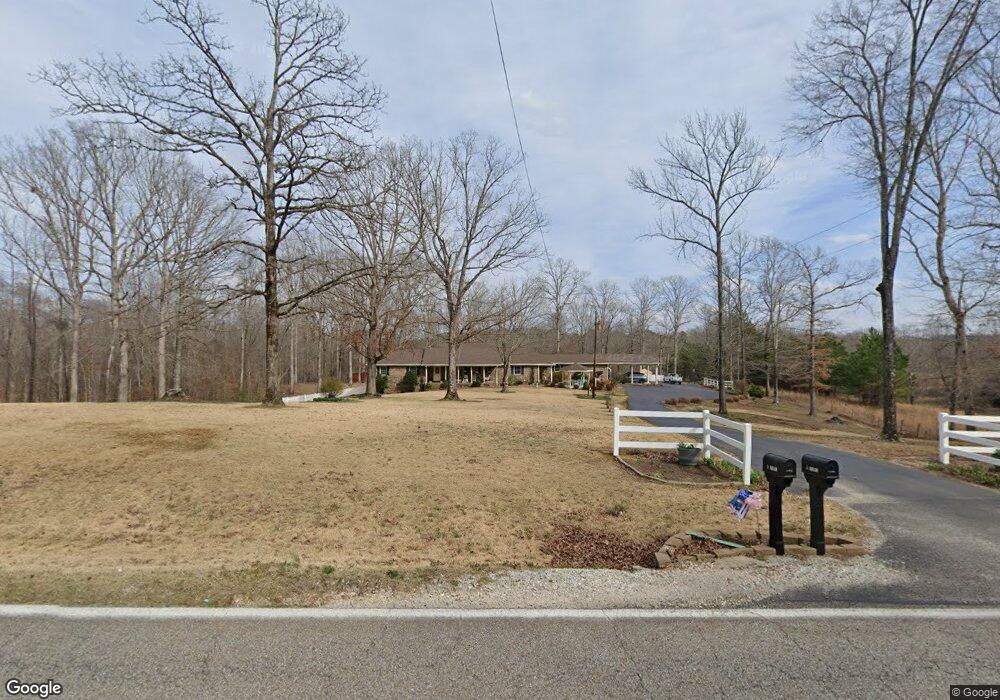
4067 Brooksie Thompson Rd Decaturville, TN 38329
Estimated Value: $234,000 - $299,000
--
Bed
2
Baths
2,094
Sq Ft
$126/Sq Ft
Est. Value
About This Home
This home is located at 4067 Brooksie Thompson Rd, Decaturville, TN 38329 and is currently estimated at $263,365, approximately $125 per square foot. 4067 Brooksie Thompson Rd is a home located in Decatur County with nearby schools including Decaturville Elementary School, Parsons Elementary School, and Decatur County Middle School.
Ownership History
Date
Name
Owned For
Owner Type
Purchase Details
Closed on
Apr 27, 2021
Sold by
Sparks Rickey Ted and Sparks Patricia
Bought by
Sparks Rickey Ted and Sparks Patricia
Current Estimated Value
Purchase Details
Closed on
Mar 30, 1996
Sold by
Sparks Rickey Ted
Bought by
Sparks Ricky and Sparks Patricia
Purchase Details
Closed on
Feb 28, 1996
Bought by
Sparks Rickey Ted
Purchase Details
Closed on
Jan 1, 1980
Purchase Details
Closed on
Jun 17, 1976
Bought by
Sparks Rickey Ted
Purchase Details
Closed on
Jan 2, 1900
Create a Home Valuation Report for This Property
The Home Valuation Report is an in-depth analysis detailing your home's value as well as a comparison with similar homes in the area
Home Values in the Area
Average Home Value in this Area
Purchase History
| Date | Buyer | Sale Price | Title Company |
|---|---|---|---|
| Sparks Rickey Ted | -- | None Available | |
| Sparks Ricky | $2,410 | -- | |
| Sparks Rickey Ted | $2,400 | -- | |
| -- | $500 | -- | |
| Sparks Rickey Ted | -- | -- | |
| -- | -- | -- |
Source: Public Records
Tax History Compared to Growth
Tax History
| Year | Tax Paid | Tax Assessment Tax Assessment Total Assessment is a certain percentage of the fair market value that is determined by local assessors to be the total taxable value of land and additions on the property. | Land | Improvement |
|---|---|---|---|---|
| 2025 | $1,106 | $80,900 | $0 | $0 |
| 2024 | $1,106 | $42,875 | $3,375 | $39,500 |
| 2023 | $1,106 | $42,875 | $3,375 | $39,500 |
| 2022 | $1,055 | $40,900 | $3,375 | $37,525 |
| 2021 | $1,055 | $40,900 | $3,375 | $37,525 |
| 2020 | $1,055 | $40,900 | $3,375 | $37,525 |
| 2019 | $817 | $36,325 | $3,375 | $32,950 |
| 2018 | $723 | $36,325 | $3,375 | $32,950 |
| 2017 | $714 | $36,325 | $3,375 | $32,950 |
| 2016 | $714 | $35,900 | $3,375 | $32,525 |
| 2015 | $714 | $35,900 | $3,375 | $32,525 |
| 2014 | $715 | $35,906 | $0 | $0 |
Source: Public Records
Map
Nearby Homes
- 0 Blunt Rd
- 000 Hwy 641
- 00 3 Way Rd
- 00 Tucker Rd
- 0 Yarbro Landing Ln Unit RTC2891585
- 000 Old Stage Rd
- 0 Tucker Rd
- 7371 Brooksie Thompson Rd
- 4052 Largo Rd
- 0 Brooksie Thompson Rd
- 00 Mt Carmel Rd
- 0 Mt Carmel Rd Unit 10207097
- 0 Mt Carmel Rd Unit 2504814
- 0 Mt Carmel Rd Unit RTC3012065
- 3379 Old Stage Rd
- 7028 3 Way Rd
- 7028 Three Way Rd
- 00 E Tulip St
- 0 E Tulip St
- 387 Dogwood Dr
- 4070 Brooksie Thompson Rd
- 3965 Brooksie Thompson Rd
- 4000 Brooksie Thompson Rd
- 4148 Brooksie Thompson Rd
- 4245 Brooksie Thompson Rd
- 3912 Brooksie Thompson Rd
- 4248 Brooksie Thompson Rd
- 127 Blunt Rd
- 4137 Brooksie Thompson Rd
- 3807 Brooksie Thompson Rd
- 3820 Brooksie Thompson Rd
- 280 Blunt Rd
- 3765 Brooksie Thompson Rd
- 4359 Brooksie Thompson Rd
- 3760 Brooksie Thompson Rd
- 9593 Hwy 641 S
- 9398 Hwy 641 S
- 4456 Brooksie Thompson Rd
- 9685 Hwy 641 S
- 0 Highway 641 S Unit RTC2397529