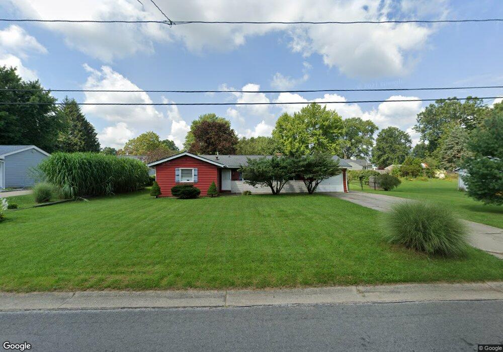
4069 Siefer Dr Rootstown, OH 44272
Estimated Value: $187,067 - $216,000
4
Beds
1
Bath
1,296
Sq Ft
$160/Sq Ft
Est. Value
About This Home
This home is located at 4069 Siefer Dr, Rootstown, OH 44272 and is currently estimated at $207,267, approximately $159 per square foot. 4069 Siefer Dr is a home located in Portage County with nearby schools including Rootstown Middle School - Schnee Building and Rootstown High School.
Ownership History
Date
Name
Owned For
Owner Type
Purchase Details
Closed on
Dec 6, 2010
Sold by
Chapman Stephanie D and Baughman Stephanie
Bought by
Chapman Erick G
Current Estimated Value
Home Financials for this Owner
Home Financials are based on the most recent Mortgage that was taken out on this home.
Original Mortgage
$82,000
Outstanding Balance
$52,924
Interest Rate
4.23%
Mortgage Type
New Conventional
Estimated Equity
$154,343
Purchase Details
Closed on
Jun 9, 1989
Bought by
Chapman Erick G
Create a Home Valuation Report for This Property
The Home Valuation Report is an in-depth analysis detailing your home's value as well as a comparison with similar homes in the area
Purchase History
| Date | Buyer | Sale Price | Title Company |
|---|---|---|---|
| Chapman Erick G | -- | Attorney | |
| Chapman Erick G | $52,000 | -- |
Source: Public Records
Mortgage History
| Date | Status | Borrower | Loan Amount |
|---|---|---|---|
| Open | Chapman Erick G | $82,000 |
Source: Public Records
Tax History
| Year | Tax Paid | Tax Assessment Tax Assessment Total Assessment is a certain percentage of the fair market value that is determined by local assessors to be the total taxable value of land and additions on the property. | Land | Improvement |
|---|---|---|---|---|
| 2025 | $2,284 | $53,840 | $10,260 | $43,580 |
| 2024 | $2,197 | $53,840 | $10,260 | $43,580 |
| 2023 | $1,890 | $41,170 | $10,260 | $30,910 |
| 2022 | $1,864 | $41,170 | $10,260 | $30,910 |
| 2021 | $1,859 | $41,170 | $10,260 | $30,910 |
| 2020 | $1,731 | $36,900 | $10,260 | $26,640 |
| 2019 | $1,739 | $36,900 | $10,260 | $26,640 |
| 2018 | $1,732 | $31,930 | $10,260 | $21,670 |
| 2017 | $1,589 | $31,930 | $10,260 | $21,670 |
| 2016 | $1,555 | $31,930 | $10,260 | $21,670 |
| 2015 | $1,551 | $31,930 | $10,260 | $21,670 |
| 2014 | $1,580 | $31,930 | $10,260 | $21,670 |
| 2013 | $1,569 | $31,930 | $10,260 | $21,670 |
Source: Public Records
Map
Nearby Homes
- 4079 Siefer Dr
- 3689 Cherry Hill
- 0 Lynn Rd Unit 5110102
- 3701 State Route 44
- V/L 2 Lynn Rd
- V/L Lynn Rd
- 4415 Farmette Dr
- 4200 Hattrick Rd
- sub lot Lane Ave
- 0 Tallmadge Rd Unit 5189301
- 0 Tallmadge Rd Unit 5189314
- 4556 Rootstown Rd
- 4140 Sandy Lake Rd
- 3637 Old Forge Rd
- 4058 Bayberry Knoll Ln
- 5394 Juniper Ct
- 3021 Hartville Rd
- 3925 Summit Rd
- 2978 Sandy Lake Rd
- 1065 Shadowlawn Dr
- 4059 Siefer Dr
- 4070 Sabin Dr
- 4058 Sabin Dr
- 4064 Siefer Dr
- 4091 Siefer Dr
- 4072 Siefer Dr
- 4088 Siefer Dr
- 4080 Siefer Dr
- 4092 Sabin Dr
- 4101 Siefer Dr
- 4315 Tallmadge Rd
- 4096 Siefer Dr
- 4299 Tallmadge Rd
- 4053 Sabin Dr
- 4069 Sabin Dr
- 4102 Sabin Dr
- 4061 Sabin Dr
- 4077 Sabin Dr
- 4109 Siefer Dr
- 4337 Tallmadge Rd
Your Personal Tour Guide
Ask me questions while you tour the home.