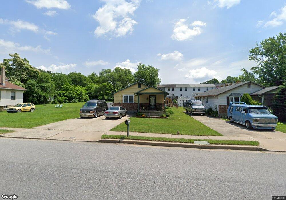
407 Middle River Rd Middle River, MD 21220
Estimated Value: $268,000 - $311,000
Studio
2
Baths
1,248
Sq Ft
$237/Sq Ft
Est. Value
About This Home
This home is located at 407 Middle River Rd, Middle River, MD 21220 and is currently estimated at $296,089, approximately $237 per square foot. 407 Middle River Rd is a home located in Baltimore County with nearby schools including Martin Boulevard Elementary School, Middle River Middle School, and Kenwood High.
Ownership History
Date
Name
Owned For
Owner Type
Purchase Details
Closed on
Oct 11, 1994
Sold by
Goles Theodore J
Bought by
Miller Cathy E
Current Estimated Value
Home Financials for this Owner
Home Financials are based on the most recent Mortgage that was taken out on this home.
Original Mortgage
$102,800
Interest Rate
8.55%
Purchase Details
Closed on
Jan 13, 1989
Sold by
Brockway Robert Frank
Bought by
Goles Theodore J
Create a Home Valuation Report for This Property
The Home Valuation Report is an in-depth analysis detailing your home's value as well as a comparison with similar homes in the area
Home Values in the Area
Average Home Value in this Area
Purchase History
| Date | Buyer | Sale Price | Title Company |
|---|---|---|---|
| Miller Cathy E | $102,900 | -- | |
| Goles Theodore J | $78,000 | -- |
Source: Public Records
Mortgage History
| Date | Status | Borrower | Loan Amount |
|---|---|---|---|
| Closed | Miller Cathy E | $102,800 |
Source: Public Records
Tax History
| Year | Tax Paid | Tax Assessment Tax Assessment Total Assessment is a certain percentage of the fair market value that is determined by local assessors to be the total taxable value of land and additions on the property. | Land | Improvement |
|---|---|---|---|---|
| 2025 | $3,045 | $236,000 | -- | -- |
| 2024 | $3,045 | $209,200 | -- | -- |
| 2023 | $1,462 | $182,400 | $78,200 | $104,200 |
| 2022 | $2,881 | $176,800 | $0 | $0 |
| 2021 | $2,676 | $171,200 | $0 | $0 |
| 2020 | $2,676 | $165,600 | $78,200 | $87,400 |
| 2019 | $2,831 | $158,767 | $0 | $0 |
| 2018 | $2,816 | $151,933 | $0 | $0 |
| 2017 | $2,629 | $145,100 | $0 | $0 |
| 2016 | $2,580 | $145,100 | $0 | $0 |
| 2015 | $2,580 | $145,100 | $0 | $0 |
| 2014 | $2,580 | $152,100 | $0 | $0 |
Source: Public Records
Map
Nearby Homes
- 327 Ballard Ave
- 214 Ballard Ave
- 1535 Chilworth Ave
- 236 Endsleigh Ave
- 719 Macdill Rd
- 9703 Biggs Rd
- 11 Torque Way
- 811 Middle River Rd
- 815 Lowe Rd
- 1201 Fuselage Ave
- 8 Control Ct
- 18 Blister St
- 24 Harrison Ave N
- 1008 Fuselage Ave
- 33 Left Wing Dr
- 9899 Decatur Rd
- 13 Harrison Ave N
- 17 Propeller Dr
- 57 Transverse Ave
- 66 Transverse Ave
- 405 Middle River Rd
- 409 Middle River Rd
- 403 Middle River Rd
- 44 Holcumb Ct
- 42 Holcumb Ct
- 46 Holcumb Ct
- 48 Holcumb Ct
- 50 Holcumb Ct
- 411 Middle River Rd
- 52 Holcumb Ct
- 401 Middle River Rd
- 54 Holcumb Ct
- 56 Holcumb Ct
- 58 Holcumb Ct
- 40 Holcumb Ct
- 39 Holcumb Ct
- 38 Holcumb Ct
- 500 Middle River Rd
- 37 Holcumb Ct
- 36 Holcumb Ct
Your Personal Tour Guide
Ask me questions while you tour the home.