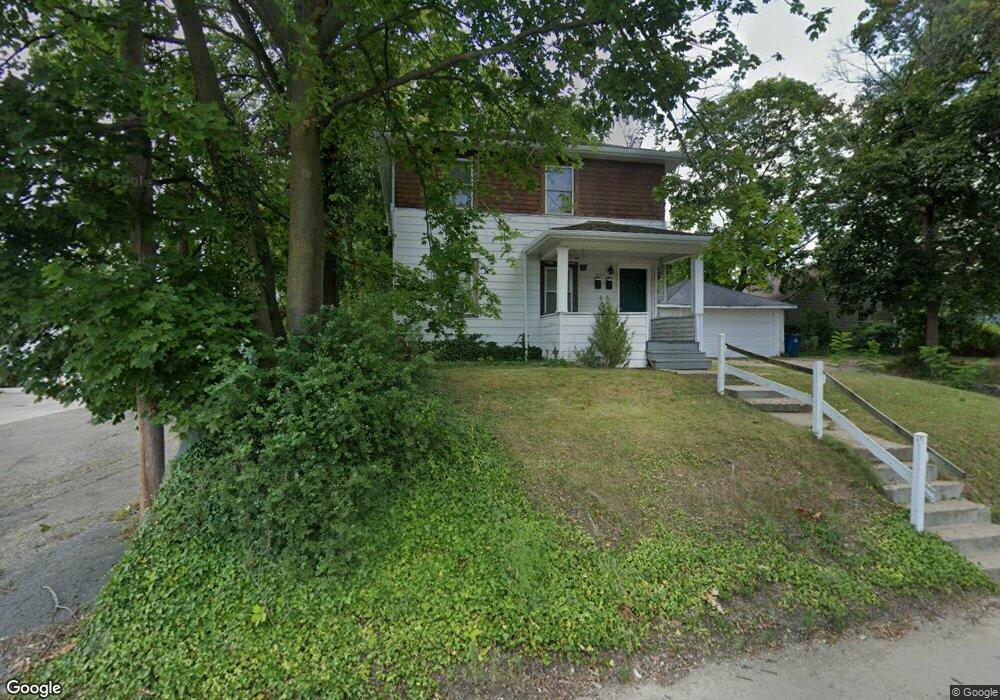
407 N Dartmouth St Kalamazoo, MI 49006
Westwood NeighborhoodEstimated Value: $193,000 - $233,000
4
Beds
2
Baths
1,632
Sq Ft
$134/Sq Ft
Est. Value
About This Home
This home is located at 407 N Dartmouth St, Kalamazoo, MI 49006 and is currently estimated at $218,058, approximately $133 per square foot. 407 N Dartmouth St is a home located in Kalamazoo County with nearby schools including Northglade Montessori School, Hillside Middle School, and Kalamazoo Central High School.
Ownership History
Date
Name
Owned For
Owner Type
Purchase Details
Closed on
Mar 31, 2015
Sold by
Kronner Mary J and Kronner Robert
Bought by
Meyer John F and Meyer Kathleen A
Current Estimated Value
Home Financials for this Owner
Home Financials are based on the most recent Mortgage that was taken out on this home.
Original Mortgage
$57,750
Outstanding Balance
$44,441
Interest Rate
3.73%
Mortgage Type
New Conventional
Estimated Equity
$173,617
Create a Home Valuation Report for This Property
The Home Valuation Report is an in-depth analysis detailing your home's value as well as a comparison with similar homes in the area
Home Values in the Area
Average Home Value in this Area
Purchase History
| Date | Buyer | Sale Price | Title Company |
|---|---|---|---|
| Meyer John F | $77,000 | Devon Title Company |
Source: Public Records
Mortgage History
| Date | Status | Borrower | Loan Amount |
|---|---|---|---|
| Open | Meyer John F | $57,750 |
Source: Public Records
Tax History Compared to Growth
Tax History
| Year | Tax Paid | Tax Assessment Tax Assessment Total Assessment is a certain percentage of the fair market value that is determined by local assessors to be the total taxable value of land and additions on the property. | Land | Improvement |
|---|---|---|---|---|
| 2025 | $3,951 | $94,700 | $0 | $0 |
| 2024 | $578 | $87,800 | $0 | $0 |
| 2023 | $551 | $77,000 | $0 | $0 |
| 2022 | $3,667 | $69,500 | $0 | $0 |
| 2021 | $3,470 | $62,200 | $0 | $0 |
| 2020 | $3,415 | $55,500 | $0 | $0 |
| 2019 | $3,291 | $49,500 | $0 | $0 |
| 2018 | $3,209 | $45,000 | $0 | $0 |
| 2017 | $0 | $45,000 | $0 | $0 |
| 2016 | -- | $43,400 | $0 | $0 |
| 2015 | -- | $42,800 | $0 | $0 |
| 2014 | -- | $40,300 | $0 | $0 |
Source: Public Records
Map
Nearby Homes
- 2010 Commonwealth Ave
- 426 Pinehurst Blvd
- 204 Nelson Ave
- 1709 Jefferson Ave
- 2306 Kenwood St
- 1605 W North St
- 1455 W North St
- 1416 Forbes St
- 150 Carberry Hill Ct Unit C
- 124 Lanark Ct Unit 64
- 154 Carberry Hill Ct Unit 43
- 707 Jenks Blvd
- 1108 Warren Place
- 141 Selkirk Ct Unit 103
- 113 Inverness Ct
- 1338 Summit Ave
- 115 Monroe St
- 1332 Summit Ave
- 629 Jefferson Place
- 225 N Lauderdale Dr
- 407 N Dartmouth St Unit 1 & 2
- 2015 Commonwealth Ave
- 2002 W Main St
- 2017 Commonwealth Ave
- 0 N Dartmouth St
- 53553 N Dartmouth St
- 535537 N Dartmouth St
- 1925 Commonwealth Ave
- 1930 W Main St
- 2006 Commonwealth Ave
- 2026 W Main St
- 1917 Commonwealth Ave
- 2018 Commonwealth Ave
- 1930 Commonwealth Ave
- 2022 Commonwealth Ave
- 1918 W Main St
- 442 Commonwealth Place
- 1922 Commonwealth Ave
- 1911 Commonwealth Ave
- 2038 W Main St