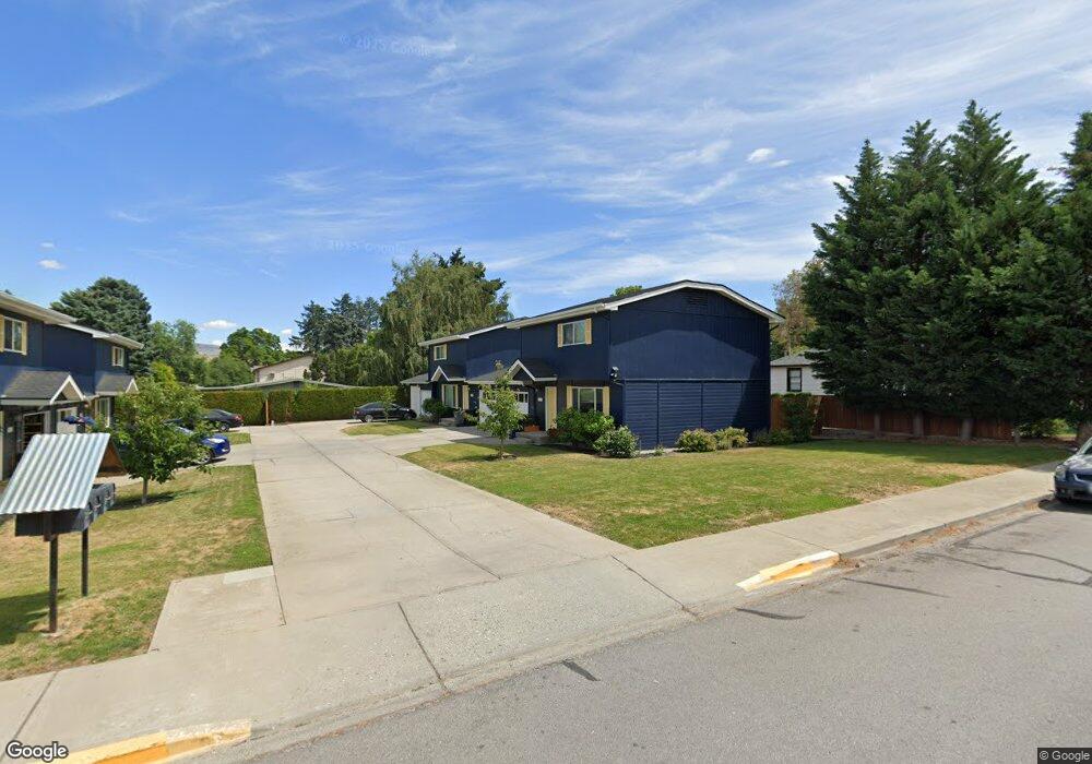
407 Pear Ln Wenatchee, WA 98801
Estimated Value: $524,883 - $574,000
2
Beds
1
Bath
1,272
Sq Ft
$430/Sq Ft
Est. Value
About This Home
This home is located at 407 Pear Ln, Wenatchee, WA 98801 and is currently estimated at $546,961, approximately $430 per square foot. 407 Pear Ln is a home located in Chelan County with nearby schools including Washington Elementary School, Orchard Middle School, and Wenatchee High School.
Ownership History
Date
Name
Owned For
Owner Type
Purchase Details
Closed on
Dec 22, 2016
Sold by
Etzkorn Rick
Bought by
Etzkorn Patricia
Current Estimated Value
Purchase Details
Closed on
May 5, 2009
Sold by
Pitts Marvin L and Pitts Mary Ann
Bought by
Etzkorn Richard P and Etzkorn Patty A
Home Financials for this Owner
Home Financials are based on the most recent Mortgage that was taken out on this home.
Original Mortgage
$162,750
Outstanding Balance
$102,552
Interest Rate
4.8%
Mortgage Type
Commercial
Estimated Equity
$444,409
Create a Home Valuation Report for This Property
The Home Valuation Report is an in-depth analysis detailing your home's value as well as a comparison with similar homes in the area
Home Values in the Area
Average Home Value in this Area
Purchase History
| Date | Buyer | Sale Price | Title Company |
|---|---|---|---|
| Etzkorn Patricia | -- | None Available | |
| Etzkorn Richard P | $217,000 | North Meridian Title & Escro |
Source: Public Records
Mortgage History
| Date | Status | Borrower | Loan Amount |
|---|---|---|---|
| Open | Etzkorn Richard P | $162,750 |
Source: Public Records
Tax History Compared to Growth
Tax History
| Year | Tax Paid | Tax Assessment Tax Assessment Total Assessment is a certain percentage of the fair market value that is determined by local assessors to be the total taxable value of land and additions on the property. | Land | Improvement |
|---|---|---|---|---|
| 2021 | $1,886 | $191,621 | $60,000 | $131,621 |
| 2020 | $2,038 | $194,979 | $60,000 | $134,979 |
| 2019 | $1,959 | $196,657 | $60,000 | $136,657 |
| 2018 | $2,521 | $199,785 | $60,000 | $139,785 |
| 2017 | $2,358 | $210,791 | $60,000 | $150,791 |
| 2016 | $2,148 | $214,271 | $60,000 | $154,271 |
| 2015 | $2,148 | $216,350 | $60,000 | $156,350 |
| 2013 | $2,148 | $194,556 | $60,000 | $134,556 |
Source: Public Records
Map
Nearby Homes
- 936 Vassar Ave
- 9 Elliott Ave N
- 33 Furney St
- 204 Pershing Cir
- 307 N Franklin Ave
- 512 4th St
- 106 N Franklin Ave
- 230 N Emerson Ave
- 1013 Amherst Ave
- 1020 Harvard Ave
- 246 N Delaware Ave
- 1525 Westwood Ave
- 909 Meadow Ridge Dr Unit 37
- 1310 Castlerock Ave Unit 19
- 1310 Castlerock Ave Unit 30
- 1625 Pleasant Ave
- 110 N Delaware Ave Unit A/B
- 1628 Pleasant Ave
- 22 S Emerson Ave
- 226 Pennsylvania Ave