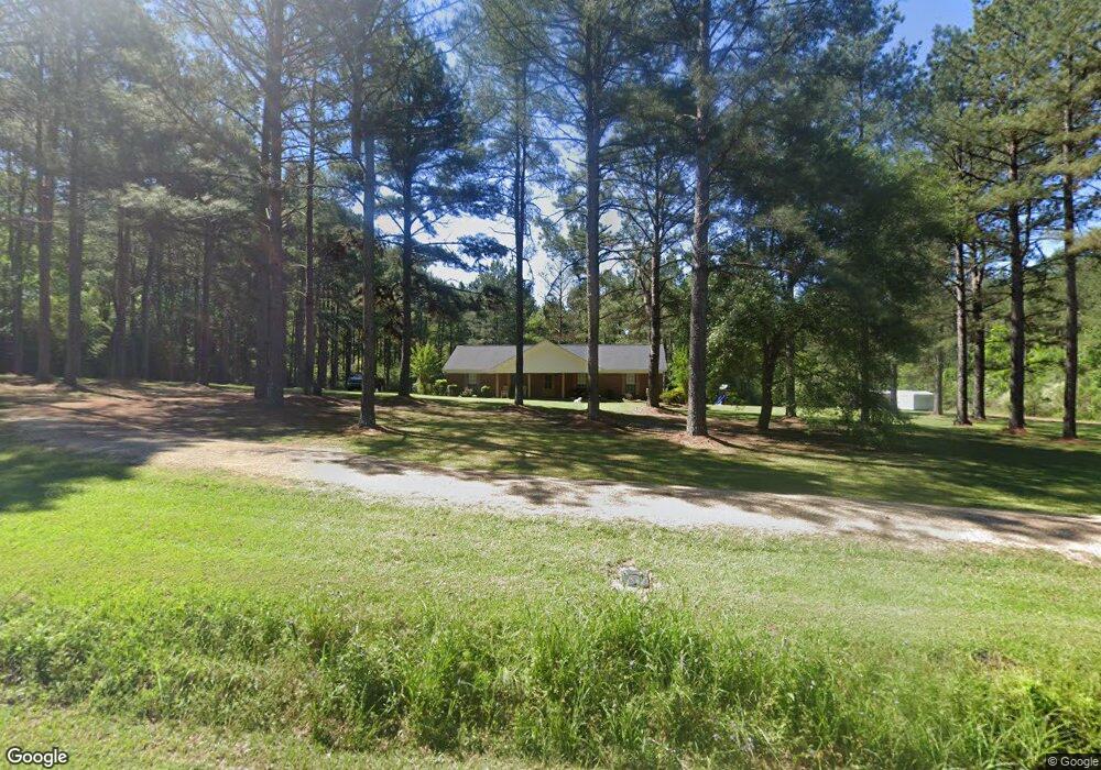
407 Walters Loop Laurel, MS 39443
Estimated Value: $190,284 - $249,000
Studio
--
Bath
1,740
Sq Ft
$123/Sq Ft
Est. Value
About This Home
This home is located at 407 Walters Loop, Laurel, MS 39443 and is currently estimated at $213,821, approximately $122 per square foot. 407 Walters Loop is a home located in Jones County with nearby schools including East Jones Elementary School.
Ownership History
Date
Name
Owned For
Owner Type
Purchase Details
Closed on
Aug 6, 2018
Sold by
Avera Christopher Keith and Avera Joni P
Bought by
Mccarty Channing and Mccarty Lauren
Current Estimated Value
Purchase Details
Closed on
Sep 20, 2013
Sold by
James Thomas James Thomas and Branch Tanya
Bought by
Avera Christopher Keith and Avera Joni Phillips
Home Financials for this Owner
Home Financials are based on the most recent Mortgage that was taken out on this home.
Original Mortgage
$140,409
Interest Rate
4.57%
Mortgage Type
FHA
Create a Home Valuation Report for This Property
The Home Valuation Report is an in-depth analysis detailing your home's value as well as a comparison with similar homes in the area
Purchase History
| Date | Buyer | Sale Price | Title Company |
|---|---|---|---|
| Mccarty Channing | -- | -- | |
| Avera Christopher Keith | -- | -- |
Source: Public Records
Mortgage History
| Date | Status | Borrower | Loan Amount |
|---|---|---|---|
| Previous Owner | Avera Christopher Keith | $140,409 |
Source: Public Records
Tax History
| Year | Tax Paid | Tax Assessment Tax Assessment Total Assessment is a certain percentage of the fair market value that is determined by local assessors to be the total taxable value of land and additions on the property. | Land | Improvement |
|---|---|---|---|---|
| 2025 | $1,033 | $11,072 | $0 | $0 |
| 2024 | $1,063 | $10,768 | $0 | $0 |
| 2023 | $1,063 | $10,771 | $0 | $0 |
| 2022 | $1,094 | $10,772 | $0 | $0 |
| 2021 | $1,100 | $10,774 | $0 | $0 |
| 2020 | $1,135 | $10,848 | $0 | $0 |
| 2019 | $1,994 | $16,154 | $0 | $0 |
| 2018 | $1,134 | $10,799 | $0 | $0 |
| 2017 | $1,132 | $10,796 | $0 | $0 |
| 2016 | $1,017 | $10,163 | $0 | $0 |
| 2015 | $28 | $10,155 | $0 | $0 |
| 2014 | $28 | $10,121 | $0 | $0 |
Source: Public Records
Map
Nearby Homes
- 43.16 Crooked Rd
- 20 Sunset Hills Rd
- 21 Sunset Hills Rd
- 7 G Morgan Rd
- 00 N Forrest Road 205
- 135 Gatlin Jordan Rd
- 3270 U S 84
- 27 Pace Martin Rd
- 302 Freedom Rd
- 0 Walt Culpepper Rd
- 0 Strickland Rd
- 68 Clara Strengthford Rd
- 23 Wren Sam Rd
- 215 Church Dr
- 427 Charlie Green Rd
- 582 Antioch Dr
- 12 Timber Ridge
- 101 Pearl Hodge Rd
- 310 Antioch Dr
- 16 Shadow Ridge Dr
- 11 Clay Taylor Rd
- 24 Robert Walters Rd
- 419 Walters Loop
- 20 Clay Taylor Rd
- 350 Walters Loop
- 17 Nowell Rd
- 38 Robert Walters Rd
- 23 Robert Walters Rd
- 363 Walters Loop
- 33 Clay Taylor Rd
- 44 Robert Walters Rd
- 349 Walters Loop
- 53 Nowell Rd
- 458 Walters Loop
- 58 Robert Walters Rd
- 63 Robert Walters Rd
- 66 Nowell Rd
- 468 Walters Loop
- 48 Nowell Rd
- 48 Nowell Rd
Your Personal Tour Guide
Ask me questions while you tour the home.