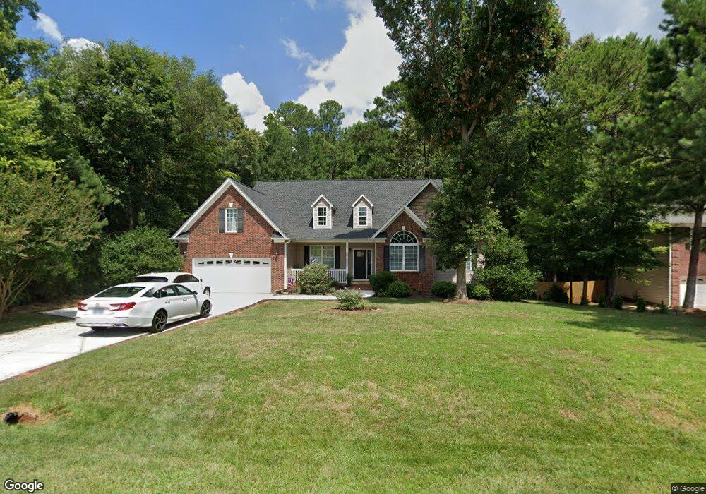
4071 Flint Dr Lancaster, SC 29720
Estimated Value: $389,531 - $438,000
Studio
3
Baths
2,246
Sq Ft
$184/Sq Ft
Est. Value
About This Home
This home is located at 4071 Flint Dr, Lancaster, SC 29720 and is currently estimated at $413,633, approximately $184 per square foot. 4071 Flint Dr is a home located in Lancaster County with nearby schools including Erwin Elementary School, South Middle School, and Lancaster High School.
Ownership History
Date
Name
Owned For
Owner Type
Purchase Details
Closed on
Jun 15, 2007
Sold by
Henry Home Construction Llc
Bought by
Thompson Gregory V and Thompson Veronica C
Current Estimated Value
Home Financials for this Owner
Home Financials are based on the most recent Mortgage that was taken out on this home.
Original Mortgage
$61,750
Outstanding Balance
$37,356
Interest Rate
6.16%
Mortgage Type
Credit Line Revolving
Estimated Equity
$376,277
Create a Home Valuation Report for This Property
The Home Valuation Report is an in-depth analysis detailing your home's value as well as a comparison with similar homes in the area
Home Values in the Area
Average Home Value in this Area
Purchase History
| Date | Buyer | Sale Price | Title Company |
|---|---|---|---|
| Thompson Gregory V | $247,000 | None Available |
Source: Public Records
Mortgage History
| Date | Status | Borrower | Loan Amount |
|---|---|---|---|
| Open | Thompson Gregory V | $61,750 | |
| Open | Thompson Gregory V | $185,250 |
Source: Public Records
Tax History
| Year | Tax Paid | Tax Assessment Tax Assessment Total Assessment is a certain percentage of the fair market value that is determined by local assessors to be the total taxable value of land and additions on the property. | Land | Improvement |
|---|---|---|---|---|
| 2024 | $1,654 | $10,784 | $1,200 | $9,584 |
| 2023 | $1,648 | $10,784 | $1,200 | $9,584 |
| 2022 | $1,642 | $10,784 | $1,200 | $9,584 |
| 2021 | $1,607 | $10,784 | $1,200 | $9,584 |
| 2020 | $1,534 | $10,012 | $1,200 | $8,812 |
| 2019 | $3,385 | $10,012 | $1,200 | $8,812 |
| 2018 | $3,257 | $10,012 | $1,200 | $8,812 |
| 2017 | $1,499 | $0 | $0 | $0 |
| 2016 | $1,462 | $0 | $0 | $0 |
| 2015 | $1,189 | $0 | $0 | $0 |
| 2014 | $1,189 | $0 | $0 | $0 |
| 2013 | $1,189 | $0 | $0 | $0 |
Source: Public Records
Map
Nearby Homes
- 4203 Flint Dr
- 2383 Charlotte Hwy
- 128 Paul Snipes Rd
- 1927 Terra Ln
- 000 Shiloh Unity Rd
- 1790 Windsor Dr
- 1790 Havenwood Dr
- 1780 Havenwood Dr Unit 37
- 970 Pemberley St
- 940 Pemberley St
- 2500 Lazy Oak Dr
- TBD Lazy Oak Dr
- 372 Maplestead St
- 1017 Pemberley St
- 936 Pemberley St
- 2508 Lazy Oak Dr
- 2255 Moon Crest Rd Unit 137
- 2255 Moon Crest Rd
- 997 Pemberley St
- 4339 Camden Glen Rd
- 4079 Flint Dr
- 4063 Flint Dr
- 4063 Flint Dr Unit 38
- 4087 Flint Dr
- 4059 Flint Dr
- 4070 Flint Dr
- 4060 Flint Dr
- 4060 Flint Dr Unit 95
- 4059 Flint Dr
- 4078 Flint Dr
- 4086 Flint Dr
- 4051 Flint Dr
- 4046 Flint Dr
- 3752 Travertine Dr
- 5206 Quarry Dr
- 5206 Quarry Dr Unit 91
- 4019 Flint Dr
- 4103 Flint Dr Unit 44
- 4103 Flint Dr
- 5214 Quarry Dr
Your Personal Tour Guide
Ask me questions while you tour the home.