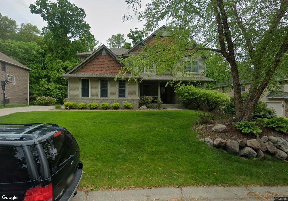
4071 Maple Hurst Dr S Rockford, MN 55373
Estimated Value: $645,000 - $846,000
4
Beds
4
Baths
3,553
Sq Ft
$198/Sq Ft
Est. Value
About This Home
This home is located at 4071 Maple Hurst Dr S, Rockford, MN 55373 and is currently estimated at $703,079, approximately $197 per square foot. 4071 Maple Hurst Dr S is a home located in Wright County with nearby schools including Rockford Elementary Arts Magnet School, Rockford Middle School - Center for Environmental Studies, and Rockford High School.
Ownership History
Date
Name
Owned For
Owner Type
Purchase Details
Closed on
Jul 2, 2012
Sold by
Allen Michael J and Allen Judith A
Bought by
Perkins Lisa M and Perkins Kelly J
Current Estimated Value
Purchase Details
Closed on
Mar 31, 2006
Sold by
U S Home Corp
Bought by
Allen Michael J and Allen Judith A
Purchase Details
Closed on
Sep 9, 2005
Sold by
Darrel A Farr Development Corp
Bought by
U S Home Corp
Create a Home Valuation Report for This Property
The Home Valuation Report is an in-depth analysis detailing your home's value as well as a comparison with similar homes in the area
Home Values in the Area
Average Home Value in this Area
Purchase History
| Date | Buyer | Sale Price | Title Company |
|---|---|---|---|
| Perkins Lisa M | $384,000 | -- | |
| Allen Michael J | $529,990 | -- | |
| U S Home Corp | $2,860,000 | -- |
Source: Public Records
Tax History Compared to Growth
Tax History
| Year | Tax Paid | Tax Assessment Tax Assessment Total Assessment is a certain percentage of the fair market value that is determined by local assessors to be the total taxable value of land and additions on the property. | Land | Improvement |
|---|---|---|---|---|
| 2025 | $8,060 | $654,900 | $90,000 | $564,900 |
| 2024 | $7,766 | $657,300 | $90,000 | $567,300 |
| 2023 | $7,622 | $655,200 | $90,000 | $565,200 |
| 2022 | $7,828 | $584,600 | $85,000 | $499,600 |
| 2021 | $8,088 | $540,400 | $70,000 | $470,400 |
| 2020 | $8,306 | $545,100 | $70,000 | $475,100 |
| 2019 | $8,594 | $528,300 | $0 | $0 |
| 2018 | $7,212 | $527,200 | $0 | $0 |
| 2017 | $6,526 | $480,100 | $0 | $0 |
| 2016 | $6,114 | $0 | $0 | $0 |
| 2015 | $6,004 | $0 | $0 | $0 |
| 2014 | -- | $0 | $0 | $0 |
Source: Public Records
Map
Nearby Homes
- 4040 Maple Hurst Dr S
- 4090 Maple Hurst Dr S
- 4231 Maple Hurst Dr N
- XXX Jansen Ave SE
- 6761 Maple Dr
- 7021 Meadow Ct
- 6630 Maple Dr
- 8130 Ravenrock Rd
- 8041 Prairie Trail
- 8530 Fir St
- 7040 Winfield Rd
- 3439 Hall Ave SE
- 6101 Boulder Ridge Dr
- 8833 Walnut Place
- 8098 26th St SE
- 8800 86th Ave N
- 7175 Sterling Dr
- 5523 Basswood Cir
- 7624 Red Fox Trail
- XX Hamlin Ave SE
- 4071 4071 Maple Hurst Dr S
- 4061 Maple Hurst Dr S
- 4081 Maple Hurst Dr S
- 4061 4061 Maple Hurst-Drive-s
- 4061 4061 Maple Hurst Dr S
- 4070 Maple Hurst Dr S
- 4070 4070 Maple Hurst Dr S
- 4070 4070 Maple Hurst-Drive-s
- 4051 Maple Hurst Dr S
- 4051 Maple Hurst Dr S
- 4080 Maple Hurst Dr S
- 4080 4080 Maple Hurst Dr S
- 4051 4051 Maple Hurst-Drive-s
- 4111 Maple Hurst Dr S
- 4111 4111 Maple Hurst-Drive-s
- 4060 Maple Hurst Dr S
- 4041 Maple Hurst Dr S
- XXX Shadow Ridge
- 4050 Maple Hurst Dr S
- 4050 4050 Maple Hurst Dr S