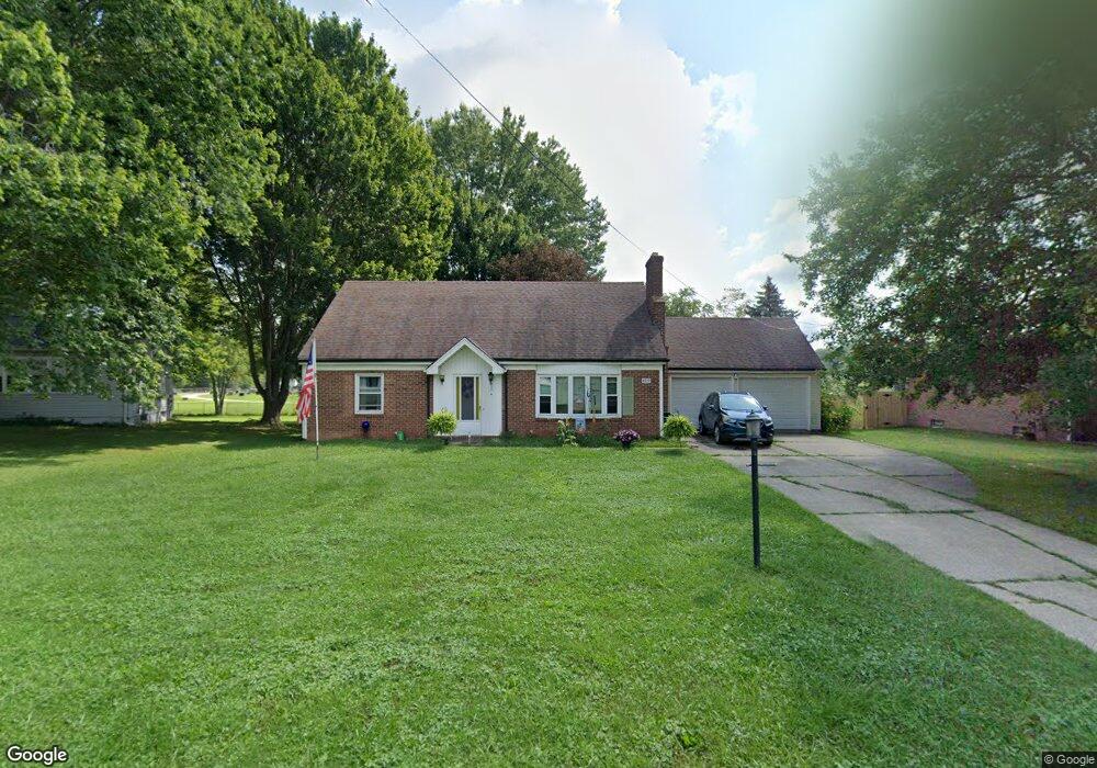
4072 Siefer Dr Rootstown, OH 44272
Estimated Value: $228,666 - $264,000
4
Beds
2
Baths
1,560
Sq Ft
$155/Sq Ft
Est. Value
About This Home
This home is located at 4072 Siefer Dr, Rootstown, OH 44272 and is currently estimated at $242,167, approximately $155 per square foot. 4072 Siefer Dr is a home located in Portage County with nearby schools including Rootstown Middle School - Schnee Building and Rootstown High School.
Ownership History
Date
Name
Owned For
Owner Type
Purchase Details
Closed on
Jun 12, 2006
Sold by
Haines Mary M
Bought by
Peterson Daniel J and Peterson Karen L
Current Estimated Value
Home Financials for this Owner
Home Financials are based on the most recent Mortgage that was taken out on this home.
Original Mortgage
$154,200
Outstanding Balance
$95,835
Interest Rate
8.12%
Mortgage Type
Purchase Money Mortgage
Estimated Equity
$146,332
Purchase Details
Closed on
Jan 1, 1990
Bought by
Haines Mary M
Create a Home Valuation Report for This Property
The Home Valuation Report is an in-depth analysis detailing your home's value as well as a comparison with similar homes in the area
Purchase History
| Date | Buyer | Sale Price | Title Company |
|---|---|---|---|
| Peterson Daniel J | $154,200 | First American Title Ins Co | |
| Haines Mary M | -- | -- |
Source: Public Records
Mortgage History
| Date | Status | Borrower | Loan Amount |
|---|---|---|---|
| Open | Peterson Daniel J | $154,200 |
Source: Public Records
Tax History
| Year | Tax Paid | Tax Assessment Tax Assessment Total Assessment is a certain percentage of the fair market value that is determined by local assessors to be the total taxable value of land and additions on the property. | Land | Improvement |
|---|---|---|---|---|
| 2025 | $2,417 | $56,990 | $9,770 | $47,220 |
| 2024 | $2,637 | $56,990 | $9,770 | $47,220 |
| 2023 | $2,226 | $43,270 | $9,770 | $33,500 |
| 2022 | $2,896 | $43,270 | $9,770 | $33,500 |
| 2021 | $1,956 | $43,270 | $9,770 | $33,500 |
| 2020 | $2,235 | $38,650 | $9,770 | $28,880 |
| 2019 | $2,157 | $38,650 | $9,770 | $28,880 |
| 2018 | $2,014 | $34,380 | $9,770 | $24,610 |
| 2017 | $2,054 | $34,380 | $9,770 | $24,610 |
| 2016 | $2,130 | $34,380 | $9,770 | $24,610 |
| 2015 | $1,804 | $34,380 | $9,770 | $24,610 |
| 2014 | $1,699 | $34,380 | $9,770 | $24,610 |
| 2013 | $1,688 | $34,380 | $9,770 | $24,610 |
Source: Public Records
Map
Nearby Homes
- 4079 Siefer Dr
- 0 Lynn Rd Unit 5110102
- 3689 Cherry Hill
- 3701 State Route 44
- V/L 2 Lynn Rd
- V/L Lynn Rd
- 4200 Hattrick Rd
- 4415 Farmette Dr
- sub lot Lane Ave
- 0 Tallmadge Rd Unit 5189301
- 0 Tallmadge Rd Unit 5189314
- 4556 Rootstown Rd
- 4140 Sandy Lake Rd
- 3637 Old Forge Rd
- 4058 Bayberry Knoll Ln
- 5394 Juniper Ct
- 3021 Hartville Rd
- 3925 Summit Rd
- 2978 Sandy Lake Rd
- 1065 Shadowlawn Dr
Your Personal Tour Guide
Ask me questions while you tour the home.