Estimated payment $1,866/month
Highlights
- 1 Fireplace
- Enclosed Patio or Porch
- Laundry Room
- No HOA
- 2 Car Attached Garage
- Forced Air Heating System
About This Home
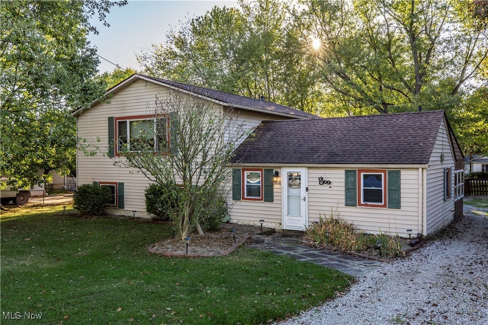
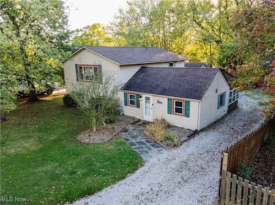
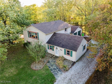
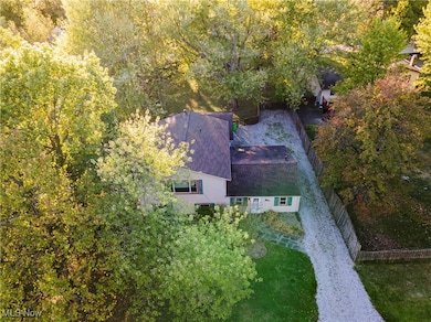
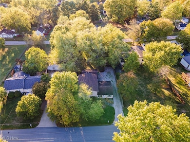
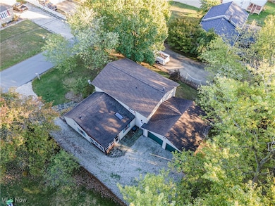
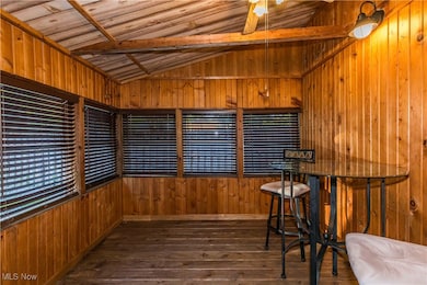
Welcome to this charming and spacious split-level home nestled in a serene, park-like setting—perfectly combining privacy and convenience. Situated on a beautifully landscaped lot with a fully fenced backyard and road-to-road property line, this home offers the ideal outdoor space for relaxation, play, and entertaining. This home has seen numerous updates over the years, including a major addition in 1997, flooring and kitchen updates in 2017, and a partial roof replacement in 2025—bringing comfort, style, and peace of mind. Inside, you’ll find four spacious bedrooms, including a primary suite with a walk-in closet and private master bath. The large laundry room offers plenty of functionality, while a flexible bonus room is perfect for a home office, playroom, crafting space, or guest area. The sunroom is a true highlight, offering a peaceful retreat to enjoy your morning coffee or unwind after a long day. Conveniently located just minutes from schools, shopping, and expressway access, this home is a perfect blend of comfort, space, and location. Don’t miss the opportunity to own this unique and inviting property—schedule your showing today!
Listing Agent
EXP Realty, LLC. Brokerage Email: marniemackayrealtor@gmail.com, 330-289-4643 License #2013003986 Listed on: 10/17/2025

Co-Listing Agent
EXP Realty, LLC. Brokerage Email: marniemackayrealtor@gmail.com, 330-289-4643 License #2007003792
Home Details
Home Type
- Single Family
Est. Annual Taxes
- $3,936
Year Built
- Built in 1957
Lot Details
- 0.38 Acre Lot
- Partially Fenced Property
- Chain Link Fence
Parking
- 2 Car Attached Garage
- Unpaved Parking
Home Design
- Split Level Home
- Fiberglass Roof
- Asphalt Roof
- Vinyl Siding
Interior Spaces
- 2,026 Sq Ft Home
- 2-Story Property
- 1 Fireplace
- Partial Basement
- Laundry Room
Kitchen
- Range
- Microwave
Bedrooms and Bathrooms
- 4 Bedrooms
- 2 Full Bathrooms
Outdoor Features
- Enclosed Patio or Porch
Utilities
- No Cooling
- Forced Air Heating System
- Heating System Uses Gas
Community Details
- No Home Owners Association
Listing and Financial Details
- Assessor Parcel Number 5600701
Map
Home Values in the Area
Average Home Value in this Area
Tax History
| Year | Tax Paid | Tax Assessment Tax Assessment Total Assessment is a certain percentage of the fair market value that is determined by local assessors to be the total taxable value of land and additions on the property. | Land | Improvement |
|---|---|---|---|---|
| 2025 | $3,812 | $67,358 | $12,649 | $54,709 |
| 2024 | $3,812 | $67,358 | $12,649 | $54,709 |
| 2023 | $3,812 | $67,358 | $12,649 | $54,709 |
| 2022 | $3,511 | $54,761 | $10,283 | $44,478 |
| 2021 | $3,145 | $54,761 | $10,283 | $44,478 |
| 2020 | $3,092 | $54,760 | $10,280 | $44,480 |
| 2019 | $2,581 | $42,570 | $10,280 | $32,290 |
| 2018 | $2,539 | $42,570 | $10,280 | $32,290 |
| 2017 | $2,610 | $42,570 | $10,280 | $32,290 |
| 2016 | $2,686 | $42,570 | $10,280 | $32,290 |
| 2015 | $2,610 | $42,570 | $10,280 | $32,290 |
| 2014 | $2,612 | $42,570 | $10,280 | $32,290 |
| 2013 | $2,596 | $42,570 | $10,280 | $32,290 |
Property History
| Date | Event | Price | List to Sale | Price per Sq Ft |
|---|---|---|---|---|
| 01/23/2026 01/23/26 | Pending | -- | -- | -- |
| 01/03/2026 01/03/26 | Price Changed | $289,900 | -3.3% | $143 / Sq Ft |
| 11/14/2025 11/14/25 | Price Changed | $299,900 | -2.0% | $148 / Sq Ft |
| 10/17/2025 10/17/25 | For Sale | $306,000 | -- | $151 / Sq Ft |
Purchase History
| Date | Type | Sale Price | Title Company |
|---|---|---|---|
| Interfamily Deed Transfer | -- | Secure Title Of Ohio | |
| Interfamily Deed Transfer | -- | -- | |
| Deed | $117,000 | -- |
Mortgage History
| Date | Status | Loan Amount | Loan Type |
|---|---|---|---|
| Open | $113,600 | New Conventional | |
| Closed | $105,300 | New Conventional | |
| Closed | $12,000 | No Value Available |
Source: MLS Now
MLS Number: 5165334
APN: 56-00701
Disclaimer: Certain information contained herein is derived from information provided by parties other than Homes.com. All information provided is deemed reliable, but is not guaranteed to be accurate and should be independently verified.
![]() IDX information is provided exclusively for personal, non-commercial use, and may not be used for any purpose other than to identify prospective properties consumers may be interested in purchasing. Information is deemed reliable but not guaranteed.
IDX information is provided exclusively for personal, non-commercial use, and may not be used for any purpose other than to identify prospective properties consumers may be interested in purchasing. Information is deemed reliable but not guaranteed.
- 4040 Burton Dr
- 0 Vira Rd
- 4155 Burton Dr
- 2365 Norman Dr
- 3828 Osage St Unit 3832
- 2260 E Gilwood Dr
- 2293 Wickley Ave
- 3961 Klein Ave
- 3861 Klein Ave
- 4138 Genevieve Blvd
- 4556 Fishcreek Rd
- 4399-4403 Cherryhurst Dr
- 3874 Lake Run Blvd
- 3767 Lake Run Blvd
- 3666 Hiwood Ave
- 3679 Sanford Ave
- 2944 Heatherwood Ct
- 3753 Lake Run Blvd
- 2194 Santom Rd E
- 2055-2059 Bryn Mawr Dr
Ask me questions while you tour the home.