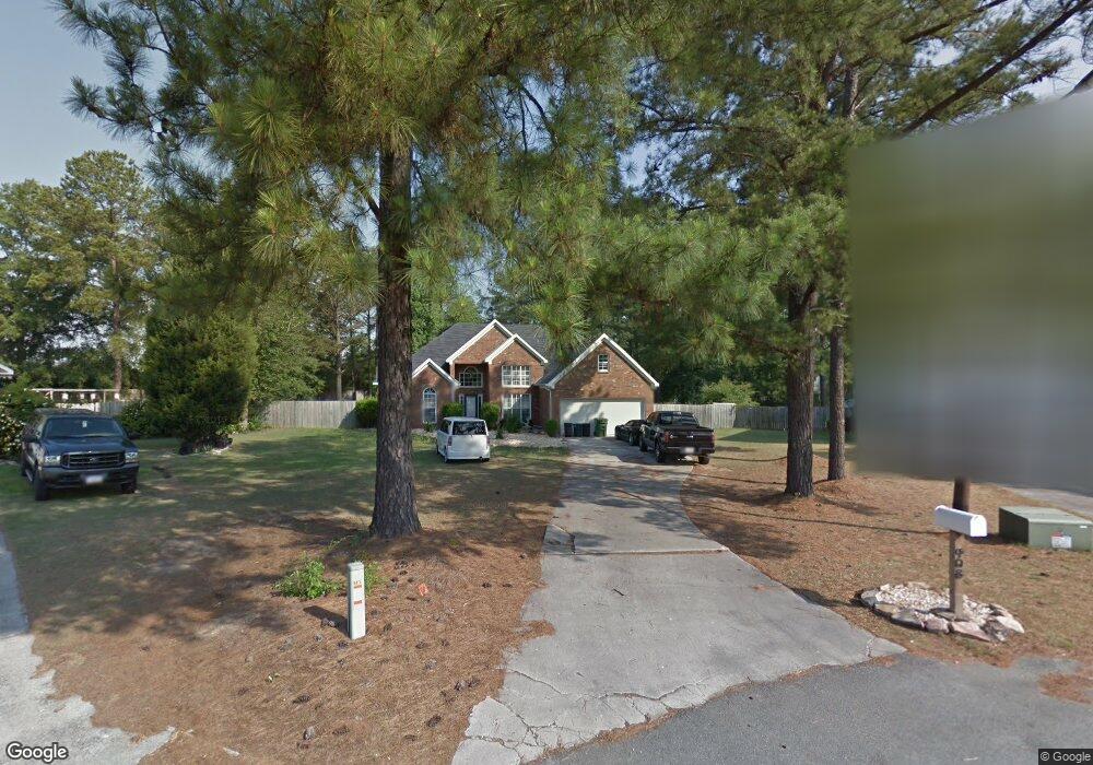
408 Bransford Cir Macon, GA 31216
Estimated Value: $255,441 - $259,000
3
Beds
2
Baths
1,708
Sq Ft
$151/Sq Ft
Est. Value
About This Home
This home is located at 408 Bransford Cir, Macon, GA 31216 and is currently estimated at $257,110, approximately $150 per square foot. 408 Bransford Cir is a home located in Bibb County with nearby schools including Porter Elementary School, Rutland Middle School, and Rutland High School.
Ownership History
Date
Name
Owned For
Owner Type
Purchase Details
Closed on
Jul 27, 2007
Sold by
Lucas James M and Crader Rebecca S
Bought by
Branstrom Mark
Current Estimated Value
Home Financials for this Owner
Home Financials are based on the most recent Mortgage that was taken out on this home.
Original Mortgage
$146,300
Outstanding Balance
$102,184
Interest Rate
8.99%
Mortgage Type
Unknown
Estimated Equity
$154,926
Purchase Details
Closed on
Oct 4, 2002
Purchase Details
Closed on
Jun 30, 1999
Purchase Details
Closed on
Feb 7, 1997
Create a Home Valuation Report for This Property
The Home Valuation Report is an in-depth analysis detailing your home's value as well as a comparison with similar homes in the area
Home Values in the Area
Average Home Value in this Area
Purchase History
| Date | Buyer | Sale Price | Title Company |
|---|---|---|---|
| Branstrom Mark | $154,000 | None Available | |
| -- | $136,300 | -- | |
| -- | $118,500 | -- | |
| -- | $111,900 | -- |
Source: Public Records
Mortgage History
| Date | Status | Borrower | Loan Amount |
|---|---|---|---|
| Open | Branstrom Mark | $146,300 |
Source: Public Records
Tax History Compared to Growth
Tax History
| Year | Tax Paid | Tax Assessment Tax Assessment Total Assessment is a certain percentage of the fair market value that is determined by local assessors to be the total taxable value of land and additions on the property. | Land | Improvement |
|---|---|---|---|---|
| 2025 | $2,333 | $94,952 | $12,000 | $82,952 |
| 2024 | $2,412 | $94,952 | $12,000 | $82,952 |
| 2023 | $2,080 | $81,891 | $12,000 | $69,891 |
| 2022 | $2,754 | $79,541 | $9,600 | $69,941 |
| 2021 | $2,357 | $62,020 | $8,000 | $54,020 |
| 2020 | $2,408 | $62,020 | $8,000 | $54,020 |
| 2019 | $2,428 | $62,020 | $8,000 | $54,020 |
| 2018 | $3,898 | $62,020 | $8,000 | $54,020 |
| 2017 | $2,451 | $65,420 | $9,600 | $55,820 |
| 2016 | $2,263 | $65,420 | $9,600 | $55,820 |
| 2015 | $3,204 | $65,420 | $9,600 | $55,820 |
| 2014 | $3,209 | $65,420 | $9,600 | $55,820 |
Source: Public Records
Map
Nearby Homes
- 120 Bransford Dr
- 208 Pendleton Ct
- 113 Ridge Cir
- Crofton Plan at Highland Pointe
- Redland Plan at Highland Pointe
- Hanover Plan at Highland Pointe
- 4285 Holly Hill Dr
- 423 Windsor Ct
- 180 Ridge Cir
- 6233 Skipperton Rd
- 3988 Hartley Bridge Rd
- 104 Tyler Ct
- 3906 Hartley Bridge Rd
- 1122 Alma Dr
- 3824 Bobby Ct
- 3812 Western Way
- 3770 Hartley Bridge Rd
- 1062 Alma Dr
- 405 Bransford Cir
- 404 Bransford Cir
- 128 White Pine Ct
- 125 Bransford Dr
- 129 Bransford Dr
- 124 White Pine Ct
- 121 Bransford Dr
- 133 Bransford Dr
- 132 White Pine Ct
- 128 Bransford Dr
- 137 Bransford Dr
- 117 Bransford Dr
- 136 White Pine Ct
- 136 Bransford Dr
- 116 Bransford Dr
- 129 White Pine Ct
- 113 Bransford Dr
- 140 Bransford Dr
- 121 White Pine Ct