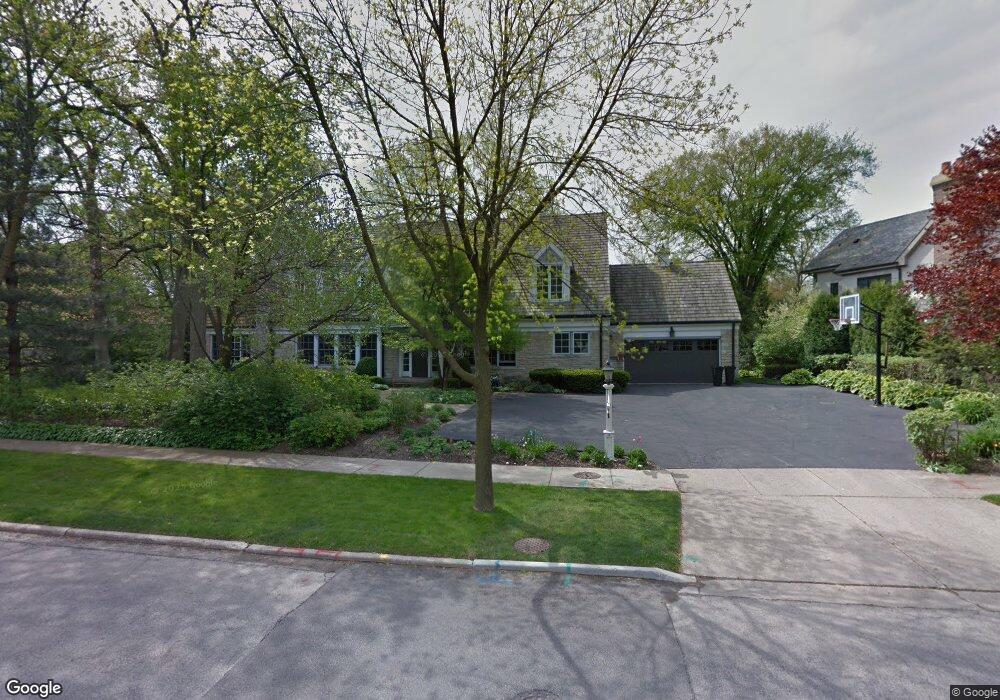
408 Sheridan Rd Glencoe, IL 60022
Estimated Value: $1,686,817 - $2,410,000
5
Beds
3
Baths
3,950
Sq Ft
$491/Sq Ft
Est. Value
About This Home
This home is located at 408 Sheridan Rd, Glencoe, IL 60022 and is currently estimated at $1,940,954, approximately $491 per square foot. 408 Sheridan Rd is a home located in Cook County with nearby schools including South Elementary School, Central School, and West School.
Ownership History
Date
Name
Owned For
Owner Type
Purchase Details
Closed on
Apr 20, 2021
Sold by
Drane Scott A and Drane Celia G
Bought by
Celia G Drane Trust and Drane
Current Estimated Value
Purchase Details
Closed on
Aug 8, 1995
Sold by
Lipnick Stanley M and Lipnick Judith
Bought by
Drane Scott A and Drane Celia G
Home Financials for this Owner
Home Financials are based on the most recent Mortgage that was taken out on this home.
Original Mortgage
$368,000
Interest Rate
6.87%
Create a Home Valuation Report for This Property
The Home Valuation Report is an in-depth analysis detailing your home's value as well as a comparison with similar homes in the area
Home Values in the Area
Average Home Value in this Area
Purchase History
| Date | Buyer | Sale Price | Title Company |
|---|---|---|---|
| Celia G Drane Trust | -- | None Listed On Document | |
| Drane Scott A | $76,000 | -- |
Source: Public Records
Mortgage History
| Date | Status | Borrower | Loan Amount |
|---|---|---|---|
| Previous Owner | Drane Scott A | $368,000 |
Source: Public Records
Tax History Compared to Growth
Tax History
| Year | Tax Paid | Tax Assessment Tax Assessment Total Assessment is a certain percentage of the fair market value that is determined by local assessors to be the total taxable value of land and additions on the property. | Land | Improvement |
|---|---|---|---|---|
| 2024 | $29,892 | $128,000 | $27,887 | $100,113 |
| 2023 | $27,864 | $128,000 | $27,887 | $100,113 |
| 2022 | $27,864 | $128,000 | $27,887 | $100,113 |
| 2021 | $19,661 | $74,572 | $26,619 | $47,953 |
| 2020 | $19,202 | $74,572 | $26,619 | $47,953 |
| 2019 | $19,020 | $80,339 | $26,619 | $53,720 |
| 2018 | $22,392 | $91,520 | $22,816 | $68,704 |
| 2017 | $21,769 | $91,520 | $22,816 | $68,704 |
| 2016 | $20,643 | $91,520 | $22,816 | $68,704 |
| 2015 | $20,018 | $79,054 | $19,330 | $59,724 |
| 2014 | $19,538 | $79,054 | $19,330 | $59,724 |
| 2013 | $20,006 | $84,736 | $19,330 | $65,406 |
Source: Public Records
Map
Nearby Homes
- 410 Green Bay Rd
- 590 Green Bay Rd Unit 590
- 313 Hawthorn Ave Unit 313F
- 677 Greenleaf Ave
- 265 Randolph St
- 150 Linden Ave
- 205 Scott Ave
- 1235 Scott Ave
- 1 Briar Ln
- 560 Drexel Ave
- 219 Lincoln Dr
- 794 Greenwood Ave
- 64 Crescent Dr
- 130 Maple Hill Rd
- 1015 Sheridan Rd
- 1492 Asbury Ave
- 979 Vine St
- 908 Elm Place
- 943 Westmoor Rd
- 710 Strawberry Hill Dr
- 397 Palos Rd
- 405 Palos Rd
- 385 Palos Rd
- 415 Sheridan Rd
- 419 Sheridan Rd
- 159 Montgomery St
- 195 Fairview Rd
- 375 Palos Rd
- 435 Sheridan Rd
- 190 South Ave
- 124 Dell Place
- 145 Montgomery St
- 365 Palos Rd
- 443 Sheridan Rd
- 120 Dell Place
- 206 Fairview Rd
- 162 Montgomery St
- 455 Sheridan Rd
- 419 Greenleaf Ave
- 440 Sheridan Rd