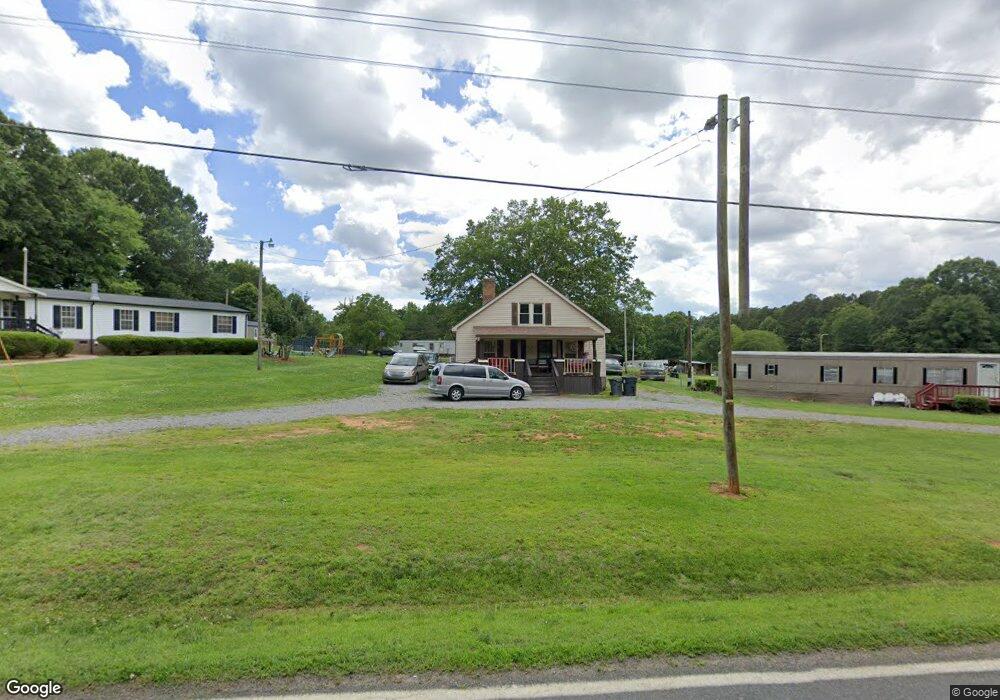
408 Weathers Creek Rd Troutman, NC 28166
Estimated Value: $269,876 - $382,000
4
Beds
1
Bath
1,656
Sq Ft
$200/Sq Ft
Est. Value
About This Home
This home is located at 408 Weathers Creek Rd, Troutman, NC 28166 and is currently estimated at $331,469, approximately $200 per square foot. 408 Weathers Creek Rd is a home located in Iredell County with nearby schools including Shepherd Elementary School, Troutman Middle School, and South Iredell High School.
Ownership History
Date
Name
Owned For
Owner Type
Purchase Details
Closed on
Aug 16, 2004
Sold by
Westmoreland Otis and Westermoreland Lennie
Bought by
Westmoreland Patricia
Current Estimated Value
Home Financials for this Owner
Home Financials are based on the most recent Mortgage that was taken out on this home.
Original Mortgage
$90,000
Outstanding Balance
$45,192
Interest Rate
6.19%
Mortgage Type
Credit Line Revolving
Estimated Equity
$286,277
Purchase Details
Closed on
Aug 1, 1996
Purchase Details
Closed on
Jun 1, 1901
Create a Home Valuation Report for This Property
The Home Valuation Report is an in-depth analysis detailing your home's value as well as a comparison with similar homes in the area
Home Values in the Area
Average Home Value in this Area
Purchase History
| Date | Buyer | Sale Price | Title Company |
|---|---|---|---|
| Westmoreland Patricia | -- | -- | |
| -- | -- | -- | |
| -- | -- | -- |
Source: Public Records
Mortgage History
| Date | Status | Borrower | Loan Amount |
|---|---|---|---|
| Open | Westmoreland Patricia | $90,000 |
Source: Public Records
Tax History Compared to Growth
Tax History
| Year | Tax Paid | Tax Assessment Tax Assessment Total Assessment is a certain percentage of the fair market value that is determined by local assessors to be the total taxable value of land and additions on the property. | Land | Improvement |
|---|---|---|---|---|
| 2024 | $989 | $157,420 | $103,400 | $54,020 |
| 2023 | $989 | $157,420 | $103,400 | $54,020 |
| 2022 | $794 | $116,900 | $77,550 | $39,350 |
| 2021 | $790 | $116,900 | $77,550 | $39,350 |
| 2020 | $790 | $116,900 | $77,550 | $39,350 |
| 2019 | $778 | $116,900 | $77,550 | $39,350 |
| 2018 | $681 | $105,210 | $73,240 | $31,970 |
| 2017 | $681 | $105,210 | $73,240 | $31,970 |
| 2016 | $681 | $105,210 | $73,240 | $31,970 |
| 2015 | $681 | $105,210 | $73,240 | $31,970 |
| 2014 | $642 | $106,270 | $73,240 | $33,030 |
Source: Public Records
Map
Nearby Homes
- 154 Winford Rd
- 279 Winford Rd
- 286 Winford Rd
- 294 Winford Rd
- 200 Weatherstone Ranch Trail
- 232 Sugar Hill Rd
- 212 Sugar Hill Rd
- 122 Round Rock Rd
- 682 Houston Rd
- 658 Houston Rd
- 515 Brawley Rd
- 306 Fesperman Cir
- 909 Shinnville Rd
- 154 Fairfield Dr
- 229 Fesperman Cir
- 117 Carmine Ct
- 144 Fairfield Dr
- Wagner Plan at Wheatfield Estates
- Declan Plan at Wheatfield Estates
- Huntley Plan at Wheatfield Estates
- 402 Weathers Creek Rd
- 412 Weathers Creek Rd
- 396 Weathers Creek Rd
- 415 Weathers Creek Rd
- 411 Weathers Creek Rd
- 422 Weathers Creek Rd
- 419 Weathers Creek Rd
- 387 Weathers Creek Rd
- 431 Weathers Creek Rd
- 329 Overcash Rd
- 378 Weathers Creek Rd
- 101 Overcash Rd
- 317 Overcash Rd
- 376 Weathers Creek Rd
- 131 Winford Rd
- 377 Weathers Creek Rd
- 329 Weathers Creek Rd
- 370 Weathers Creek Rd
- 135 Winford Rd
- 446 Weathers Creek Rd