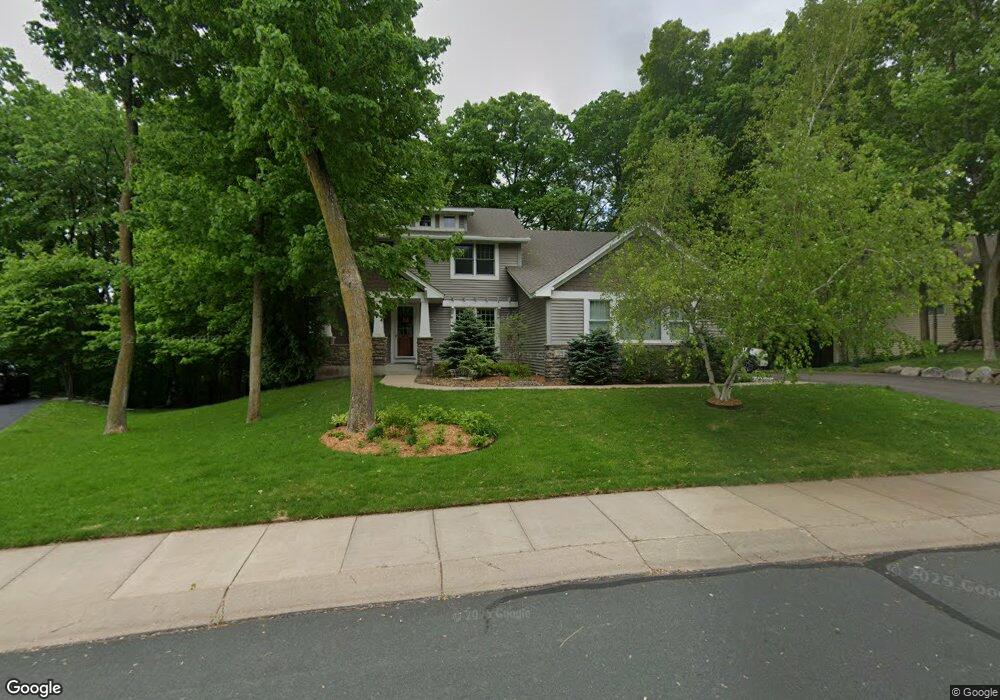
4080 4080 Maple Hurst Dr S Rockford, MN 55373
Estimated Value: $561,061 - $691,000
5
Beds
4
Baths
2,960
Sq Ft
$207/Sq Ft
Est. Value
About This Home
This home is located at 4080 4080 Maple Hurst Dr S, Rockford, MN 55373 and is currently estimated at $611,265, approximately $206 per square foot. 4080 4080 Maple Hurst Dr S is a home located in Wright County with nearby schools including Rockford Elementary Arts Magnet School, Rockford Middle School - Center for Environmental Studies, and Rockford High School.
Ownership History
Date
Name
Owned For
Owner Type
Purchase Details
Closed on
Jun 21, 2010
Sold by
Presbyterion Homes & Services
Bought by
Schmidt Nathaniel S and Schmidt Rebecca E
Current Estimated Value
Purchase Details
Closed on
Apr 16, 2010
Sold by
Sykes Michael and Sykes Laurie
Bought by
Presbyterian Homes & Services
Purchase Details
Closed on
Jul 28, 2006
Sold by
U S Home Corp
Bought by
Sykes Michael and Sykes Laurie
Create a Home Valuation Report for This Property
The Home Valuation Report is an in-depth analysis detailing your home's value as well as a comparison with similar homes in the area
Home Values in the Area
Average Home Value in this Area
Purchase History
| Date | Buyer | Sale Price | Title Company |
|---|---|---|---|
| Schmidt Nathaniel S | $345,000 | -- | |
| Presbyterian Homes & Services | $355,000 | -- | |
| Sykes Michael | -- | -- |
Source: Public Records
Tax History Compared to Growth
Tax History
| Year | Tax Paid | Tax Assessment Tax Assessment Total Assessment is a certain percentage of the fair market value that is determined by local assessors to be the total taxable value of land and additions on the property. | Land | Improvement |
|---|---|---|---|---|
| 2025 | $6,288 | $533,400 | $90,000 | $443,400 |
| 2024 | $6,056 | $532,500 | $90,000 | $442,500 |
| 2023 | $6,208 | $530,400 | $90,000 | $440,400 |
| 2022 | $6,294 | $491,000 | $85,000 | $406,000 |
| 2021 | $6,346 | $441,400 | $70,000 | $371,400 |
| 2020 | $6,542 | $435,200 | $70,000 | $365,200 |
| 2019 | $6,750 | $420,900 | $0 | $0 |
| 2018 | $5,908 | $418,700 | $0 | $0 |
| 2017 | $5,618 | $393,100 | $0 | $0 |
| 2016 | $5,460 | $0 | $0 | $0 |
| 2015 | $5,372 | $0 | $0 | $0 |
| 2014 | -- | $0 | $0 | $0 |
Source: Public Records
Map
Nearby Homes
- 4090 Maple Hurst Dr S
- 4040 Maple Hurst Dr S
- 4231 Maple Hurst Dr N
- XXX Jansen Ave SE
- 6761 Maple Dr
- 6630 Maple Dr
- 7021 Meadow Ct
- 8130 Ravenrock Rd
- 8041 Prairie Trail
- 8530 Fir St
- 7040 Winfield Rd
- 3439 Hall Ave SE
- 6101 Boulder Ridge Dr
- 8833 Walnut Place
- 8800 86th Ave N
- 8098 26th St SE
- 7175 Sterling Dr
- 7624 Red Fox Trail
- 5523 Basswood Cir
- 7757 Sterling Dr
- 4080 Maple Hurst Dr S
- 4070 Maple Hurst Dr S
- 4070 4070 Maple Hurst Dr S
- 4070 4070 Maple Hurst-Drive-s
- 4071 Maple Hurst Dr S
- 5XX Jansen Ave SE
- 4060 Maple Hurst Dr S
- 4081 Maple Hurst Dr S
- XXX Shadow Ridge
- 4061 Maple Hurst Dr S
- 4100 Maple Hurst Dr S
- 3021 Shadow Ridge Dr
- 3021 3021 Shadow Ridge Dr
- 4071 4071 Maple Hurst Dr S
- 3011 Shadow Ridge Dr
- 4061 4061 Maple Hurst-Drive-s
- 4061 4061 Maple Hurst Dr S
- 4050 Maple Hurst Dr S
- 4050 4050 Maple Hurst Dr S
- 3031 Shadow Ridge Dr