Estimated Value: $530,000 - $644,000
--
Bed
1
Bath
3,182
Sq Ft
$182/Sq Ft
Est. Value
About This Home
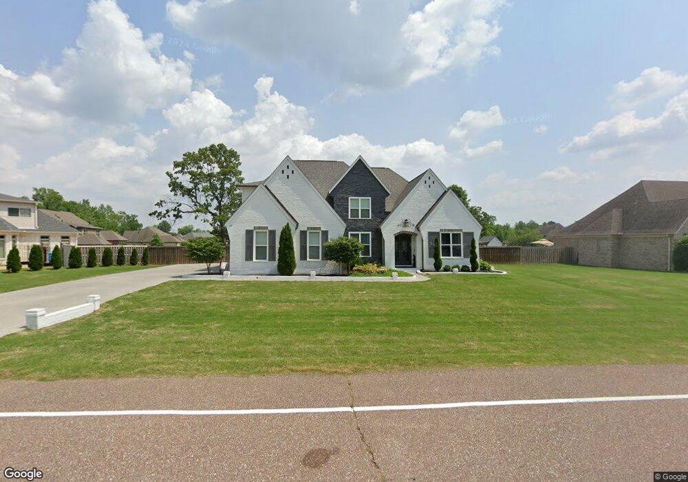
This home is located at 409 Colton Ridge Ln, Atoka, TN 38004 and is currently estimated at $578,566, approximately $181 per square foot. 409 Colton Ridge Ln is a home with nearby schools including Atoka Elementary School, Munford Middle School, and Munford High School.
Ownership History
Date
Name
Owned For
Owner Type
Purchase Details
Closed on
May 30, 2025
Sold by
Carter Bryan and Carter Teaha
Bought by
Carter Family Trust and Carter
Current Estimated Value
Home Financials for this Owner
Home Financials are based on the most recent Mortgage that was taken out on this home.
Original Mortgage
$100,000
Outstanding Balance
$99,570
Interest Rate
6.81%
Mortgage Type
Credit Line Revolving
Estimated Equity
$478,996
Purchase Details
Closed on
Apr 10, 2025
Sold by
Carter Family Trust and Carter Bryan Ashley
Bought by
Carter Bryan and Carter Teaha
Home Financials for this Owner
Home Financials are based on the most recent Mortgage that was taken out on this home.
Original Mortgage
$100,000
Outstanding Balance
$99,570
Interest Rate
6.81%
Mortgage Type
Credit Line Revolving
Estimated Equity
$478,996
Purchase Details
Closed on
Dec 23, 2016
Sold by
Carlisle Bradley W
Bought by
Carter Bryan and Carter Teaha
Purchase Details
Closed on
Dec 14, 2011
Sold by
Apc Investments Llc
Bought by
Carlisle Bradley W and Carlisle Amy S
Create a Home Valuation Report for This Property
The Home Valuation Report is an in-depth analysis detailing your home's value as well as a comparison with similar homes in the area
Home Values in the Area
Average Home Value in this Area
Purchase History
| Date | Buyer | Sale Price | Title Company |
|---|---|---|---|
| Carter Family Trust | -- | None Listed On Document | |
| Carter Family Trust | -- | None Listed On Document | |
| Carter Bryan | -- | None Listed On Document | |
| Carter Bryan | -- | None Listed On Document | |
| Carter Bryan | $50,815 | -- | |
| Carlisle Bradley W | $58,000 | -- |
Source: Public Records
Mortgage History
| Date | Status | Borrower | Loan Amount |
|---|---|---|---|
| Open | Carter Family Trust | $100,000 |
Source: Public Records
Tax History Compared to Growth
Tax History
| Year | Tax Paid | Tax Assessment Tax Assessment Total Assessment is a certain percentage of the fair market value that is determined by local assessors to be the total taxable value of land and additions on the property. | Land | Improvement |
|---|---|---|---|---|
| 2024 | $0 | $148,075 | $16,900 | $131,175 |
| 2023 | $3,340 | $148,075 | $16,900 | $131,175 |
| 2022 | $3,302 | $107,550 | $14,900 | $92,650 |
| 2021 | $3,248 | $107,550 | $14,900 | $92,650 |
| 2020 | $2,905 | $96,275 | $14,900 | $81,375 |
| 2019 | $3,133 | $87,275 | $11,475 | $75,800 |
| 2018 | $3,133 | $87,275 | $11,475 | $75,800 |
| 2017 | $1,185 | $87,275 | $11,475 | $75,800 |
| 2016 | $370 | $11,475 | $11,475 | $0 |
| 2015 | $369 | $11,475 | $11,475 | $0 |
| 2014 | $341 | $11,475 | $0 | $0 |
Source: Public Records
Map
Nearby Homes
- 104 Lochmeade Dr
- 128 Loch Haven Cove S
- 114 Walker Lake Rd
- 371 Beverly Dr
- 93 Sterling Farm Dr
- 0 Atoka McLaughlin Dr
- 420 Trebing Pkwy
- 376 Stroud Cir
- 189 Cotton Fall Dr
- 00 Atoka Idaville Rd
- 0 Smith Dr Unit 10202728
- 538 Rosemark Rd
- 249 Mignon Rd
- 78 Doe Trail
- 35 Drysdale Cove
- 29 Merino Dr
- 60 Drysdale Cove
- 170 Como Ln
- 50 Drysdale Cove
- 236 Como Ln
- 375 Colton Ridge Ln
- 433 Colton Ridge Ln
- 422 Colton Ridge Ln
- 400 Colton Ridge Ln
- 43 Lake Point Cove
- 343 Colton Ridge Ln
- 382 Colton Ridge Ln
- 442 Colton Ridge Ln
- 48 Waters Edge Cove
- 24 Waters Edge Cove
- 65 Lake Point Cove
- 464 Colton Ridge Ln
- 364 Colton Ridge Ln
- 121 Meade Lake Rd
- 346 Colton Ridge Ln
- 97 Meade Lake Rd
- 66 Waters Edge Cove
- 303 Colton Ridge Ln
- 58 Lake Point Cove
- 489 Colton Ridge Ln