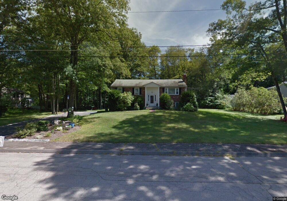
409 Coronation Dr Franklin, MA 02038
Estimated Value: $627,000 - $699,000
3
Beds
2
Baths
1,338
Sq Ft
$489/Sq Ft
Est. Value
About This Home
This home is located at 409 Coronation Dr, Franklin, MA 02038 and is currently estimated at $654,555, approximately $489 per square foot. 409 Coronation Dr is a home located in Norfolk County with nearby schools including John F. Kennedy Memorial School, Horace Mann Middle School, and Franklin High School.
Ownership History
Date
Name
Owned For
Owner Type
Purchase Details
Closed on
Apr 29, 1999
Sold by
Hirshfield David and Hirshfield Susan
Bought by
Brooks Jonathan M and Brooks Michele H
Current Estimated Value
Home Financials for this Owner
Home Financials are based on the most recent Mortgage that was taken out on this home.
Original Mortgage
$154,400
Interest Rate
6.95%
Mortgage Type
Purchase Money Mortgage
Purchase Details
Closed on
Oct 4, 1990
Sold by
Nason George H
Bought by
Hirshfield David
Create a Home Valuation Report for This Property
The Home Valuation Report is an in-depth analysis detailing your home's value as well as a comparison with similar homes in the area
Home Values in the Area
Average Home Value in this Area
Purchase History
| Date | Buyer | Sale Price | Title Company |
|---|---|---|---|
| Brooks Jonathan M | $193,000 | -- | |
| Hirshfield David | $158,000 | -- |
Source: Public Records
Mortgage History
| Date | Status | Borrower | Loan Amount |
|---|---|---|---|
| Open | Hirshfield David | $154,000 | |
| Closed | Hirshfield David | $156,000 | |
| Closed | Hirshfield David | $154,400 |
Source: Public Records
Tax History Compared to Growth
Tax History
| Year | Tax Paid | Tax Assessment Tax Assessment Total Assessment is a certain percentage of the fair market value that is determined by local assessors to be the total taxable value of land and additions on the property. | Land | Improvement |
|---|---|---|---|---|
| 2025 | $6,779 | $583,400 | $243,700 | $339,700 |
| 2024 | $5,969 | $506,300 | $243,700 | $262,600 |
| 2023 | $6,095 | $484,500 | $245,800 | $238,700 |
| 2022 | $5,804 | $413,100 | $203,100 | $210,000 |
| 2021 | $5,646 | $385,400 | $217,600 | $167,800 |
| 2020 | $5,496 | $378,800 | $219,500 | $159,300 |
| 2019 | $5,250 | $358,100 | $198,800 | $159,300 |
| 2018 | $5,082 | $346,900 | $204,500 | $142,400 |
| 2017 | $4,811 | $330,000 | $187,600 | $142,400 |
| 2016 | $4,478 | $308,800 | $184,500 | $124,300 |
| 2015 | $4,516 | $304,300 | $180,000 | $124,300 |
| 2014 | $3,981 | $275,500 | $151,200 | $124,300 |
Source: Public Records
Map
Nearby Homes
- 2 Noanet Brook Ln
- 60 Southgate Rd
- 208 Irondequoit Rd
- 41 Kimberlee Ave
- 336 Maple St
- 214 Conlyn Ave
- 159 Highwood Dr
- 951 Pond St
- 1805 Franklin Crossing Rd
- 2211 Franklin Crossing Rd Unit 2211
- 2 Kayla Dr
- 66 Highwood Dr
- 605 Franklin Crossing Rd
- 83 Highwood Dr Unit 83
- 17 Pine St
- 31 Highwood Dr
- 14 Hawthorne Village Unit D
- 18 Mary Anne Dr
- 57 Raymond St Unit 2
- 0 Elm St
- 401 Coronation Dr
- 417 Coronation Dr
- 408 Paula Ln
- 400 Paula Ln
- 416 Paula Ln
- 410 Coronation Dr
- 402 Coronation Dr
- 393 Coronation Dr
- 418 Coronation Dr
- 425 Coronation Dr
- 392 Paula Ln
- 394 Coronation Dr
- 447 Oakland Pkwy
- 422 Paula Ln
- 409 Paula Ln
- 385 Coronation Dr
- 417 Paula Ln
- 401 Paula Ln
- 386 Coronation Dr
- 440 Beverly Rd