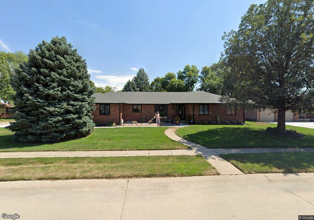
409 Devonshire Dr Gretna, NE 68028
Estimated Value: $389,932 - $452,000
2
Beds
2
Baths
2,068
Sq Ft
$199/Sq Ft
Est. Value
About This Home
This home is located at 409 Devonshire Dr, Gretna, NE 68028 and is currently estimated at $412,233, approximately $199 per square foot. 409 Devonshire Dr is a home located in Sarpy County with nearby schools including Squire John Thomas Elementary School, Gretna Middle School, and Gretna High School.
Ownership History
Date
Name
Owned For
Owner Type
Purchase Details
Closed on
Feb 16, 2021
Sold by
Frederick Mark E and Frederick Edward
Bought by
Frederick Michael J and Petersen Melvin D
Current Estimated Value
Purchase Details
Closed on
Aug 3, 2017
Sold by
Frederick Edward J and Edward J Frederick Living Trus
Bought by
Frederick Edward J and Edward J Frederick & Phyllis D Frederick
Purchase Details
Closed on
Nov 23, 1998
Sold by
Frederick Edward J and Frederick Phyllis
Bought by
Frederick Edward J and Frederick Phyllis D
Create a Home Valuation Report for This Property
The Home Valuation Report is an in-depth analysis detailing your home's value as well as a comparison with similar homes in the area
Home Values in the Area
Average Home Value in this Area
Purchase History
| Date | Buyer | Sale Price | Title Company |
|---|---|---|---|
| Frederick Michael J | -- | None Available | |
| Frederick Edward J | -- | Nebraska Title Company Om | |
| Frederick Edward J | -- | -- |
Source: Public Records
Tax History Compared to Growth
Tax History
| Year | Tax Paid | Tax Assessment Tax Assessment Total Assessment is a certain percentage of the fair market value that is determined by local assessors to be the total taxable value of land and additions on the property. | Land | Improvement |
|---|---|---|---|---|
| 2025 | $217 | $363,186 | $56,000 | $307,186 |
| 2024 | $437 | $352,611 | $54,000 | $298,611 |
| 2023 | $437 | $318,448 | $41,000 | $277,448 |
| 2022 | $6,722 | $294,588 | $41,000 | $253,588 |
| 2021 | $6,018 | $266,709 | $38,000 | $228,709 |
| 2020 | $6,574 | $293,008 | $35,000 | $258,008 |
| 2019 | $6,048 | $269,903 | $33,000 | $236,903 |
| 2018 | $5,532 | $248,010 | $33,000 | $215,010 |
| 2017 | $5,485 | $245,584 | $33,000 | $212,584 |
| 2016 | $5,523 | $247,936 | $30,000 | $217,936 |
| 2015 | $5,366 | $242,953 | $30,000 | $212,953 |
| 2014 | $5,199 | $237,379 | $30,000 | $207,379 |
| 2012 | -- | $238,108 | $30,000 | $208,108 |
Source: Public Records
Map
Nearby Homes
- 434 Devonshire Dr
- 19819 Sherwood Cir
- 19905 Maple St
- 11719 S 203rd St
- 206 E Westplains Rd
- 20717 Frances St
- 22111 Hackberry Dr
- 19910 Oak St
- 19803 Birch St
- 11647 Willow Park Dr
- 109 Meadow Ln
- 11280 S 200th Ave
- 21716 Glenmore Dr
- 21711 Glenmore Dr
- 21707 Glenmore Dr
- 20919 Birch St
- 326 Connor St
- 347 Michael Dr
- 419 Highland Dr
- 20605 Woodridge Dr
- 405 Devonshire Dr
- 206 Barrington Dr
- 201 Barrington Dr
- 205 Barrington Dr
- 410 Devonshire Dr
- 401 Brentwood Dr
- 402 Sherwood Dr
- 210 Barrington Dr
- 209 Barrington Dr
- 414 Devonshire Dr
- 406 Sherwood Dr
- 425 Devonshire Dr
- 418 Devonshire Dr
- 405 Brentwood Dr
- 213 Barrington Dr
- 214 Barrington Dr
- 410 Sherwood Dr
- 422 Devonshire Dr
- 409 Brentwood Dr
- 11505 S 201st St