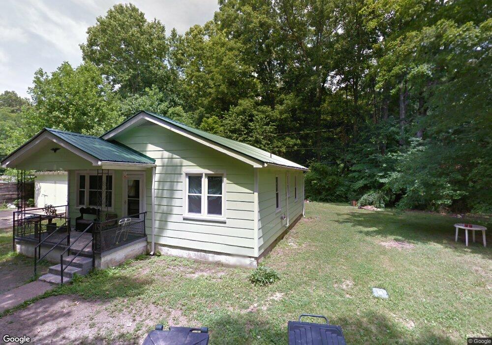
409 High Point Dr Centerville, TN 37033
Estimated Value: $72,000 - $177,000
Studio
1
Bath
840
Sq Ft
$163/Sq Ft
Est. Value
About This Home
This home is located at 409 High Point Dr, Centerville, TN 37033 and is currently estimated at $137,188, approximately $163 per square foot. 409 High Point Dr is a home located in Hickman County with nearby schools including Centerville Elementary School, Centerville Intermediate School, and Hickman County Middle School.
Ownership History
Date
Name
Owned For
Owner Type
Purchase Details
Closed on
Dec 31, 2021
Sold by
James Easley
Bought by
Nunnelly Investments Llc
Current Estimated Value
Purchase Details
Closed on
Nov 2, 2011
Sold by
Secretary Of Housing And U
Bought by
Easley James
Purchase Details
Closed on
Jan 4, 2011
Sold by
Best Alfred L
Bought by
Secretary Of Housing
Purchase Details
Closed on
Oct 18, 2001
Sold by
Lisa Talley
Bought by
Petty Susan F
Purchase Details
Closed on
Oct 18, 1995
Sold by
Irene Johnson Myrtle
Bought by
Warf Cecil E
Create a Home Valuation Report for This Property
The Home Valuation Report is an in-depth analysis detailing your home's value as well as a comparison with similar homes in the area
Home Values in the Area
Average Home Value in this Area
Purchase History
| Date | Buyer | Sale Price | Title Company |
|---|---|---|---|
| Nunnelly Investments Llc | $50,000 | Tennessee Title Services | |
| Easley James | $14,000 | -- | |
| Secretary Of Housing | -- | -- | |
| Petty Susan F | $28,000 | -- | |
| Warf Cecil E | $28,000 | -- |
Source: Public Records
Tax History
| Year | Tax Paid | Tax Assessment Tax Assessment Total Assessment is a certain percentage of the fair market value that is determined by local assessors to be the total taxable value of land and additions on the property. | Land | Improvement |
|---|---|---|---|---|
| 2025 | $516 | $13,075 | -- | -- |
| 2024 | $305 | $13,075 | -- | -- |
| 2023 | $305 | $13,075 | $0 | $0 |
| 2022 | $430 | $13,075 | $0 | $0 |
| 2021 | $448 | $11,375 | $0 | $0 |
| 2020 | $446 | $11,375 | $0 | $0 |
| 2019 | $449 | $11,375 | $0 | $0 |
| 2018 | $319 | $11,375 | $0 | $0 |
| 2017 | $316 | $10,750 | $0 | $0 |
| 2016 | $439 | $10,750 | $0 | $0 |
| 2014 | $379 | $10,738 | $0 | $0 |
Source: Public Records
Map
Nearby Homes
- 498 Highway 100
- 622 Beech St
- 351 Tennessee 100
- 480 Defeated Creek Rd
- 317 Highway 100
- 1421 Oakmont Cir
- 0 Defeated Creek Rd
- 107 Cherry St
- 200 Bulldog Blvd
- 850 Defeated Creek Rd
- 100 Murphree Ave
- 1819 E Haleys Creek Rd
- 107 E Ward St
- 594 Highway 100
- 1310 W Haley's Creek Rd
- 174 Columbia Ave
- 0 Puckett Hollow Rd
- 0 Linden Rd Unit RTC3068773
- 108 Sunset Cir
- 3011 Green Hill Dr
- 405 High Point Dr
- 412 High Point Dr
- 402 High Point Dr
- 401 High Point Dr
- 204 Tiller Dr
- 203 Tiller Dr
- 498 Tennessee 100
- 584 Highway 100
- 584 Highway 100
- 584 Highway 100
- 584 Highway 100
- 584 Highway 100
- 584 Highway 100
- 584 Highway 100
- 584 Highway 100
- 586 Highway 100
- 301 Hazel Dr
- 0 Hazel Dr Unit RTC2598572
- 0 Hazel Dr Unit RTC2487912
- 0 Hazel Dr Unit RTC2418495
Your Personal Tour Guide
Ask me questions while you tour the home.