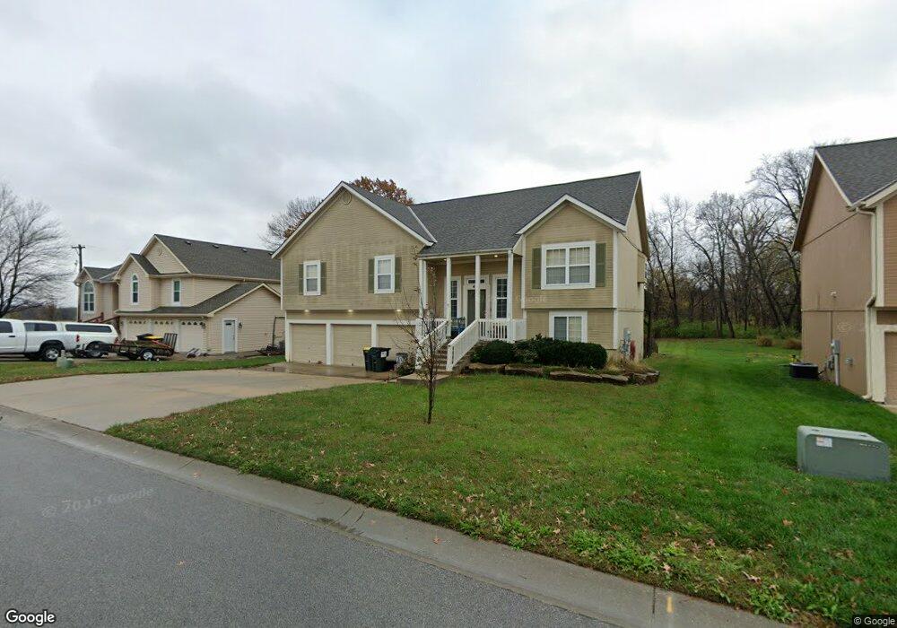
409 Hillbrook Dr Lansing, KS 66043
Estimated Value: $366,000 - $384,399
4
Beds
3
Baths
1,869
Sq Ft
$200/Sq Ft
Est. Value
About This Home
This home is located at 409 Hillbrook Dr, Lansing, KS 66043 and is currently estimated at $374,600, approximately $200 per square foot. 409 Hillbrook Dr is a home located in Leavenworth County with nearby schools including Lansing Elementary School, Lansing Middle 6-8, and Lansing High 9-12.
Ownership History
Date
Name
Owned For
Owner Type
Purchase Details
Closed on
Apr 1, 2004
Bought by
Pippin Bradley W and Pippin Lynne M
Current Estimated Value
Home Financials for this Owner
Home Financials are based on the most recent Mortgage that was taken out on this home.
Original Mortgage
$206,398
Outstanding Balance
$135,233
Interest Rate
5.52%
Mortgage Type
VA
Estimated Equity
$239,367
Create a Home Valuation Report for This Property
The Home Valuation Report is an in-depth analysis detailing your home's value as well as a comparison with similar homes in the area
Home Values in the Area
Average Home Value in this Area
Purchase History
| Date | Buyer | Sale Price | Title Company |
|---|---|---|---|
| Pippin Bradley W | $212,500 | -- |
Source: Public Records
Mortgage History
| Date | Status | Borrower | Loan Amount |
|---|---|---|---|
| Open | Pippin Bradley W | $206,398 |
Source: Public Records
Tax History Compared to Growth
Tax History
| Year | Tax Paid | Tax Assessment Tax Assessment Total Assessment is a certain percentage of the fair market value that is determined by local assessors to be the total taxable value of land and additions on the property. | Land | Improvement |
|---|---|---|---|---|
| 2025 | $5,133 | $40,795 | $6,569 | $34,226 |
| 2024 | $4,763 | $38,126 | $5,200 | $32,926 |
| 2023 | $4,763 | $36,659 | $5,200 | $31,459 |
| 2022 | $4,580 | $33,327 | $3,961 | $29,366 |
| 2021 | $4,224 | $29,343 | $3,961 | $25,382 |
| 2020 | $4,087 | $27,945 | $3,961 | $23,984 |
| 2019 | $4,011 | $27,393 | $3,961 | $23,432 |
| 2018 | $3,788 | $25,898 | $3,961 | $21,937 |
| 2017 | $3,651 | $24,921 | $3,961 | $20,960 |
| 2016 | $3,580 | $24,426 | $3,961 | $20,465 |
| 2015 | $3,569 | $24,426 | $3,961 | $20,465 |
| 2014 | $3,531 | $24,668 | $3,961 | $20,707 |
Source: Public Records
Map
Nearby Homes
- 102 S 3rd Ct
- 218 E Kay St
- 209 E Kay St
- 506 1st Terrace
- 104 Olive St
- 202 S Main St
- 124 S Main St
- 901 S Main St
- 527 S Valley Dr
- 129 Brookwood St
- 624 S Bittersweet Ln
- 722 Bittersweet Rd
- 706 N 2nd St
- 268 Holiday Dr
- 922 Southfork St
- 261 Holiday Dr
- 610 Meadowlark Rd
- 115 W Gilman Rd
- 131 Rock Creek Loop
- 415 Fairlane St
- 415 Hillbrook Dr
- 401 Hillbrook Dr
- 400 Hillbrook Dr
- 416 Hillbrook Dr
- 424 Hillbrook Dr
- 413 Hillbrook Ct
- 519 Hillbrook Dr
- 411 Hillbrook Ct
- 521 Hillbrook Dr
- 526 Hithergreen Dr
- 410 Hillbrook Ct
- 520 Hillbrook Dr
- 525 Hithergreen Dr
- 525 Hillbrook Dr
- 530 Hithergreen Dr
- 524 Hillbrook Dr
- 812 E Mary St
- 527 Hithergreen Dr
- 527 Hillbrook Dr
- 534 Hithergreen Dr