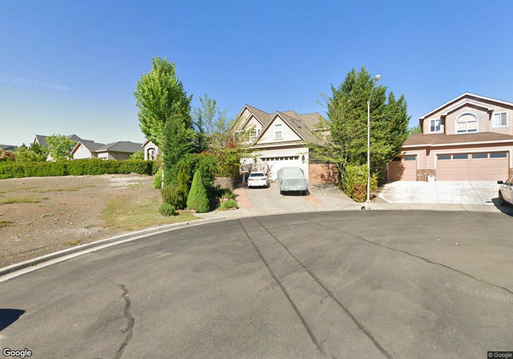
409 Leandra Ln Eagle Point, OR 97524
Estimated Value: $592,727 - $691,000
3
Beds
3
Baths
2,643
Sq Ft
$240/Sq Ft
Est. Value
About This Home
This home is located at 409 Leandra Ln, Eagle Point, OR 97524 and is currently estimated at $634,182, approximately $239 per square foot. 409 Leandra Ln is a home located in Jackson County with nearby schools including Eagle Point Middle School, White Mountain Middle School, and Eagle Point High School.
Ownership History
Date
Name
Owned For
Owner Type
Purchase Details
Closed on
Jan 17, 2025
Sold by
Beach Lena S
Bought by
Riverside Trust and Beach
Current Estimated Value
Purchase Details
Closed on
May 6, 2005
Sold by
Crume Travis and Crume Timothy R
Bought by
Beach Lena S
Home Financials for this Owner
Home Financials are based on the most recent Mortgage that was taken out on this home.
Original Mortgage
$343,920
Interest Rate
5.99%
Mortgage Type
Stand Alone First
Purchase Details
Closed on
Aug 3, 2004
Sold by
Miller Dion H and Miller Minerva B
Bought by
Crume Travis and Crume Timothy R
Home Financials for this Owner
Home Financials are based on the most recent Mortgage that was taken out on this home.
Original Mortgage
$263,000
Interest Rate
6.24%
Mortgage Type
Unknown
Create a Home Valuation Report for This Property
The Home Valuation Report is an in-depth analysis detailing your home's value as well as a comparison with similar homes in the area
Home Values in the Area
Average Home Value in this Area
Purchase History
| Date | Buyer | Sale Price | Title Company |
|---|---|---|---|
| Riverside Trust | -- | None Listed On Document | |
| Beach Lena S | $429,900 | Amerititle | |
| Crume Travis | $103,900 | Lawyers Title Ins |
Source: Public Records
Mortgage History
| Date | Status | Borrower | Loan Amount |
|---|---|---|---|
| Previous Owner | Beach Lena S | $343,920 | |
| Previous Owner | Crume Travis | $263,000 | |
| Closed | Beach Lena S | $42,990 |
Source: Public Records
Tax History
| Year | Tax Paid | Tax Assessment Tax Assessment Total Assessment is a certain percentage of the fair market value that is determined by local assessors to be the total taxable value of land and additions on the property. | Land | Improvement |
|---|---|---|---|---|
| 2026 | $5,193 | $381,690 | -- | -- |
| 2025 | $5,071 | $370,580 | $127,170 | $243,410 |
| 2024 | $5,071 | $359,790 | $123,470 | $236,320 |
| 2023 | $4,899 | $349,320 | $119,870 | $229,450 |
| 2022 | $4,765 | $349,320 | $119,870 | $229,450 |
| 2021 | $4,624 | $339,150 | $116,370 | $222,780 |
| 2020 | $4,912 | $329,280 | $112,980 | $216,300 |
| 2019 | $4,837 | $310,380 | $106,490 | $203,890 |
| 2018 | $4,745 | $301,340 | $103,390 | $197,950 |
| 2017 | $4,629 | $301,340 | $103,390 | $197,950 |
| 2016 | $4,538 | $284,050 | $97,450 | $186,600 |
| 2015 | $4,390 | $284,050 | $97,450 | $186,600 |
| 2014 | $4,264 | $267,750 | $91,870 | $175,880 |
Source: Public Records
Map
Nearby Homes
- 1141 Pumpkin Ridge Unit 320
- 1135 Pumpkin Ridge Unit 319
- 1147 Pumpkin Unit 321
- 1152 Pumpkin Unit 334
- 1159 Pumpkin Ridge Unit 323
- 1153 Pumpkin Unit 322
- 1146 Pumpkin Unit 335
- 1140 Pumpkin Ridge Unit 336
- 1164 Pumpkin Unit 332
- 374 Leandra Ln
- 279 Robert Trent Jones Blvd
- 384 Robert Trent Jones Blvd
- 1151 Arrowhead Trail
- 1231 Poppy Ridge Dr
- 1297 Stonegate Dr Unit 473
- 1043 Arrowhead Trail
- 1050 Azure Way
- 74 Eagle View Dr
- 0 Riley Rd Unit 220209029
- 1319 Crestmont Place
- 413 Leandra Ln
- 403 Patricia Ln
- 395 Patricia Ln
- 428 Leandra Ln
- 413 Patricia Ln
- 410 Leandra Ln
- 416 Leandra Ln
- 396 Patricia Ln
- 389 Patricia Ln
- 417 Patricia Ln
- 402 Patricia Ln
- 390 Patricia Ln
- 422 Leandra Ln
- 395 Leandra Ln
- 383 Patricia Ln
- 410 Patricia Ln
- 384 Patricia Ln
- 16 Milagros Ct
- 1129 Pumpkin Unit 319
- 377 Patricia Ln
Your Personal Tour Guide
Ask me questions while you tour the home.