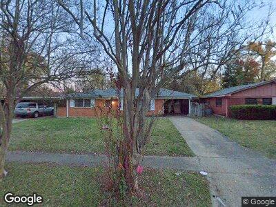
409 Mohawk Trail Shreveport, LA 71107
Freestate-North Highlands NeighborhoodEstimated Value: $63,000 - $90,000
3
Beds
1
Bath
1,159
Sq Ft
$66/Sq Ft
Est. Value
About This Home
This home is located at 409 Mohawk Trail, Shreveport, LA 71107 and is currently estimated at $76,976, approximately $66 per square foot. 409 Mohawk Trail is a home with nearby schools including Cherokee Park Elementary School, Fairfield Magnet School, and Claiborne Fundamental Elementary School.
Ownership History
Date
Name
Owned For
Owner Type
Purchase Details
Closed on
Jul 3, 2020
Sold by
Lewis Tommy Earl and Lewis Alicia Michelle
Bought by
Lewis Alicia Michelle and Lewis Tommy Earl
Current Estimated Value
Purchase Details
Closed on
Dec 8, 2010
Sold by
Taylor Catherine Ann Schwab and Schwab Kenneth Albert
Bought by
Lewis Tommy Earl
Home Financials for this Owner
Home Financials are based on the most recent Mortgage that was taken out on this home.
Original Mortgage
$59,247
Interest Rate
4.22%
Mortgage Type
Unknown
Create a Home Valuation Report for This Property
The Home Valuation Report is an in-depth analysis detailing your home's value as well as a comparison with similar homes in the area
Home Values in the Area
Average Home Value in this Area
Purchase History
| Date | Buyer | Sale Price | Title Company |
|---|---|---|---|
| Lewis Alicia Michelle | $45,312 | None Available | |
| Lewis Tommy Earl | $58,000 | None Available |
Source: Public Records
Mortgage History
| Date | Status | Borrower | Loan Amount |
|---|---|---|---|
| Previous Owner | Lewis Tommy Earl | $59,247 |
Source: Public Records
Tax History Compared to Growth
Tax History
| Year | Tax Paid | Tax Assessment Tax Assessment Total Assessment is a certain percentage of the fair market value that is determined by local assessors to be the total taxable value of land and additions on the property. | Land | Improvement |
|---|---|---|---|---|
| 2024 | $1,098 | $7,045 | $750 | $6,295 |
| 2023 | $1,016 | $6,372 | $714 | $5,658 |
| 2022 | $1,016 | $6,372 | $714 | $5,658 |
| 2021 | $1,000 | $6,372 | $714 | $5,658 |
| 2020 | $1,000 | $6,372 | $714 | $5,658 |
| 2019 | $1,024 | $6,329 | $714 | $5,615 |
| 2018 | $0 | $6,329 | $714 | $5,615 |
| 2017 | $1,040 | $6,329 | $714 | $5,615 |
| 2015 | -- | $6,870 | $710 | $6,160 |
| 2014 | -- | $6,870 | $710 | $6,160 |
| 2013 | -- | $6,870 | $710 | $6,160 |
Source: Public Records
Map
Nearby Homes
- 401 Seneca Trail
- 470 Mayfair Dr
- 1136 Arncliff Dr
- 118 Mayfair Dr
- 726 Tecumseh Trail
- 731 Summitt St
- 0 Silver Point Dr Unit 20833957
- 0 Silver Point Dr Unit 3 20803133
- 0 Silver Point Dr Unit 11 20803059
- 0 Silver Point Dr Unit 7 20803008
- 0 Silver Point Dr Unit 5A 20802976
- 0 Silver Point Dr Unit 4 20796401
- 0 N Hearne Ave
- 4925 N Market St
- 000 N Market St
- 0 Hwy 1 Unit 20677067
- 0 Hwy 1 Unit 20326562
- 1500 Traffic St
- 409 Wyche St
- 518 Thompson St
- 409 Mohawk Trail
- 405 Mohawk Trail
- 413 Mohawk Trail
- 417 Mohawk Trail
- 2013 E Algonquin Trail
- 410 Seneca Trail
- 406 Mohawk Trail
- 414 Seneca Trail
- 410 Mohawk Trail
- 406 Seneca Trail
- 414 Mohawk Trail
- 421 Mohawk Trail
- 418 Mohawk Trail
- 2005 E Algonquin Trail
- 2017 E Algonquin Trail
- 425 Mohawk Trail
- 422 Mohawk Trail
- 2021 E Algonquin Trail
- 409 Chickasaw Trail
- 426 Mohawk Trail